12th May 2022
The cold chill hit me like a blast to the heart the second I opened my eyes on day 4 of my West Highland Way adventure. I hadn’t even unzipped my sleeping bag! As I laid there contemplating my next move, I knew before I even looked outside that the weather was going to be bad. I could see my own breath in puffs of steam in front of me as I hastily boiled water for a morning coffee, something I hadn’t yet experienced so far on this trail.
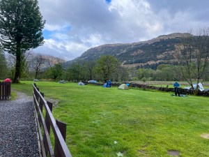
Upon stepping out of the tent, the campsite was already a hive of activity at 7am with people frantically dismantling their tents and packing away before the rain started. So far the weather was cloudy and dull and the grass very wet underfoot indicating that there had been some rain overnight. Although not raining at present, it was still extremely cold. The waterfall that I had heard last night and which was only a short distance away, could not be seen having being completely hidden away by low lying fog, however it could still be clearly heard.
Sleeping last night hadn’t been an issue having been aided greatly by my colossal meal and pint in the pub the previous evening which I had thoroughly enjoyed. So it had been a very enjoyable and comfortable night of camping at Beinglas. Being able to set up camp, have a hot shower and enjoy food and drink after such a difficult day was like an absolute Godsend. It had definitely brightened my spirits no end.
Now for today… Where would today take me?
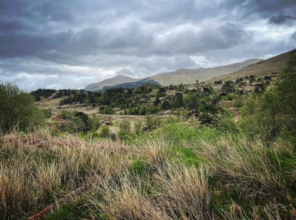
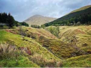
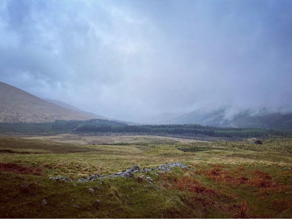
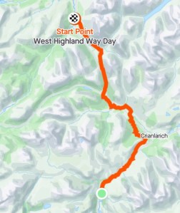
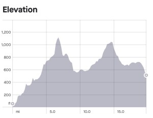
Overview: Day 4 walk route
Today was a little different to the previous days in that I was still undecided of exactly how far I should walk. In the lead up to the hike and during its planning, day 4 is what I had struggled with the most. I only had 7 days in which to complete the West Highland Way and because of this, it meant one of my days was going to be considerably longer in distance. I had decided against day 3 as I knew beforehand it was going to be challenging along Loch Lomond and that had certainly turned out to be the case. Therefore it left only today or tomorrow (day 5) as a possible option.
The route today would see me leave Beinglas Farm Camping and the relatively closed in valleys with thick, lush woodland and greenery to start the adventure across more rugged, open terrain with rolling hills and mountains. That said though, the route would be more easier going than what is experienced on day 3 with less ascent and longer periods of flatter pathway.
Many hikers of the West Highland Way opt to end their day at Tyndrum on day 4 which is approximately 12 miles past Beinglas Camping but it would make day 5 much longer for me if I chose to do this. The alternative option was to continue past Tyndrum today and hike a further 7 miles to Bridge of Orchy, making day 5 only 11 miles. After very careful thought, I opted for the latter when I considered the weather forecast on day 5. It was said to be the worst of all the days and the route included crossing very open and exposed moorland such as Rannoch Moor. I decided in the end to make day 5 shorter and easier by getting the longest day done today on relatively flat terrain. Little did I realise what a blessing my decision here had been!
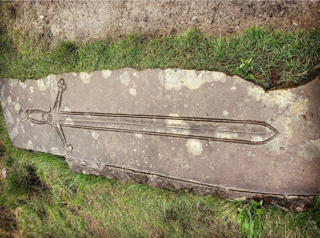
Despite the prospect of hiking 20 miles, (the longest I had ever hiked) the route today was set to throw some interesting historical sights my way. First, there was the Falls of Falloch just shortly after leaving Beinglas, then a stunning forestry climb through the Ewich Forest at Crianlarich towards Strathfillan. Here was a very interesting section of trail as there were the likes of St Fillan’s Priory, Kirkton Burial Ground and Strathfillan Wigwams to be enjoyed. Heading further along the trail towards Tyndrum, the Lochan of the Lost Sword lies just to the right side of the path and this was what I was most interested in on this section.
Upon reaching Tyndrum, I planned to take a break and stock up on supplies before heading onwards past Beinn Odhar and Beinn Dorain towards Bridge of Orchy where I planned to wild camp.
Leave No Trace
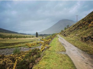
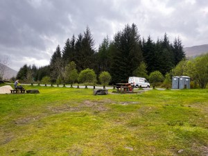
As can be seen in the photograph that follows, the ground for pitching at Beinglas is superb. Lush, thick grass and flat ground with good water drainage. This was my last sight as I left Beinglas that morning. My pitch had been more or less in the middle of the green space. I left no trace and made use of the on site waste disposal before leaving.
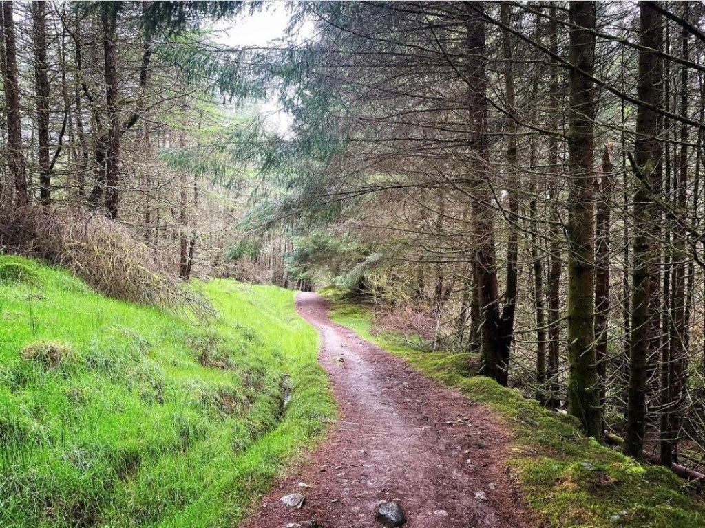
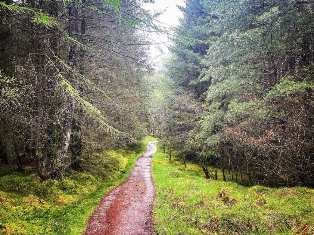
Beinglas Camping to Ewich Forest
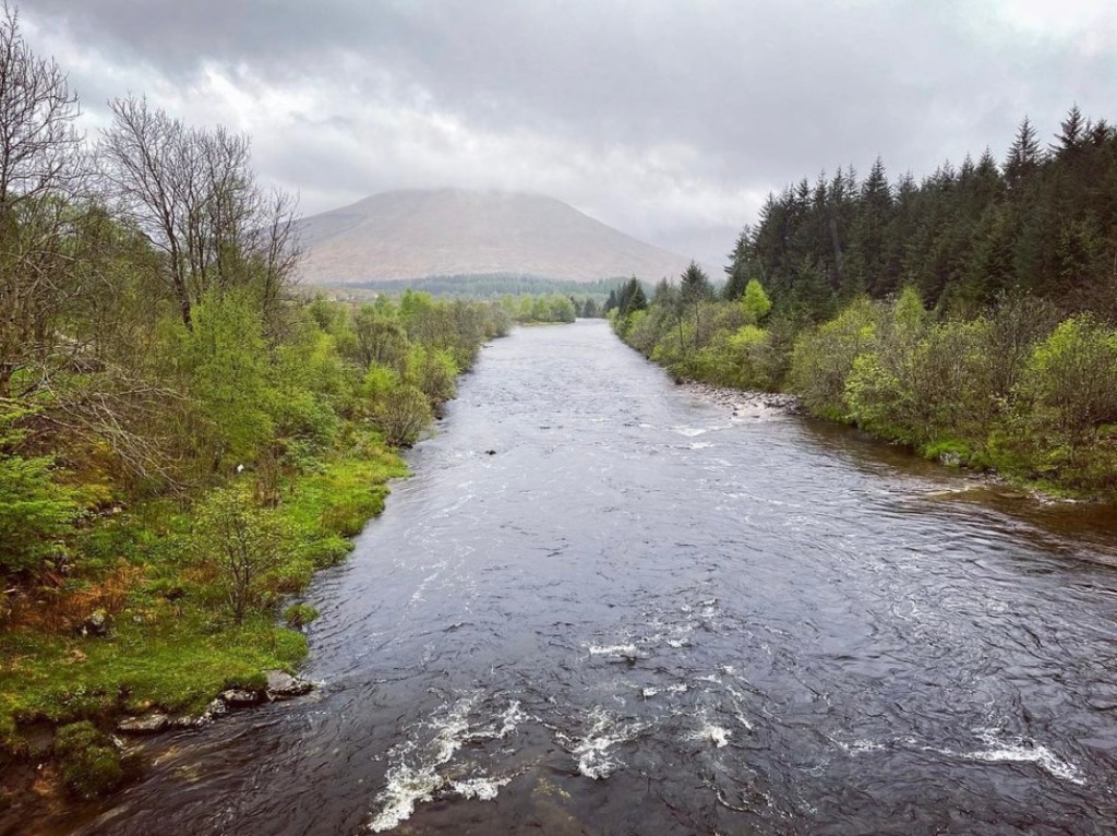
It was a cloudy start with a chill in the air as I left Beinglas Camping at approximately 8.30am that morning. Turning left at the top of the exit path, I began heading north along the wide track following the river Falloch through Glen Falloch. Despite the low hanging cloud and grey sky, it was great to see that the fog was gradually clearing and to be back on the trail once more. The scenery here in this location is truly stunning and it was hard to properly get into a rhythm at first due to my impulses to stop and take in the views.
Due to an early start, the trail appeared quite lonely at this moment in time. There were no other walkers on the track and as I ambled along, I couldn’t help but feel captivated by the amazing beauty of the landscape and the history which had occurred. The surrounding trees and vegetation here are made up of a variety of oak, ash, birch and alder which were harvested every 24 years for the likes of timber and charcoal production. The hike here to begin the day was easy going and relatively flat on wide gravel farm track.
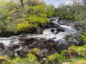
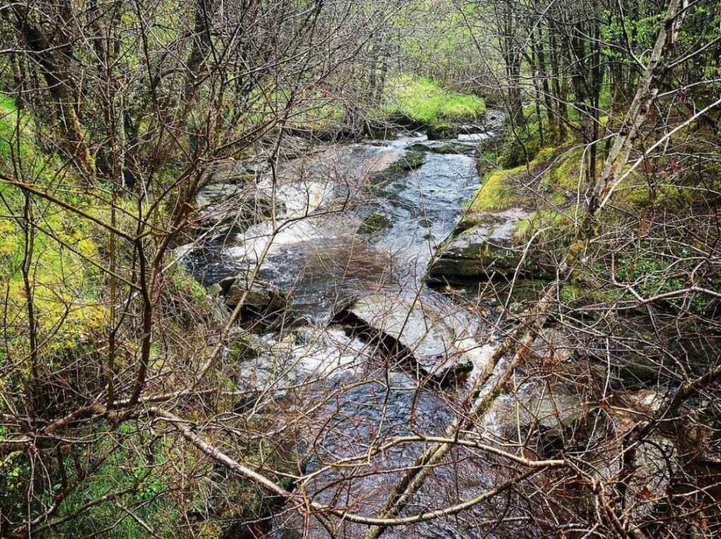
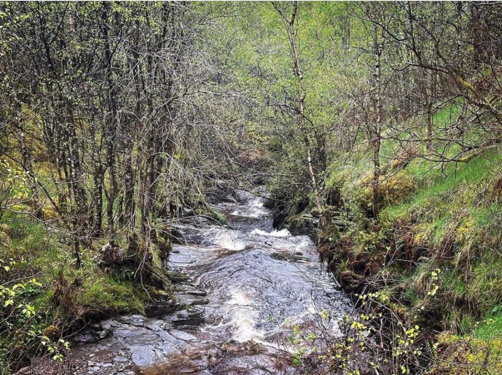
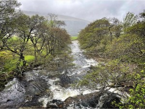
Eventually I reached a spot on the left side of the track where I could view the spectacular Falls of Falloch.
Falls of Falloch (Eas Falloch in Scottish Gaelic) meaning ‘Hidden Waterfall’ stands at 30 foot high and is a local beauty spot located 4 miles (7km) southwest of Crianlarich village in the county of Stirling. It can at times be extremely rough flowing especially after prolonged rainfall. I didn’t visit close up on this occasion but managed a few photographs as I passed. However they are not the best views to be had of the falls as these are reserved for the opposite side of the river where the viewing is much clearer. If you look carefully when passing, there is a covered bridge and viewing platform which gives spectacular views of the waterfall for those willing to take the detour.
Shortly after leaving the Falls of Falloch the track bares left before dropping downward towards a farm and derelict house at Derrydaroch. It is also around this location that a recent footbridge had been newly replaced, a fortunate blessing as since late 2019, there had been no bridge to cross a fast flowing burn ( Allt a’Chuillin) and a diversion had been in place. This added time and distance onto the walk. I remember feeling grateful that a newly built sturdy wooden bridge had been erected thus preventing a prolonged stretch of this section.
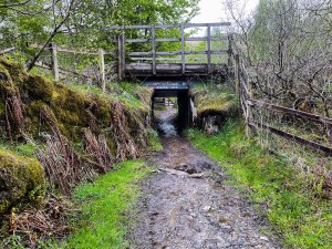
Below is a photograph of one of 3 sheep creeks in this section which have to be passed through on the way towards Crianlarich. One in particular is a very narrow and low creek which when carrying a heavy rucksack makes it harder to walk bent over. However the creeks are particularly useful in creating a safe route underneath the A82 road and the railway without the need of navigating these as part of the West Highland Way Trail. The second one, located shortly before the halfway point at Crianlarich is a wide tunnel type creek with stairs at the far end leading upwards onto the long path over open moorland.
After climbing the rocky old stairs, I was grateful of a short rest stop at the side of some large boulders which provided fantastic shelter from the wind. It was here that I sat and made my first coffee of the day and enjoyed some biscuits before continuing along the trail to Crianlarich.
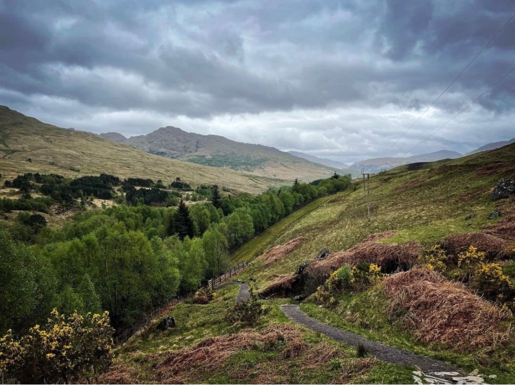
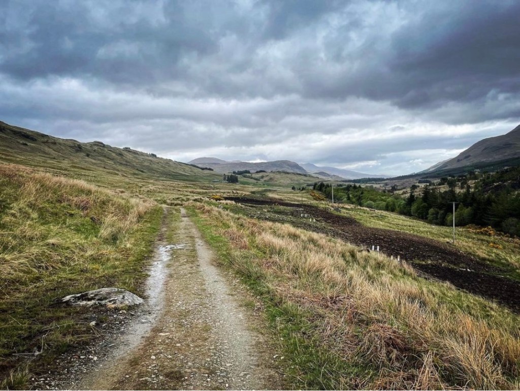
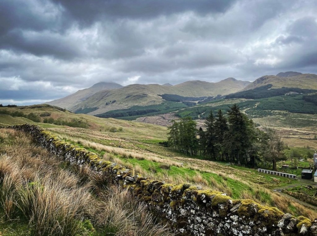
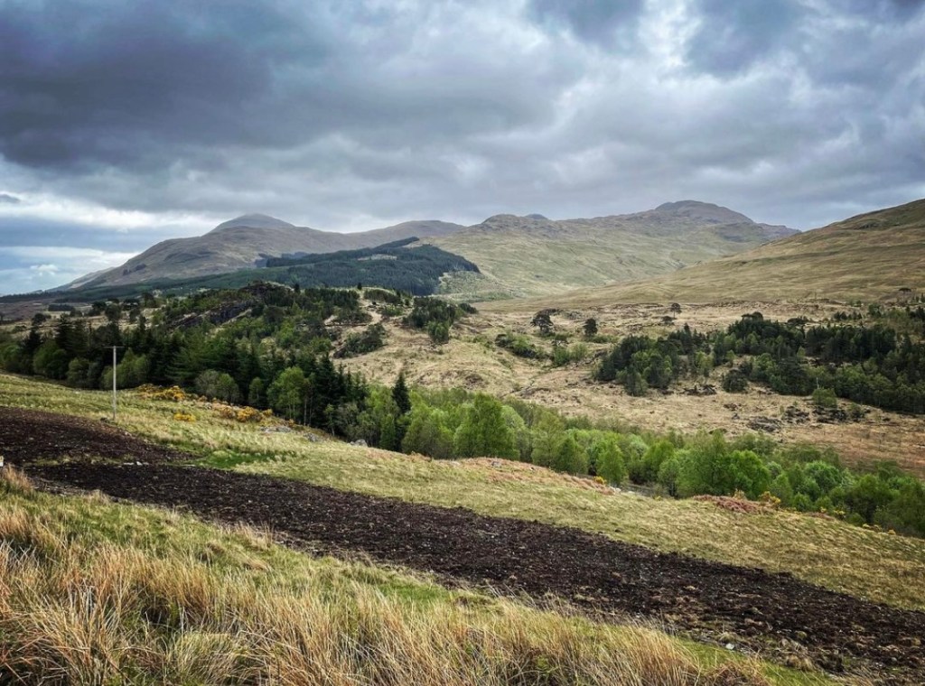
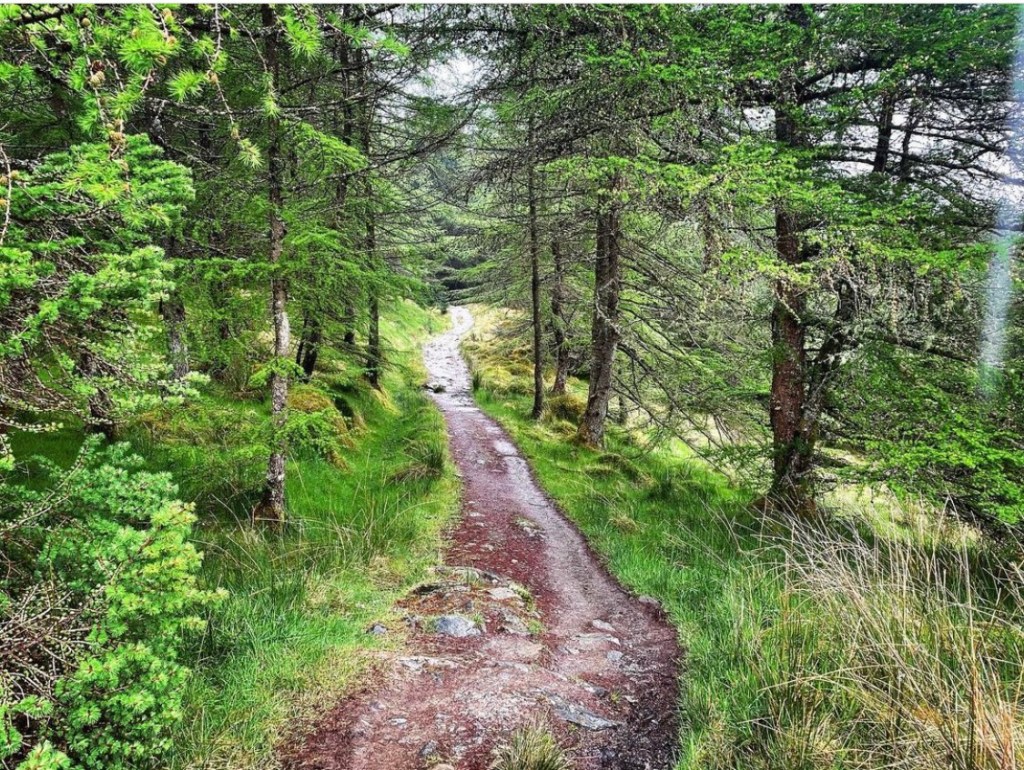
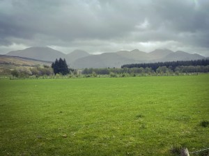
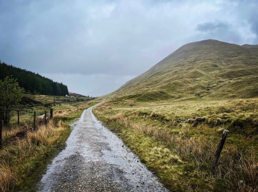
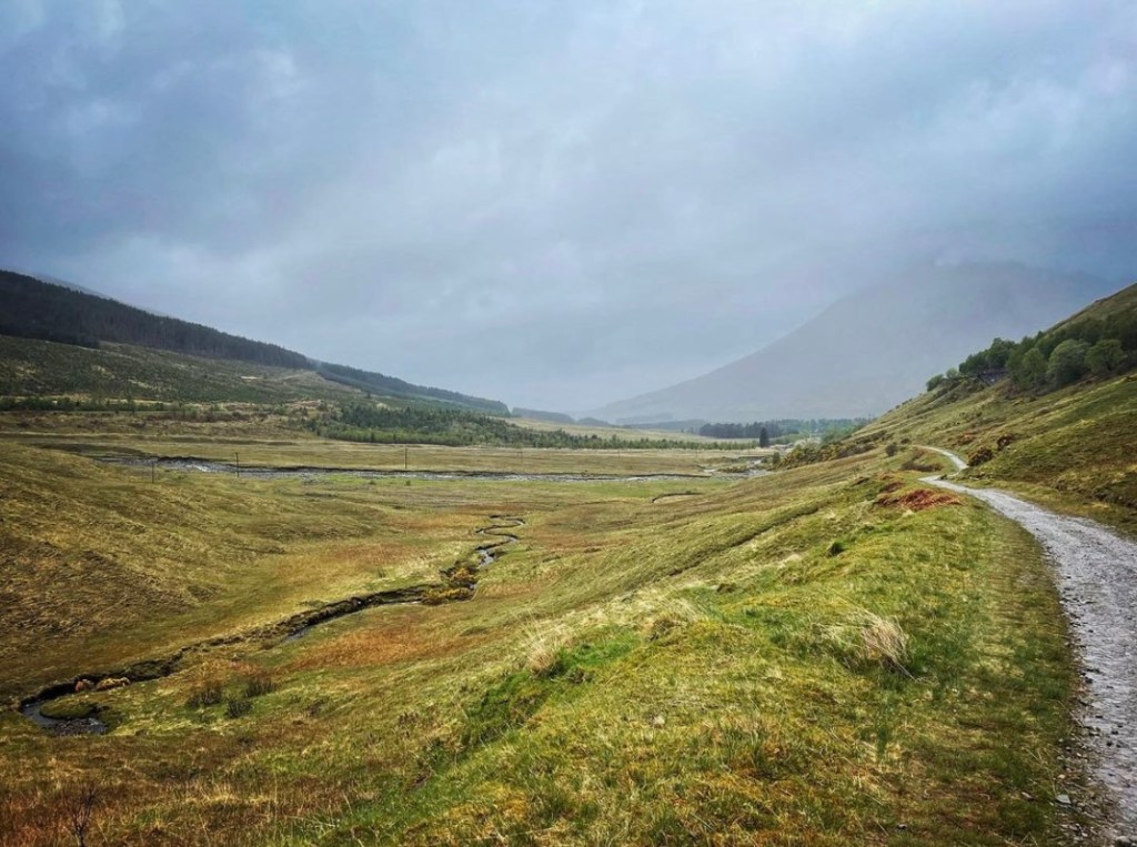
The long stretch ahead in this section offers fantastic scenery from here on with rolling hills and grazing territory all the way towards Crianlarich. Local mountains which can be viewed along here are the An Caisteal at 995 meters, Beinn Tulaichean at 946 meters, Stob Binnein at 1165 meters and Ben More at 1174 meters. This long pathway follows the left side of a long drystone wall for most of the way and although the weather remained overcast and moody, it was still very beautiful. I was truly loving the very different terrain to the closed in sections around Loch Lomond and it felt good to be able to see the distant peaks and vast open landscapes.
Below are some photographs of what I experienced on that long section before Crianlarich.
Upon reaching the end of the long pathway, I reached a tall gate and a point where there was a junction. Here I noticed a large signpost which signified several routes towards the village of Crianlarich and also up into the Ewich Forestry. What I didn’t realise at this point was that this signpost was the halfway point of the West Highland Way at 48 miles in.
If taking a detour into the village of Crianlarich from this point, it is approximately a 15 minute walk downhill where upon arrival there is a public house, hotel, hostel, railway station, tea room and shop.
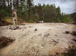
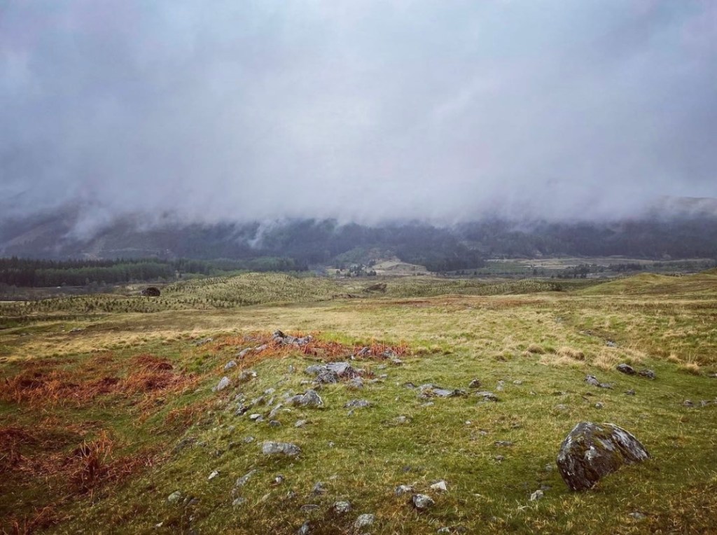
There are a number of reasons why I might have missed the halfway milestone at Crianlarich. By the time I realised that I had already passed, it was several miles onwards and I remember feeling disappointed and a little sad. I had seen the signpost on many occasions from looking at photographs and videos of others, yet my experience of reaching the halfway point was very different. The main reason is that the landscape in the area had changed dramatically in the last couple of years. Where once had stood miles of lush, dense pine forestry as the backdrop to the signpost, right now as I passed was nothing but mounds of earth, logs and felled trees. So prominent was the change that I just simply didn’t recognise it.
I remember feeling the familiar sense of disheartenment as I looked in dismay at the barren, empty space before me and a sad realisation hit. Many areas of forestry across the UK was seeing vast amounts of deforestation and Scotland sadly is no different. Since my return from the West Highland Way, I learned that this area of forest land was being sold for private purposes. There are still some forestry that remains untouched but it certainly leaves an unknown future for this section of the trail.
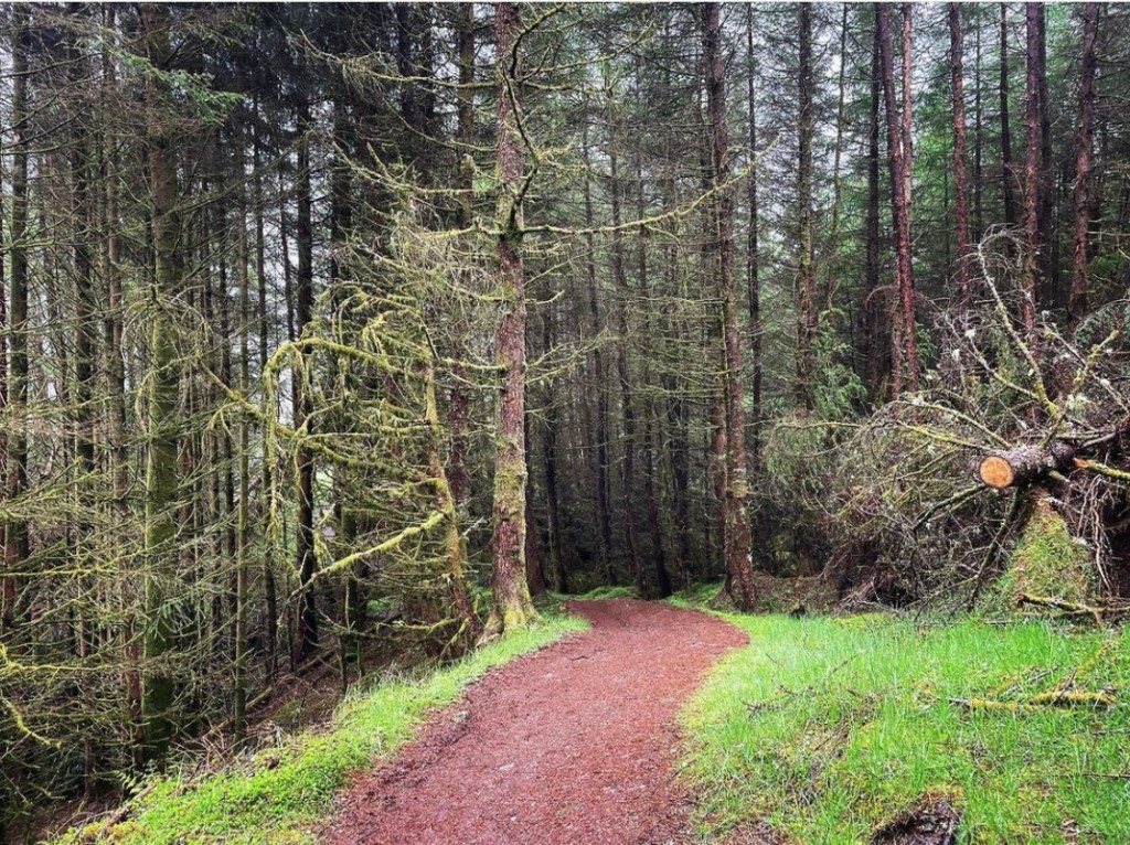
Ewich Forest to Strathfillan
After leaving the open landscape, it is a sharp climb up into the forest at Crianlarich. Rain had begun yet again and at one point I took some welcoming cover under a long arch of trees running the length of the path before continuing onwards.
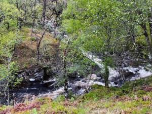
The Ewich Forest is a stunning section once further along the path away from the deforestation, however it is not the easiest going. It is a gradual uphill pull as it winds through the trees. Due to the rain which by now was heavy, the footpath had become nothing more than quagmire. Crossing over the Herive Burn via a small wooden footbridge it was so deep with mud I didn’t think it was even possible but it was and made for a very slippery walk. I managed to capture some images before the muddy sections of some of my favourite parts of the remaining Ewich Forest and hopefully these will stay around much longer. My lunch spot on this day was under the trees in photograph 2 which proved to be dry and quite comfortable.
It was not long though before the trail suddenly leaves the scenic sanctuary of the beautiful pine and ash trees and begins heading downhill across the deforested landscape once again. With my heart feeling heavy, I once again endured the bleak, bare, churned up ground littered with fallen trees as an overwhelming feeling of sadness overcame me. It is worth mentioning here that at the time I walked the way, the pathway here was very difficult to follow at times due to being obstructed by logs, debris and churned up land. I wasn’t the only hiker that day who strayed a little off track and I remember thinking to myself that it was such a shame that this was happening to such a beautiful piece of forestry as that at Crianlarich.
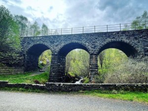
Eventually the pathway descends down some steep steps towards the old stone railway viaduct at Crianlarich. Here there is a low stone wall which proved to be a popular stop off on the route with many other walkers feeling the same after such an uneventful hike down through the deforestation.
After a very brief but much needed rest stop to revitalise my dulled senses, I continued on the trail as it crosses the A82 before heading over a stile into fields at Kirkton Farm. The fields around the footpath do contain livestock and other farm animals and appropriate signposts are erected to guide hikers through this section.
Strathfillan to Tyndrum
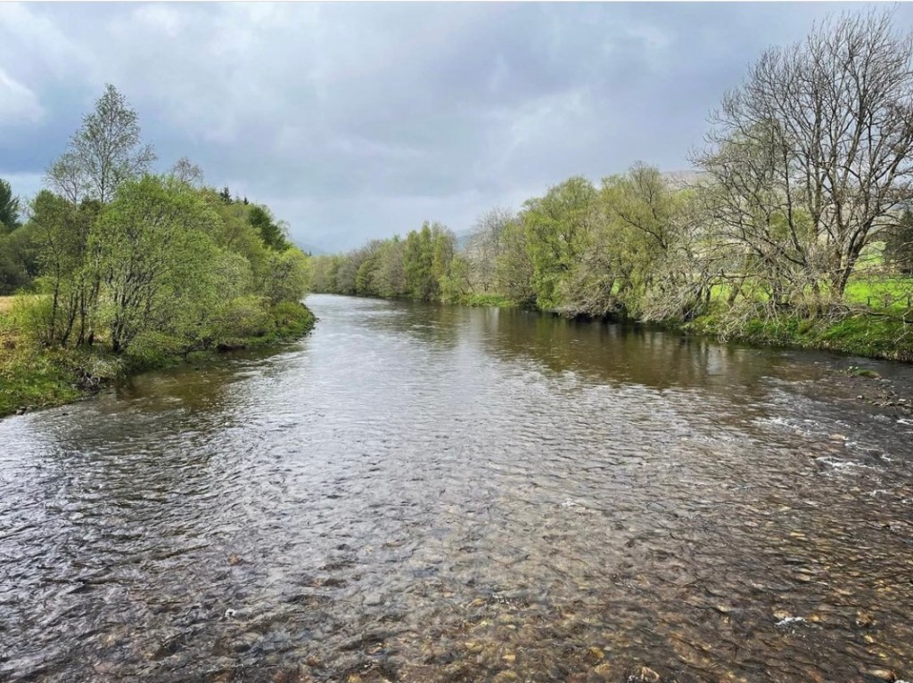
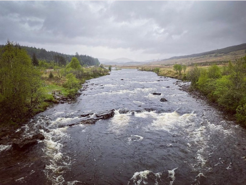
Meeting up with the wide river Fillan I stood on the bridge there and gazed longingly over both sides from the central viewpoints. The rain had stopped briefly but there was still a faint obstruction in viewing caused by far off mist and drizzle. Stob Binnein and Ben More, the 2 popular Munro’s in this location could still clearly be seen dominating the skyline as I made my way closer along the farm road leading towards Strathfillan.

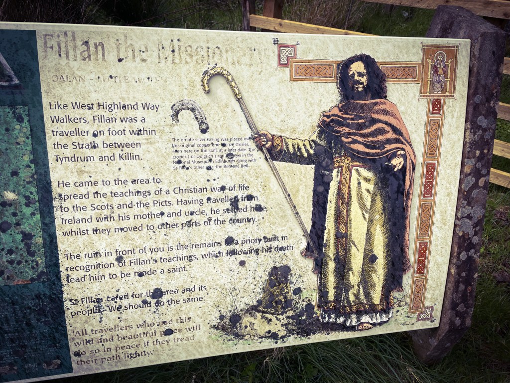
It was here that I came across an interesting piece of history and my first real one of the day. It was none other than St Fillan’s Priory also known as St Fillan’s Church which is now nothing more than ancient ruins. It is said that Robert the Bruce established the priory in 1318 as a gesture of thanks to St Fillan for his help at the Battle of Bannockburn. St Fillan was widely believed to have brought Christianity from Iona in the 8th century and following Robert the Bruce’s defeat at the Battle of Methven in 1306, he was granted sanctuary in this old chapel here.
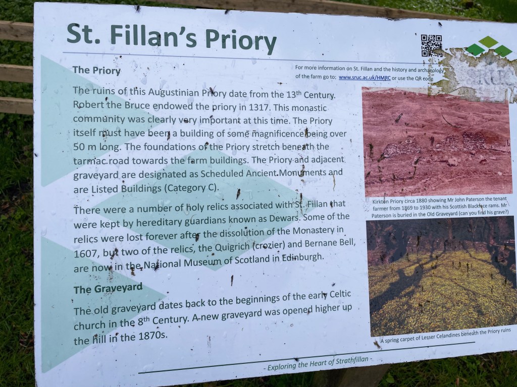
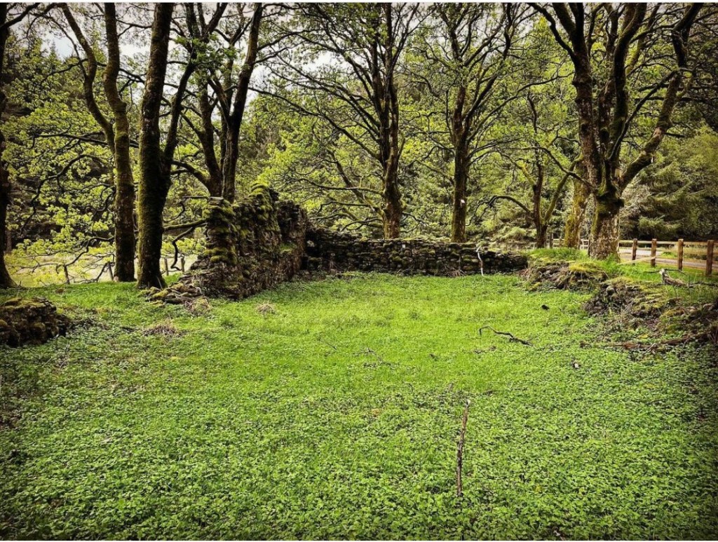
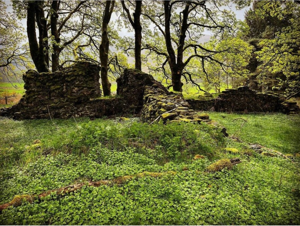
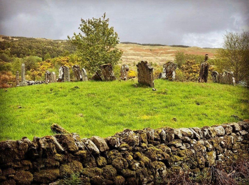
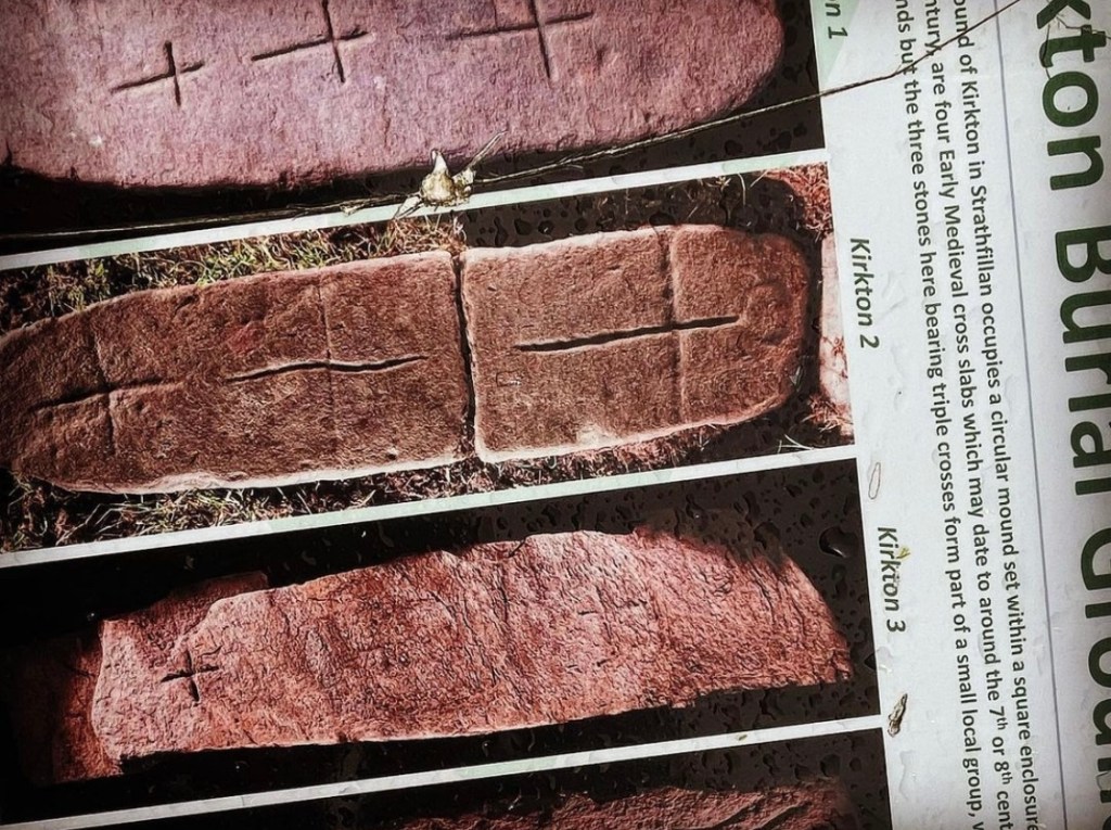
Kirkton Burial Ground located just slightly north of St Fillan’s Priory is believed to date back to the 8th century. It is a small ancient graveyard which is no longer in use and is on a raised mound surrounded by crumbling dry stone walls.
Leaving the Priory and burial ground behind it was a short hike along the farm track towards my next rest stop of the day, Strathfillan Wigwams.
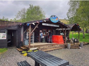
Strathfillan Wigwams is located on a working farm (Auchtertyre Farm) and is exactly as it states on the tin. It is a wigwam glamping site and accommodation can be booked here when hiking the West Highland Way. Despite this not being my stop off point, I did rest a short while and took a brief look around at the facilities. It did look a decent place to stay, it just wasn’t far enough in the day for me.
The farm shop, (Trading Post) is the first thing people will notice when they approach Strathfillan Wigwams from the trail. In the shop there are tables and seating found both inside and outside the small shack like building. The shop has an array of food and gifts on offer with hot drinks such as tea and coffee and the most amazing smelling pies and bacon rolls. I decided to purchase an egg and bacon roll and due to the rain which was now once again pounding heavily, sat in the adjoining sheltered area just to the side of the shop.
The owners here were very welcoming and friendly and gave me a full update of the weather forecast for the next couple of days. I had so far had not one dry day on the trail and was hoping for a little respite. It was looking like it was not to be however, as according to the forecast, the rain was set to continue heavy for the rest of the day and right the way into tomorrow. Oh the joys of the Scottish weather!
A pleasant short rest here in the Trading Post and made use of the clean toilet facilities before hitting the trail once more.
Leaving the farm via its car park I began heading along a lonely lane on my left. Turning left again off the road onto a path which led through an underpass, I eventually reached a stone bridge at a small road where I spotted this sign conveniently placed on the edge of some beautiful woodland. It is here that the path follows alongside the trees and the river Cononish as it heads further towards Tyndrum.
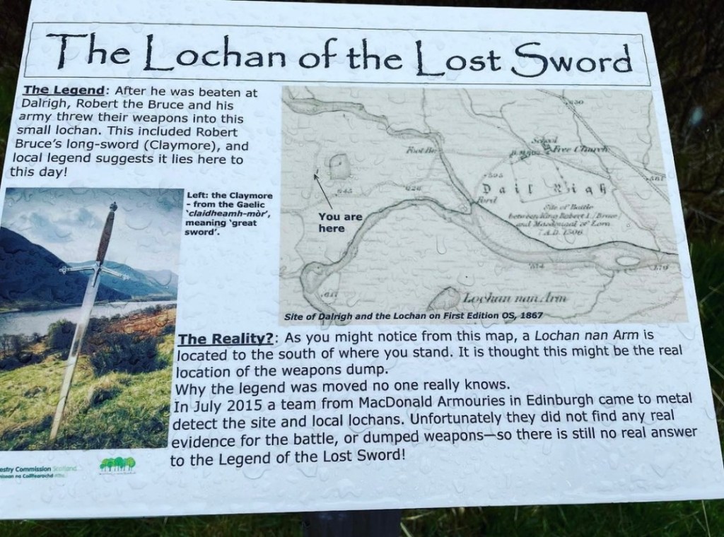
I remember this point of the journey clearly as despite the miserable weather conditions so far experienced on day 4, I was looking forward to this next section of walk. Coming up on my approach was the historical location of the Lochan of the Lost Sword. The interest here, is that as the legend states, Robert the Bruce and his army upon being defeated by English troops at the Battle of Dal Righ back in 1306, abandoned their swords into the lochan in order to make a hasty escape. Roberts’ own sword (Claymore), is said to have been discarded here and legend has it that it still remains in the hidden depths to this very day.
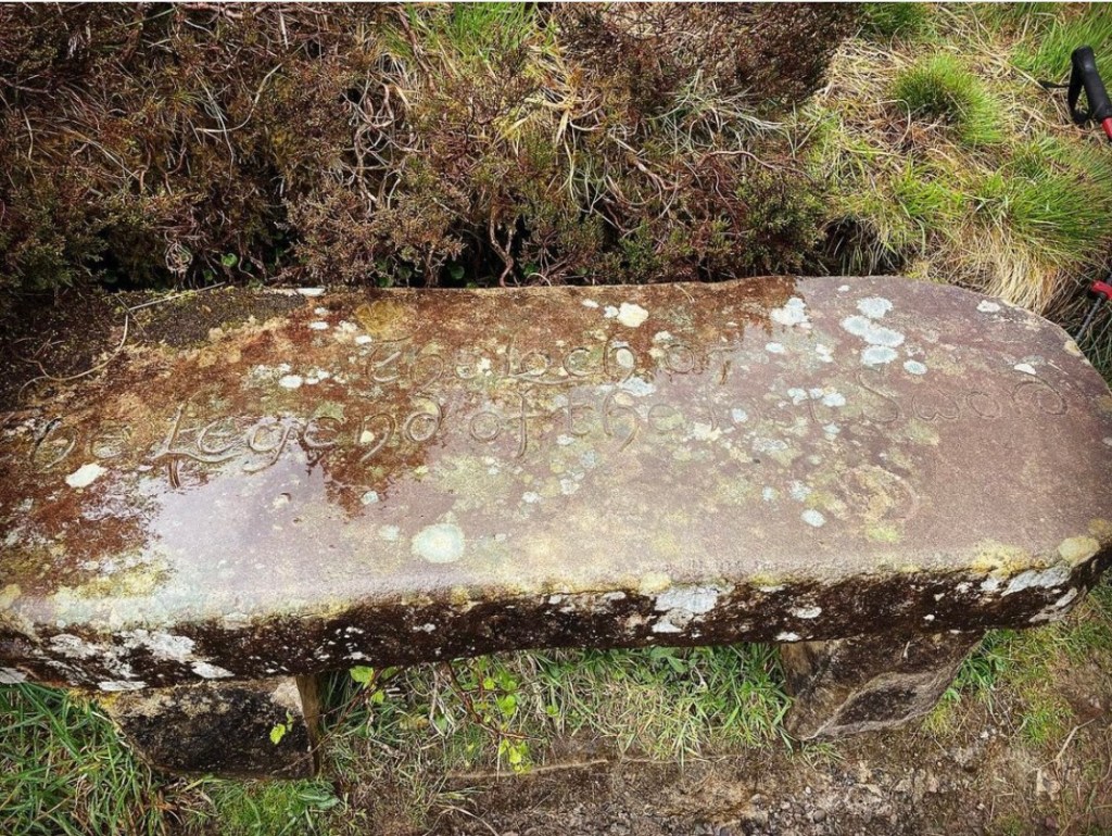
The path continues over this open space passing a stone bench commemorating the Battle of Dal Righ and some other interesting artefacts before crossing a small bridge over the river Crom Allt.
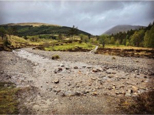
Below is a photograph of the river crossing I encountered just before reaching the village of Tyndrum. I was lucky on this day that the river wasn’t in full flow and so the route across was fairly straightforward. I remember feeling quite surprised at the time, given the amount of rainfall this week alone. I have seen footage where this location is a full washout in water and has involved some paddling to get across.
Shortly after this, is a very barren patch of land at the site of the old lead smelting mill in Tyndrum where absolutely nothing has grown for the last 100 years. Unfortunately lead poisoning has a devastating effect on plant life and vegetation and it is common to find dead and bare patches of land where these works have been carried out. What is more shocking though despite the buildings nolonger being present, was the sheer length of time that had passed. 100 years is a long time and it was showing no sign of improvement anytime soon. This is a relatively flat and easy going section underfoot.
The pathway drops down quite close to the waters edge at the Crom Allt and follows the left side of it into Tyndrum. Along the way, hikers will pass lots of beautiful properties including 2 campsites. The first one passed is located on the opposite side of the Crom Allt named the Pines Campsite where a small bridge appropriately guides walkers across. The second is By The Way Campsite and hostel which is the usual stop of point on day 4. Once again, I noticed the number of hikers still walking the way had dwindled by this point with many choosing to end their day in Tyndrum. My planned intinery meant that I should press on and try and reach Bridge of Orchy in another approximate 7/8 miles.

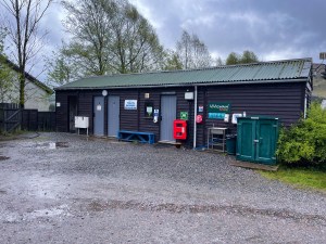
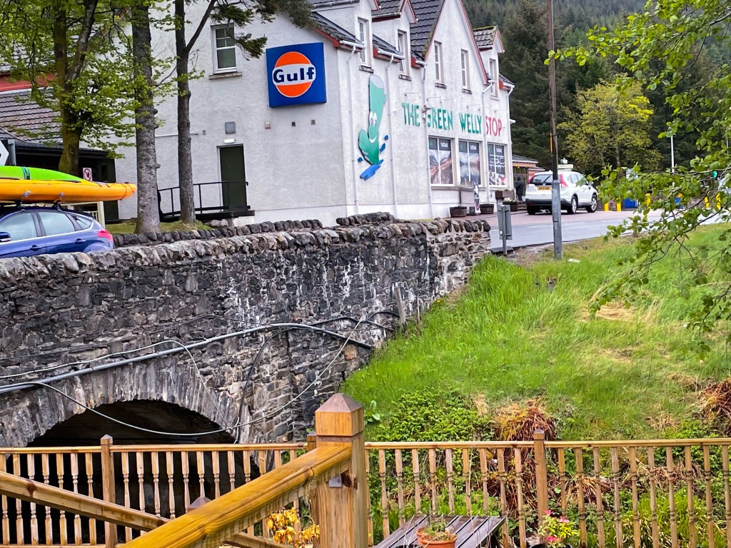
Upon reaching the A82 at Tyndrum there is an array of choices if taking a break here. With public houses, eating establishments, shops and campsites, it is a popular stop of point on the West Highland Way with many hikers calling it a night here. The Green Welly Stop and Brodies Store are well known suppliers of all camping and backpacking needs for hikers of the way and sell literally anything from food and drink to blister plasters. Further into the village there are public toilets, places to replenish water bottles and even a pay as you use self serve laundrette.
Heads up: It is worth noting that the Green Welly Stop and Brodies Store are the last opportunity to stock up on supplies for the next 27 miles from Tyndrum to Kinlochlevan.
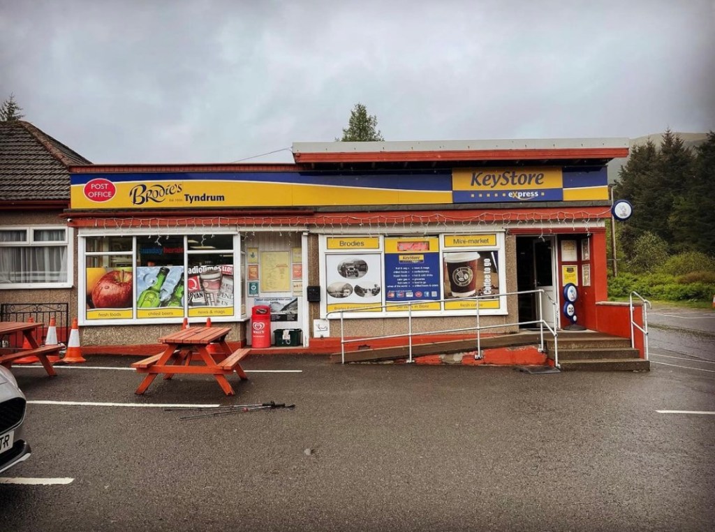
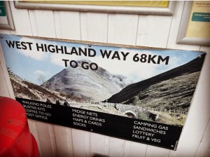
Taking a rest stop at a bench outside Brodies Store I couldn’t help but notice this sign on the outside wall. A subtle reminder that there was still another 68K to hike of the West Highland Way. I had thought about calling it a night here and setting up wild camping outside the Rodney Holland Tree Carvings a short distance along the trail but decided against it when I knew it would make tomorrow longer. I only had 7 days in which to complete the trail and knowing that tomorrow’s hike across Rannoch Moor was likely to be treacherous, I decided to get the longest day out of the way. This in mind I decided to press on the extra 7 miles towards Bridge of Orchy.
Tyndrum to Bridge of Orchy
The rain started once again just before departure from Brodies Store. As I walked a part of me was questioning whether I had made the right decision continuing today and if I might be wiser to stay put in the safe confines of Tyndrum and the Green Welly Stop. The hike so far today had already reached nearly 14 miles and another 7 on top would make my longest ever hike carrying camping gear and a heavy backpack. Still, I felt fine and still quite energised, so I figured having resupplied at Brodies, I could always find a spot to wild camp if the need arose. What an added bonus it would be if I actually made it to Bridge of Orchy.
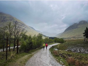
Following the trail uphill, a wide, well marked track continues alongside the store for some distance before heading past tree carvings towards the open glen. From then on, it becomes a long track climbing steeply to skirt Beinn Odhar. All the time there were clear views of the A82 on the left which cut right through the landscape, a concrete reminder of just how vast the sections of moorland and mountain terrain is here in these parts of Scotland. The A82 is one of the main through roads to be able to access these secluded and rugged locations and remains busy no matter the time of year. It is common, if one looks hard enough when walking this long section between Tyndrum and Bridge of Orchy to see droves of people waving from the National Express coaches heading back towards Glasgow. They are no doubt the hikers of the West Highland Way who shortly before me, had stood and walked where I was right now and were now on their return journeys home having reached the finish in Fort William. I myself experienced this whilst I walked the way and it was a truly surreal feeling when I too became one of the wavers on my return journey.
After climbing the track towards Beinn Odhar, the track narrows to a single footpath which in turn becomes rocky and uneven. Care should be taken here as the path turns on a slant for quite some distance with loose moving rocks underfoot and steeper drops down the hillside. Pace became slower here due to the rain making everywhere slippery and risk of rolling an ankle. It was also the place where I became aware of a hotspot on my foot and upon checking, had obtained my first blister of the West Highland Way. Stopping briefly to treat the blister with Compede Blister Plasters, I then pressed onwards on the path skirting Beinn Odhar and dropped down towards a narrow sheep creek carrying the railway line. Passing through this I then rejoined a well established track heading right the way through the glen towards the towering Beinn Dorain.
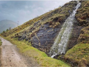
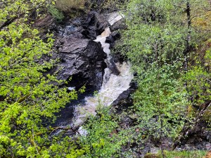
The following section of trail is extremely long and relentless. It is easy to stand within the confines of Tyndrum and make a decision to press onwards whilst saying to yourself that it’s only another 7 miles to Bridge of Orchy. When seeing it that way, it never appears too far. I can honestly say having made the decision to press on that this 7 miles was some of the longest of my life. The track isn’t particularly hard by means of elevation or obstacles. It is flat in most parts but it is very very long! By the time I reached the waterfall, the rain was pelting down and it carried on for the rest of the day and night. The track in parts became submerged in water looking not much different to a stream or gurgling brook. Mist and then fog drifted in, completely hiding the mighty Munro ahead from view despite it only being a short distance in front and visibility quickly became difficult.
The flock of hikers that I had came across earlier in the day had all but disappeared, many choosing to end their day in Tyndrum. Yet here I was continuing onward. At this stage of the day I was beginning to feel similar to what I had felt that first day after leaving Dryman Camping when I suddenly found myself alone on the trail. As a solo hiker, being alone and being comfortable with it are part and parcel of the hike. It is something you become accustomed to. However in a brief moment our feelings change and we become all too aware that despite everything, we do need other people in our lives.
However my feelings of loneliness didn’t last long as it appeared my prayers for company in that instant were answered. For around a corner not far in front, I met a lovely couple and walked with them a number of miles. They sounded like they might be from Poland or around that region and they were headed for the Bridge of Orchy also. It was fair to say that by now, we were all feeling done in for the day and were looking forward to ending our days at the wild camping site by the River Orchy.
Dropping down into the valley at the foot of Beinn Dorain where a stone bridge crosses the River Allt Kinglass we sat for a short rest stop with the rain pelting our heads. The pathway now resembled a flowing stream and it was hard to distinguish which actually was the Allt Kinglass or not. Yet if it wasn’t for the extreme weather and the biting cold which consumed you within minutes of stopping walking, I perhaps could have appreciated the true beauty of my surroundings. It really was a stunning location out here and was more like the kind of landscape and terrain I’d been looking forward to since first beginning this adventure. The low lying mist added to the atmosphere despite not being able to see the towering peaks of the surrounding Munro and hills.
Later along the trail, my new companions and I parted ways as they continued without any further breaks towards Bridge of Orchy. My feet feeling rather sore, I chose to hang fire and rest a little longer. After a while though of getting wetter and wetter by the second I gingerly placed one sodden boot in front of the other and slowly pressed onwards.
The track stretched onwards for miles and due to the mist and rain, I couldn’t see more than 10 meters in front of me. Just when I thought we might be near to the Bridge of Orchy, the track would either turn a corner or rise from the depths of a dip to continue stretching painfully and relentlessly onward. A friend of mine had told me to keep an eye out for the phone mast tower which can be seen for miles and is often used as a landmark to signify the end of this long stretch, however today with poor visibility, seeing this was impossible.
Eventually though the path turns off to the left through a swing gate and drops down steps towards Bridge of Orchy railway station. From here it is a relatively short walk down a narrow road towards the Bridge of Orchy Hotel and the River Orchy where the wild camping spot is located.
The relief that washed over me at this point was hard to describe. It had been a long, wet, tiring walk from Tyndrum and my longest day on the trail yet. I had been a little nervous as I’d sat at the River Allt Kinglass as I remembered what a friend had told me about the spot here. The ground at Bridge of Orchy can become very boggy and waterlogged especially after heavy rainfall and pitching the tent can be very difficult. I desperately hoped that there would be some decent pitches left.
Camping spot
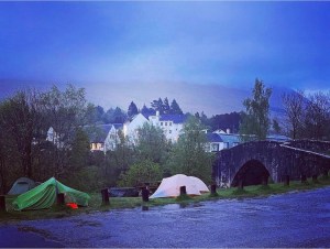
Bridge of Orchy wild camping spot is located on the far side of the stone bridge close to the Bridge of Orchy Hotel. The bridge in question runs over the river Orchy and on it’s bank is a dedicated wild camping location. It proves a popular place to set up camp due to its close proximity to the Bridge of Orchy Hotel where hot food and beverages are served. As of 2022, there has been placed 2 portable toilets at the site and there are picnic tables and seating with bbq facilities.

The weather was at its worst when I finally arrived at the wild camping spot at approximately 7.30pm and the rain was showing absolutely no chance of slowing. A beautiful spot but I noticed that people were absolutely right in their description of it being boggy. Everywhere was sodden to point of the ground being completely unsuitable for tent pitching. All except one spot. I managed to secure myself the last suitable pitch at the back of the site right next to the road and at the side of a picnic table.
Putting up the tent in the rain was tough and nearly everything got soaked in the process. Eventually though, I was glad to get into the warmth of the tent and enjoy some tea by Basecamp Foods and a cup of hot coffee, my first hot drink since leaving Strathfillan Wigwams at around lunchtime earlier.
It was on this night as I sat soaked to the bone and freezing that I began to ask myself if I had done the right thing coming here after all. The West Highland Way didn’t seem half as exciting tonight with the rain pelting down all day as it had whilst I’d been planning it all those months before. ‘Pitter patter, pitter patter’ went the rain as it thundered down on the tent and everything all around.
My feet really felt it too and upon checking them out in the warm confines of the tent, I realised my blisters were much worse than I had first thought. Since applying Compeed as I’d neared Beinn Dorain, I had developed 3 further blisters which required treatment immediately. Two of them were unfortunately between my toes which meant they were difficult to adequately protect with blister plasters and would serve to cause problems for the remainder of the trip.
I hadn’t banked on the amount of rainfall that we got either although I had expected some. The previous weeks walkers were blessed to fair weather and the way had looked so inviting and fun, however this week so far, all I had seen was heavy rain which had been relentless for all the 4 days that I had been on the trail. It made the going hard work and visibility in parts was restricted.
Yet later that evening during one of my many trips across the road to the portaloos, I couldn’t help but smile when I looked around at my surroundings. Yes it was still raining heavily and no one was out of their tents but in the solitude of the moment, the location looked stunning. Surrounding Bridge of Orchy were the towering hills and mountains, their summits completely hidden from view by swirling grey mists, the white walls of the surrounding houses appeared to gleam and project light all around in the pale moonlight and everywhere had a soft, calm feel to it despite the weather being extremely harsh. I realised then that this is what long distance trail hiking was really about. Situations like this are what keeps it alive and real.
Snuggling down in my tent that night for the final time I listened tentatively to the sound of the rain on the outer fly sheet. Comfort and contentment flooded over me in an instant. There is truly nothing better than being snuggled up warm on a cold night whilst listening to the pitter patter of rain outside, hot drink on the go and everything you could possibly need by your side. “Things could be worse”, I reassured myself…. “Pitter patter, pitter patter, pitter patter” answered the rain.
Hike Summary
Distance walked: 19.85 miles
Elevation gain: 2,225 feet
Special Thanks on day 4 go to the following:
Beinglas Farm and Camping who went out of their way to make my stay with them so comfortable. I had a fantastic time there in the bar and restaurant and was impressed by the comfortable facilities which I was so grateful for after my treacherous hike along Loch Lomond. As it currently stands, Beinglas Camping has changed hands since I was there in 2022 so this applies to the previous owners, however I am still hearing great things regarding the current ones and hope to return soon for another visit.
The wonderful staff at the Trading Post at Strathfillan Wigwams who make the best bacon and egg rolls and were so kind and welcoming.
Brodies Store in Tyndrum. Keep providing the service that you do. Believe me it is well and truly appreciated.
The lovely young couple I met near the waterfall not far from Ben Dorain. Sadly I never remembered your name but if you can remember a scruffy, soaked, bedraggled looking woman from around this area of trail and walking to the river Allt Kinglass with her, it’s me! Thankyou for your company on this long stretch. You made a challenging hike so much sweeter. I saw you again later at the Kingshouse and hope you managed to complete the trail.
The kind guy I met at the Bridge of Orchy wild camping spot who was in the tent at the side of mine. Again I never got your name but Thankyou for checking in on me after you saw me putting my tent up in the pouring rain. You offered to help and I declined but it was appreciated all the same.
Lastly to my readers of this blog. Thankyou for all your support and positive comments throughout this series so far. It is definitely a challenge to write a series blog and juggling commitments with this can become overwhelming. Still, I love what I do and writing is as much part of me as the exploring itself. Day 4 was the longest and most action packed of all the days on the trail so there was such a lot to discuss and talk about. I apologise for how long it has taken me to release this post but now it is, I hope it gives an insight into what this section has to offer. Much respect to those of you who have given my humble blog a chance. For me it truly means the world.
Take care everyone and see you soon in day 5. Happy hiking and stay safe. Lucy xx
KEMP, Nick. (2019) Another National Park Forestry Failure – Section of the West Highland Way up for sale. Parkswatchscotland. http://www.parkswatchscotland.co.uk
LACAILLE, A D. (1924) Kirkton, St Fillan’s Priory, Graveyard. Canmore National Record of the Historical Environment. Last accessed 07/05/23. http://www.canmore.org.uk
MACRAE, Fraser. (2019) St Fillan’s Priory. Outdooractive. http://www.outdooractive.com
SCOTLANDS FINEST (2023) Battle site of Dalrigh 1306. http://www.scotlandsfinest.nl
Walkhighlands (2023) West Highland Way 5: Tyndrum to Inverarnan. Last accessed 07/05/23. http://www.walkhighlands.co.uk
World of Waterfalls (2023) Falls of Falloch: Crianlarich/Loch Lomond and the Trossachs National Park, Scotland, Uk, Great Britain. Last accessed 02/05/23. http://www.world-of-waterfalls.com/waterfalls/europe-falls-of-falloch
WHW. (2023) Official West Highland Way Trail Guide. http://www.westhighlandway.org
All photographs used in the creation of this blog post are my own and have been captured using an iPhone 12 camera device. They have been sourced and edited by myself Lucy Bailey from my Instagram account found at SoloExplorer23 using Instagram editor tool to improve clarity and quality of the image. All distance and elevation images as tracked from Strava GPS are my own and were live recorded on the day in question.

Really pleased to find this installment posted on twitter this morning. I thought perhaps there would be no more!! I think you’re blog’s great and really appreciate the detail. My train to Milngavie is booked for June for my first attempt. Your itinerary and mix of wild and campsite camping is exactly what I’m planning so I’m finding your blog really useful. Look forward to your account of Rannoch moor. Do please keep posting. xx
LikeLiked by 1 person
Thankyou so much for your kind comment John. I’m so pleased that the information in the blog is helpful to you. The 5th instalment is already in planning and I aim to complete it within the month.
I hope your adventure of the WHW goes smoothly. I’m sure it will. I had the most amazing time on the trail and it definitely one I will keep coming back to. I’ve walked a few now and all have been brilliant with their own quirks and surprises, however the WHW is special. The people you will meet are definitely what makes it. I have never enjoyed such a popular trail more! That said though, it does have its challenges and it will test every emotion and fibre of your being. I hope the weather is a little kinder to you than it was me. I only had 1 clear day in the whole 7 that I was there but looking back it was still an awesome experience. I wish you well on your upcoming adventure. Lucy
LikeLike