31st October 2020
There are 88 trig points which make up the Peak District Trig Point Challenge and 32 of these are located on private land. The trig which will feature in this post is White Edge Trig Point which is located in the White Peak section of the Peak District National Park.
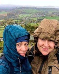
I heard the rain before I saw it that dark, gloomy Halloween morning. It was 7am, miserable outside but the pull to go adventuring had never felt stronger. I was looking forward to this one in a very different sense, possibly because for the first time in what had seemed like ages I wouldn’t be hiking alone. As much as I enjoy solo adventures, it is always a pleasure to share the trail once in a while to laugh and offload various stresses in ways in which we cannot always accomplish oneself.
My best friend Kat had talked of going hiking lots over the recent weeks, however hill walking and visiting moorland locations were new to her. So new in fact that apart from never visiting the Peak District, she had never even heard of it!
We had become friends in 2019 after meeting at a party and through our shared interests in music, had developed overtime a close friendship which I knew would last a lifetime. Other hobbies began to be introduced in our spare time and despite a long 7 months of not seeing each other during the lockdown of the 2020 Covid 19 pandemic, we both jumped when the socialisation ‘bubble of 6’ was introduced. After all this time, we were damned if rain was going to get in the way of this adventure.
Today I had chosen a new location. One which I felt would be short but stimulating for a first time visitor to the Peak District as well as being packed with excitement. Two evenings previous had been dedicated to selecting and planning this adventure and I had browsed the internet repeatedly searching for one which would satisfy our needs.
I had immediately been drawn to the idea of an edge walk feeling certain that the no doubt surrounding views would ensure that the effort had been worth it, yet I wasn’t looking for a particularly long walk that day. Due to the time of year, I wasn’t intending on taking packed lunch either, moreover hoping for a stop off in a nice country pub along the route. What luck I had felt when eventually, I stumbled upon the map showing the very route we took on that October day! It felt at the time that it had been specifically written for us and I couldn’t have planned it better if I’d tried.
The walk that I selected for Kat’s Peak District walking debut was one which combined the High, Dark and White Peaks of the Peak District National Park. Right on the borders where these peaks meet was a location I had not yet visited at this stage but which looked amazing on photographs. It was the Curbar, Froggatt and White Edge circular route which finally took my preference that autumn Halloween day.
I have been asked by some readers who are not familiar with the territory of the Peak District about what the difference between these Peaks are and what is actually meant by their naming. Therefore I felt that I should explain at this point:
The White Peak – is characterised by limestone and paler rocks and landscape in general.
The Dark Peak – is highly noticeable for its gritstone and peat moorland which makes the landscape stand out as considerably dark.
The High Peak – is always the settlements and areas which are in the highest elevation locations and can cover both the White and Dark Peak sections.
Overview
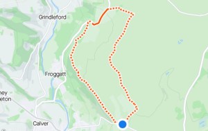
The nature of today’s adventure is an edge walk spanning a distance of approximately 6 miles in total, beginning at Curbar Gap car park in the High Peak of the Peak District National Park and running full circle across 3 magnificent edges back to the starting point. Along the way, we intended to take in the panoramic views across the surrounding landscapes of Chatsworth, Grindleford and Derwent as we made our way across Curbar and Froggatt Edge. These are 2 stunning crags adorned with magnificent rock formations and steep, jagged edges with a footpath leading the way across the high tops, before dropping down to Owler Bar Road. Following the lane from here, the plan was to break for lunch in the Grouse Inn Public House at Froggatt where afterwards, we would head out across White Edge on Big Moor. Heading now into White Peak territory, we would follow the main footpath and take a slight detour to visit the trig point at White Edge before branching off onto the footpath leading the way back towards Curbar Gap car park.
We arrived at Curbar Gap car park on Clodhall Lane at approximately 10.30am. Rain pelted down making visibility through the car windscreen almost impossible as the tires crunched over the gravel. The car park is only small and is situated just on the brow of the hill if heading up from Curbar village down in the valley. As we pulled into our parking space, I was relieved that there were only 4 other cars parked. I had read that parking around this location is limited and that it was advised to arrive early if hoping for a spot. This was not an issue however today on this miserable day in late October, with no doubt the heavy rainfall playing a large part.
It is worth noting that Curbar Gap is a paid car park and has a parking meter which at the time we visited in late 2020, took cash only. We had in fact arrived 20 minutes earlier in which to our dismay, we found that the metre didn’t accept card. It had been necessary then to drive back into nearby Baslow to withdraw funds before returning.
Sitting in the car as it was parked up that morning with the sound of the rain pelting the bonnet I could sense my friends doubt of the walk ahead. Although I was used to venturing out into the Peaks in all weathers, she wasn’t and the rain at this moment in time was heavy. However, I had reassured her plenty that it was only a short walk and therefore, we wouldn’t be out for long. Earlier in the week, she had invested in some new trousers which she had said were waterproof. They were the all in one kind which I was not familiar with which can be used to hike in all weathers, but which are waterproof in the case of rain. I guess now was as good a time as any to test their validity and after pulling on my waterproofs and grabbing our packed rucksacks from the boot, we set off up the stoney footpath towards Curbar Edge, our first edge of the day.
Curbar Edge
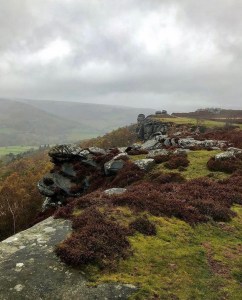
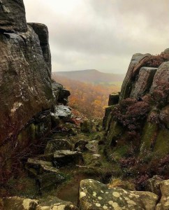
The footpath leading up to Curbar Edge begins as a single track with a slight incline before the views open up. Upon reaching the start of the edge, the footpath we were on continues forward, however, we deviated from this and headed left in order to explore the path running close to the crags. From here we would get a more detailed and clearer view of the surrounding landscape and be able to fully appreciate the fantastic rock formations and ledges which make this location special.
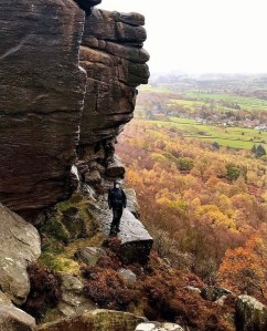
Curbar Edge, the prefix Curbar meaning ‘Corda’s fortified place’ has a height of 292 meters (958 feet) and is made up of shale and gritstone making it a prominent and well known feature of the Dark Peak, however due to its elevation above sea level, it is classed as being part of the High Peak. It is located above the village of Curbar in Derbyshire with local villages being that of Froggatt, Calver and Baslow. Nearby Padley Gorge is located in Grindleford in the bottom of the valley.
This particular edge dates back to the Bronze Age in that the Romans used this location to quarry the rock which would be used to produce millstones, which in turn would be used locally to make grey flour. Grey flour at that time was used as the main ingredient in cattle and other relevant animal feed. It turns out that the village of Curbar is one of only 4 locations within Derbyshire where millstones were produced and the road leading down from Curbar Gap car park to the village itself and beyond, was in-fact an old Roman road which is still recognised as that today.
Curbar Edge is characterised by its large overhangs of rock which form the high ledges making this route most attractive and adventurous. The overhangs have been rigorously formed overtime by severe weather and the harsh cold of passing winters. The softer layers of shale, mud and sand under the harder formed gritstone has become weathered and worn away, thus resulting in the large ledges high up.

The location is a favourite place to spot various plants and wildlife with it being home to the likes of ling heather, cowslip, guelder rose, primrose and dog’s murcury in strong abundance. Wild cattle, deer, grouse and a wide variety of birds of prey are often spotted in this area.
I have to admit that I was totally overwhelmed as I walked along the edge that day. Despite the poor weather and the constant gusts of drizzle, I was in awe at the views and the rich autumnal colours and textures which dominated the scene. Out of all the seasons of the year (and I walk them all), autumn is my favourite for hiking. The change in light, colours and moody tones drastically change the landscape enabling me to see the world through fresh eyes, in ways in which I have never seen it before. The fact that there are less leaves on the trees alone make viewing opportunity better and different seasons bring out new species of animals and plant life. The latter seasons in the year also give me more chance of getting locations to myself as less people tend to venture out in cold and adverse weather conditions. This all contributes to the creation of a new landscape and changes an adventure somewhat.
However, I do find downsides to autumn hiking in that the weather is unpredictable, it can be absolutely freezing and there is an increased chance of ice and fog. Having adequate clothing is essential at this time of year in particular. Despite this though, it was and nearly always is an absolute pleasure to be out walking in this season and my honest opinion is that people definitely miss out by restricting themselves to solely being a fair weather hiker.
The Pinnacle Stone

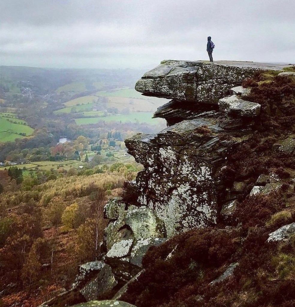
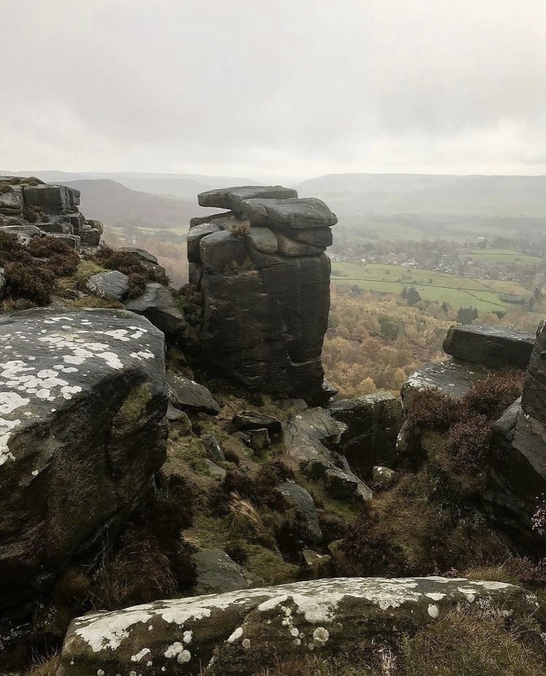
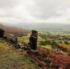
After some distance along the edge I finally noticed a large distinctive pillar of gritstone rock which stood out from all the others. This was mostly because of its size and the way it stands almost solitary in it’s upright position a distance away from the other boulders and rock formations. I recognised the rock at once as being none other than the famous Pinnacle Stone which has featured in many YouTube videos, blogs and other writings about Curbar Edge and is a favourite place for photographs. It has become almost customary to see images on most social media sites of people stood on the very top of the pillar and although I didn’t climb to the top that day as the wind and rain was atrocious, I couldn’t help but imagine the feeling one must get on succeeding. The Pinnacle Stone of the Peaks is ranked up there as a much sought out spot for the daring adventurer, in much the same way as another well documented and treacherous spot none other than the famous Trinnacles, which is located on the Dovestones and Yeoman Hey Edge walk at Saddleworth Moor.
Froggatt Edge

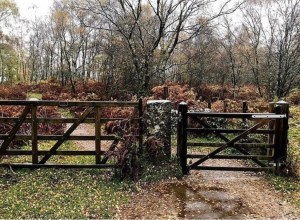
Continuing our walk we headed away from the now descending edge and headed back towards the main pathway. Following this we made our way towards a wooden fence and gateway which we learned separates Curbar from Froggatt Edge. The rain was now at its heaviest of the day and although wearing my waterproofs which were effective, my face and hair was soaked. Kat too was not comfortable, the trousers having proved to be not waterproof in the slightest. I could clearly sense her discomfort as we entered a wooded area just slightly past a pretty stream and was grateful that the trees gave some temporary cover from the worst of the weather.
Froggatt Edge is very similar to Curbar in that it was formed in much the same way. Again, it was used back in the Bronze Age for quarrying gritstone to be made into millstones. Whenever I have glanced up at the edge from down in the valley I have noticed that it very much resembles a steep gritstone edge with rocky outcrops against the skyline, however, viewing from the crag top can be obscured at times when the leaves are in bloom as in this location there are more trees and shrubbery. A forest of birch trees grow all along the path line across Froggatt Edge which looked very attractive even in the autumn months.
There are many small paths which lead off the main pathway to clearings with large boulders and overhangs at the crag edge in which we took advantage of the views here. Upon exploring this section for a short while, clear views down into Grindleford and lower Froggatt were enjoyed here through snippets of cleared sections in the forestry. If it hadn’t been raining so hard that day, I would have loved to have stayed and explored for much longer. There was potential for some fabulous picnic spots in the warmer months with rocks to sit on and shelter from the wind.
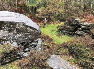
Rock climbing is a favourite in this location with lots of documented climbing routes dotted along the top and bottom of this section. Terrain underfoot is sandy pathways which are characteristic in this area of the Peak District.
Continuing on along the footpath as it winds through the woodland, we began a gradual descent towards Owler Bar Road at Froggatt. Following this we headed out of the dip in the hills and began the incline up the hill towards the Grouse Inn public house which could clearly be seen at this point on the brow of the hill. Almost by magic, the rain suddenly stopped but the sky remained bleak and dark. It was as though it was mocking us as we trudged along, teasing us with the hope that it might be the last of the rain but could start again as quickly as it left.
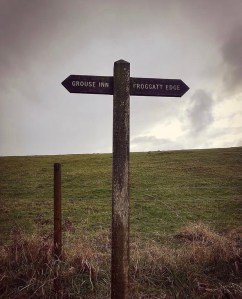
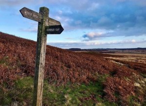
As I climbed the hill towards the pub I caught sight of the above finger post. It was not a difficult decision to make if I’m perfectly honest. By now, Kat’s trousers were saturated and as she walked slightly ahead of me, I could clearly see the water dripping down from her clothing. My stomach was rumbling too as I thought about the delicious meals that I knew were served at the Grouse Inn and I found myself speeding up my walking pace if only to be in its warm confines.
The Grouse Inn
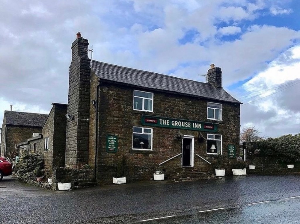
The Grouse Inn at Froggatt is situated on the brow of the hill on the left side of Owler Bar Road if heading from lower Froggatt towards the Longshaw Estate. On the day we visited in October 2020, it was open and serving hot meals with social distance measures in place as the country was experiencing tier 3 lockdown restrictions. We were made to feel welcome from the second we walked in and shown to a comfortable table in a quiet lounge by the side of a window overlooking the dark moody hills of Big Moor.
The Grouse Inn is a walker friendly pub with a designated room with coat pegs and places to put wet over clothing and boots. A selection of leaflets were also available free to take away containing information about local short walks in the area and an up to date notice board hung on the wall. Due to the current situation regarding Covid 19 in England at the time, there was limited entertainment and events on in the area but I can imagine this board will be a good source of local information in better times.
We stayed about an hour at the pub to enjoy a meal, a glass of red wine and to dry off our wet kit as best we could. The meal was absolutely delicious and I was stuffed afterwards. The staff are very prompt with service and very polite and helpful. I thoroughly enjoyed my time at the Grouse Inn and would recommend this public house as a must stop off place whilst walking in this area.
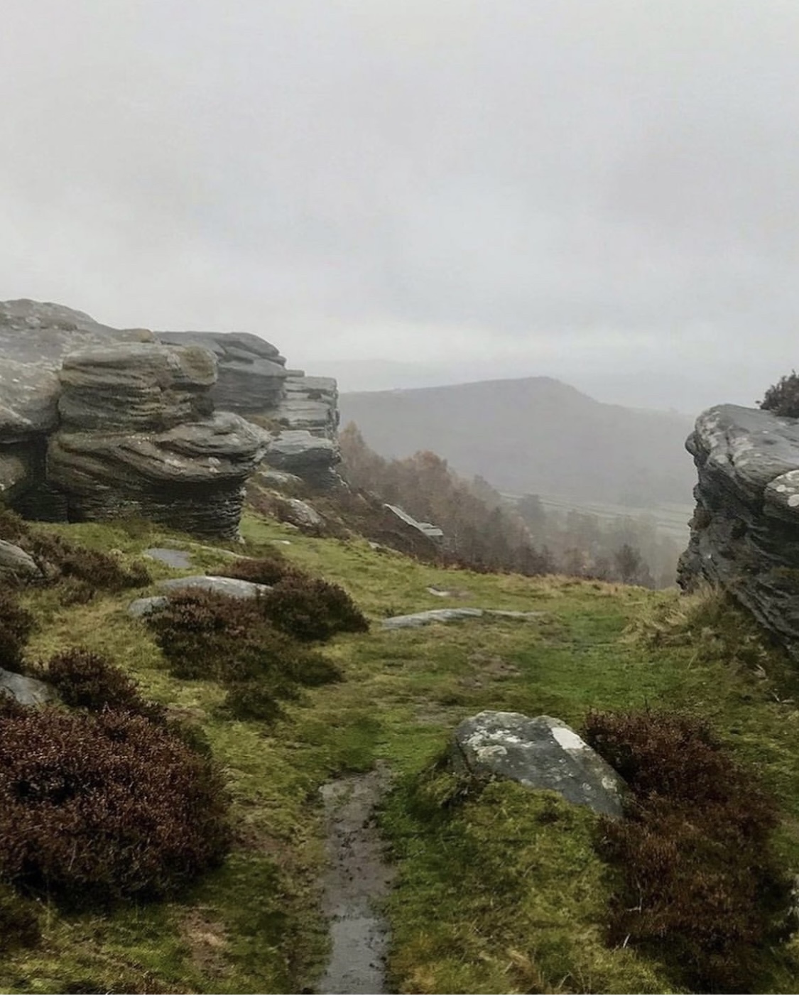
Big Moor/White Edge Moor

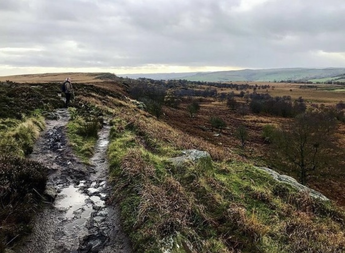
Leaving the comfort of the Grouse Inn behind us and feeling a little tipsy from the glass of wine (and it was a large one at that), we crossed Owler Bar Road and continued along it a short distance before we approached a wooden gate leading the way into open pasture and the beginning of White Peak territory. The footpath here was very muddy due to the recent rainfall and it was a slow going hike up the hillside before the path loops back on itself to begin heading along White Edge on the outskirts of Big Moor.
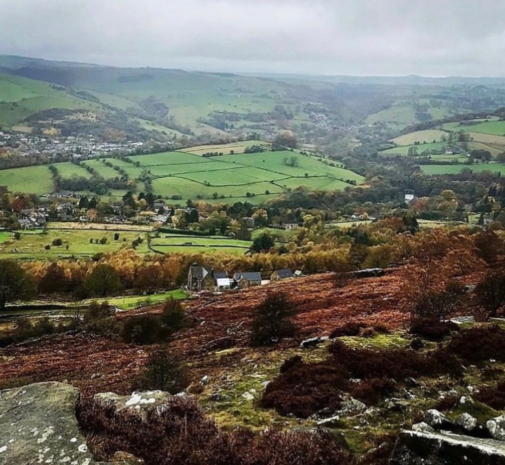
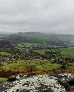
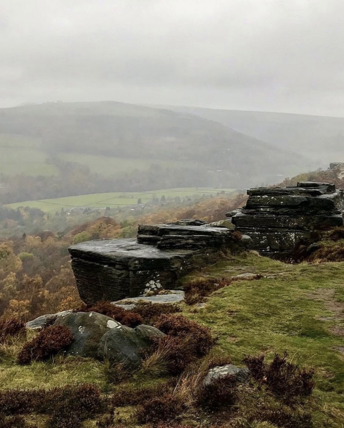
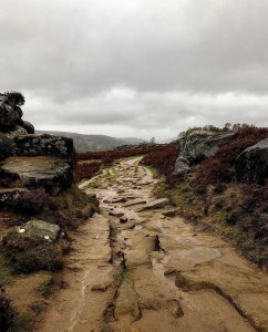
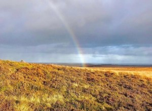
White Edge is a rocky outcrop which runs along the edge of Big Moor and is located on the outskirts of the Longshaw Estate at just over 1000 foot above sea level. It is considered to be one of the most secluded and isolated spots within the Peak District National Park yet it is only approximately 10 miles from Sheffield City Centre. The following photographs are a selection of what we experienced as we walked along the edge that day.
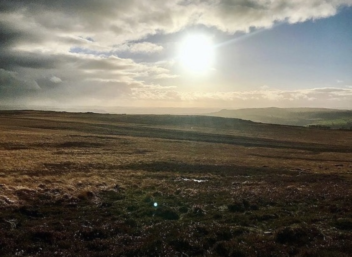

The moor is characterised by vast open landscapes for literally miles with various heathers, long rushes and grasses and it is not uncommon to spot herds of wild deer here in this location with autumn months being the commonest time. On this day however, no matter how hard we searched, we found none. I have to admit that at the time I felt slightly disappointed as it seemed every person on social media was gifted to these creatures from the very first visit, it was just my luck that they wouldn’t be there when I came. Oh well, there was always other times and now there was more of a reason to return.
Within the confines of Big Moor are 3 ancient stone circles and a burial mound which are said to date back around 4 to 5 thousand years. The land is unusable in most parts for the likes of growing crops and building and so due to this, it was left untouched for many many years meaning that any ancient relics were preserved and late being discovered.
Popular with walkers and trail runners, White Edge is a stunning place to venture giving amazing views as far as Sheffield over the vast, rolling landscape. A distance along the footpath, the trig point at White Edge can clearly be spotted. A short detour off the path, the trig is easy to get to.
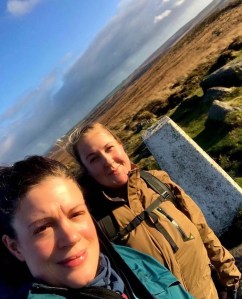
White Edge Trig Point
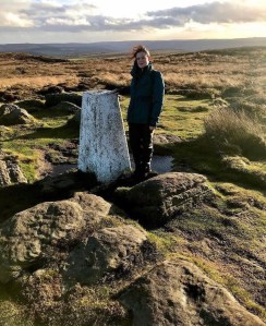
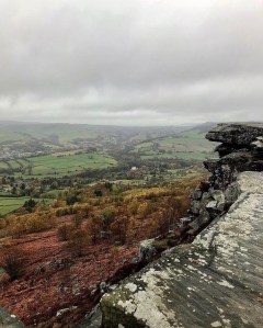
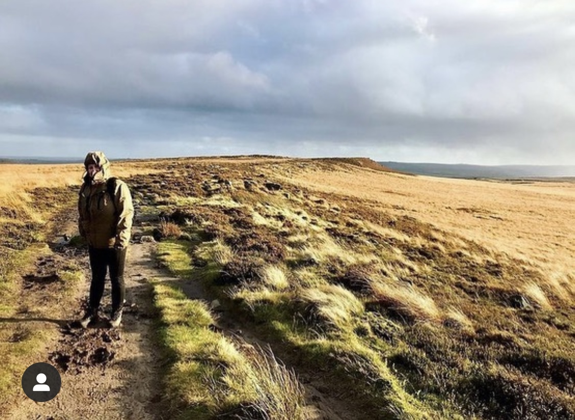
White Edge Trig Point is located on open access land just a short distance from the main path on the left side surrounded by low mounds of heather and long grasses. It is an easy trig to spot and so bagging this was not an issue. The trig stands at 365 meters above sea level (grid reference SK26378 75855) and at the time we visited was in good condition but looked as if it was in need of a good lick of fresh paint.
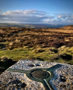
We were in luck that the weather had turned out fine enough to stay and enjoy photographs at the trig. As we stood there, the views from the top were spectacular in the sunlight which lit up everywhere in bright golden light. We could see right across towards Hathersage Moor, Owler Tor and Stanage which seemed a million miles away and panning round, there was the edge of the Longshaw Estate and the sprawling city of Sheffield. It truly was an amazing sight to be had. Our only issue was the wind. Although not terribly strong, it certainly drowned out our voices whenever we tried to talk and took our breaths away every now and again.
As much as I could’ve stayed forever at White Edge that day, we knew it was soon time to press on. The days were much shorter in autumn months and even as we watched, we could see the beginnings of sunset approaching. The time was only approximately 3.30pm but we knew better than to hang around and wait. The weather could change any second and we could once again be thrown back into torrential rainfall and heavy gusts of wind. Heading back down towards the path we left the trig point behind.
The main path continues onwards for approximately another half a mile or so before dipping down off the high top into a gully where the path forks at a junction. Here, walkers get the choice of continuing forward across Big Moor to other local attractions such as Baslow Edge, Eagle Stone and Birchen Edge, or turning right to head across to Curbar Gap and the car park we had begun at earlier in the day. We opted to head back to car now that the day was almost over and so took the right hand footpath crossing a small brook before heading swiftly back uphill.
It wasn’t a long trek in this section before we reached the road and spotted the car. As we walked, I thought all about this pleasant hike today and the immense fun it had been to share the trail with my friend. As much as I enjoy solo adventuring, it was nice to have someone to talk to for a change. After all, we are social beings and our natural drive is nearly always to be around other people. Having company is just as important as having much needed time to oneself.
As we took off our wet and muddy hiking boots and put them in the boot I couldn’t help but giggle to myself at Kat’s wet hiking trousers. Having brought no other change of clothing, she had to drive wearing them and I knew she wouldn’t be wearing them anymore after today. So much for waterproof all in ones that were about as waterproof as a bathroom sponge! On the way home, I asked Kat if she would consider another Peak District walk another time seriously thinking that this would be the end. Little did I realise, that this was only the beginning….

Walk Summary
Distance walked: 6.16 miles.
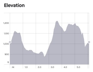
Elevation gain: 681 foot.
So when it comes to summarising this walk I can truly say that there were more pros than cons. The actual length of the hike was only a short one given the fact that my friend had never visited the Peaks but it worked well. There was so much packed into it that we were spoiled for choice in scenery and rock formations along the crag edges. Sometimes it doesn’t matter about the distance, just being able to spend quality time in a location and actually be able to see what a place has to offer is the best aspect. Many times I have missed some of the great gems hidden away in an area for no other reason than that I have felt rushed to cover miles, thus resulting in more quantity than quality.
Viewing opportunities are plentiful on this walk with stunning scenery for literally miles, covering a very large area. The crags themselves all offer their own special qualities and are unique in both views and rock formations. All 3 are strikingly attractive and although in virtually the same vicinity, none are the same. If I had to choose a favourite out of the 3, it would be Curbar Edge, mainly due to its length and the endless nooks and crannies there to explore. It’s sheer beauty captures you from the second you see it and as there’s hardly any trees in this section, it makes viewing and scenery so much better.
Going in autumn was a real eye opener as the colours were really rich, something you don’t always get in the summer. As mentioned previously, autumn is my favourite time of the year for walking due to this very reason. I found that lighting is always better and so are photographs. In saying that, it did have its downsides in that due to the cold and rain, we couldn’t stay for too long in one place. This meant that we couldn’t explore for as long as I perhaps might have if the weather had been fine. We were lucky on the day we visited that we had clear views from the crags despite rain and this cheered up the gloom somewhat.
The advantage of a pub halfway is what made this walk special too. Quite often I have to wait until the end of a hike before I find one so it was nice to ditch our soaking rain coats and enjoy the warmth of the pub once in a while. There are no public toilets on this walk as with a lot of the routes within the Peak District so this was also a useful thing to have halfway.
All in all, this is a nice easy walk with no real ascents throughout. The pathways underfoot are easy terrain of rock, sand and tiny pebbles which were not muddy or difficult to walk on despite the poor weather and in most places, access is relatively easy. I have to say that out of the many walks that I have had the pleasure to try, this 3 edges circular is one of my favourites. I plan to visit again in late summer when the heather is in bloom to experience it in colour and visit some of the stone circles which we unfortunately didn’t get to see on this visit. The location of Curbar, Froggatt and Baslow in general is teaming with history just waiting to be explored and the more I see of the Peaks, no sooner has one door closed before another opens.
Once again, hope you enjoyed this latest post and hope to catch you on the next one. It’s an ideal walk for those seeking an adventure in short distance without the usual strain and effort which so often comes with many Peak District excursions of this nature.
Resources to aid the factual information sections within this blog were sourced from the following websites and were accurate at the time of writing.
http://www.derbyshireheritage.co.uk. Curbar Corda’s Fortified Place – Derbyshire Heritage
http://www.walkingenglishman.com Walks in the Peak District – Curbar Edge and Froggatt Edge Walk
http://www.gofora walk.com. White Edge. (Big moor) 366 meters 1202 foot
http://www.letsgopeakdistrict.co.uk The intriguing millstones of the Peak District
http://www.bigmoor.co.uk The natural history of Big Moor Derbyshire
Mailor, J.P.G (2014) Quarrying on the eastern moors (PDF) The University of Sheffield.
Graham, Fergus, (1924) Recent developments in Gritstone (1st edn) Rucksack Club, Yorkshire Ramblers Club and Gritstone Club pg 83.
All images used within the creation of this blog post are my own and were captured by myself Lucy Bailey using an iPhone 7 camera device. They were further edited using Instagram editor tool and can be viewed on my Instagram page found at Soloexplorer23. Map and elevation images and information were sourced from my Strava account and are actual live GPS recordings of the walk in question.
