17th December 2021
There are 88 official trig pillars which make up the Peak District Trig Point Challenge and 32 of these are located on private land. The Trig Points that will feature in the following blog are: Abney Moor (aka Durham Edge) and Bradwell Moor Trigs. These are located within both the High and White Peak areas of the Derbyshire Peak District National Park.
Polite note – Abney Moor Trig Point is located on private farmland. There is no direct footpath up to the trig and is within close proximity to the Derbyshire and Lancashire Gliding Club. This means that accessing the land might not be possible when gliders and other light aircraft are being flown. There are several private trigs located in and around the Peak District. Permission to enter the farmland in order to visit the trig should always be obtained from the landowner wherever possible or from others who frequently and lawfully make use of the land in question. It is considered trespass to enter private land without obtaining permission prior to visiting.
It was Friday the 17th December 2021 and Christmas was just around the corner. Another year was approaching its end. A time when many are thinking about family, loved ones and the idea of spending quality time together, it is regarded as a special time of year. I’ve always thought the atmosphere has a magical tint to it around these times which is all the more enhanced by the bright twinkling of Christmas lights, the intricate firs and decorations so carefully hung in every nook and cranny. It represents for many, a time of recognition and gratitude for all we have accomplished in a year and paves the way for new thoughts and aspirations (however briefly they flicker through our minds), of what we hope for the next chapter of our lives in the new year.
Today I was heading out into the glorious Peak District once again to explore an area that was new to me. I was looking forward to a new hike. One that took me away from the popular overcrowded locations that are commonly frequented when visiting Derbyshire, whilst not being too far from familiarity at the same time. The big question however, was where?
A walk where this could be observed from a distance sounded the best bet, yet I was keen on a location that wasn’t often documented. New locations, new emotions and new mindset. That was how I pictured it and although my aim was to end the year on a positive note with some picturesque Christmassy scenes, my overall hope was to enter the new year with some wonderful memories and a fresh mind. I guess all we can ever do is hope.
New directions were not the only reason of course. Over the last year, I have been involved in the Peak District Trig Points Challenge which is shown on the website http://www.peakdistrictwalks.net. From the outset, the very idea of hunting down trigs in the Peak District excited me and gave me a sense of purpose in my hikes which isn’t always present in every day, run of the mill, walks. Therefore, I felt it necessary to plan a walk which included visiting some of the trigs included in the challenge.
Collecting trigs or ‘trig bagging’ as it is commonly known, is becoming a very popular pastime especially among hikers. The sense of satisfaction felt when you come across a trig that you have purposely set out for makes any difficulty worthwhile and gives an enormous feeling of personal achievement. For me, they at times have a sentimental value too…. As a person who is constantly on the lookout for new places to visit, I value the importance of incorporating new walk routes into the mix to give my adventures a sense of uniqueness as well as adding a touch of theme in an otherwise, ordinary winter walk.
Trig points, although no longer of official use in current times, make a tremendous landmark to our National Parks. For many, they symbolise a reward for reaching the summit of a large hill or mountain and they make great scenes for photographs and memory making. Not all of them are in high places however, some are easy to find whereas others are hard, some are in poor condition or do not resemble a traditional trig pillar and some locations are quite unusual. For me, it has become the norm to try and discover at least one trig per walk and has given me the encouragement I need to spread my wings and explore new, perhaps daunting places that maybe I wouldn’t have considered visiting before.
Planning the route and linking together trigs can be a troublesome task as I discovered early on in this challenge. They are not always close together and it may only be possible to find just one on any particular walk mostly due to where they are situated. However today, I was confident that I had managed to plan a suitable route that would get me two sought after trig points and allow me to complete the walk before darkness fell. It was December after all and the days were much shorter at this time of year.
The 07.09 Northern Rail service from Sheffield Station would get me to Bamford in the Peak District for approximately 7.30am. It was still dark as I sped along and as I edged ever closer, I could feel the familiar excitement building up about what lay ahead and the impending adventure. What would I see today? Who would I meet? Will the route be everything I hoped for or more? Will the scenery be as breathtaking as it is in my dreams? It’s like a fire has ignited within my soul and cannot be extinguished until it is experienced firsthand. The beauty of not knowing is what keeps it alive…
Overview
The aim of this walk was to begin in Bamford and finish the day in Castleton. Sounds fairly ordinary to me especially when put in simple terms! Just a quick hike along the road would do it. However where would the fun be in that? Instead, I had planned an approximate 12 mile route in between which would take me round the back of the Hope Valley and Castleton in order to venture through some of the least trodden tracks within the Peak District. Areas that the walk would pass through include:
- Shatton Village
- Shatton Edge
- Abney Moor
- Bleak Knoll
- Camp Hill
- Abney Moor Trig
- Great Hucklow
- Windmill
- Little Hucklow
- Limestone Way
- Bradwell Moor
- Bradwell Moor Trig
- Cave Dale
- Castleton
My original plan was to make it a slightly longer hike and include a sunset from the top of Winnat’s Pass and the surrounding moorland above Castleton but I had to change the route slightly at the last minute due to thick mists. That was how Cave Dale came to feature in this particular walk. With todays hike set to be roughly 12 miles and considering it was winter with less daylight hours, I set off walking the second the train pulled away from Bamford Station.
Bamford Station to Abney Moor Trig
It was a very cold, dark and frosty Bamford which awaited me as I stepped from the train onto the platform that morning. A low lying fog surrounded me and everywhere was quiet. Climbing the steps from the station up to Station Road, I immediately crossed over and began heading down Mytham Bridge. It felt so good to be out doing a winter walk. Sitting in the warm comfort of home planning it is one thing, but actually taking the plunge to get out of bed so early and step out into the cold knowing full well that everyone else is still snuggled up under the covers is well and truly another. I always get a sense of satisfaction in doing this as I’ve found that all my favourite sights are obtained either early morning or at sunset. Even photographs are better quality during this time, most likely due to the colours and rapidly changing light. The best part of all this for me though is seeing how spectacular the Peaks are in real life. That is truly better and more exhilarating than any photograph can ever be no matter what camera or filter is on offer.
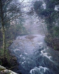
Turning right at the Hope Road I noticed my first Christmassy scene of the walk, a lonely Christmas tree set back from the road. I remember smiling to myself as I passed and instantly felt relieved that I had finished all my Christmas gift shopping the week before. No more stress and worry for me which seemed to get worse with every passing year. Continuing onwards, I followed Hope Road for approximately 10 minutes until I reached the fast flowing River Noe on my left. At this point I crossed over and took a left turn over a stone bridge crossing the river and began heading up a tiny, narrow lane leading into Shatton.
Shatton Lane, although begins as a peaceful stroll soon becomes the first incline of the day. Beginning in Hope, this narrow lane leads through the tiny village of Shatton and heads uphill for several miles through the peaks over Hope Valley before rounding the edge of Shatton Moor. The village of Shatton is not a village as I know it with shops and a quaint public house. It is hardly a village at all really. Just a cluster of pretty cottages and houses lining the lane. As I walked along that morning with the sky still dark, I knew that everyone was still sleeping. Frost gleamed on the pavement in the moonlight making the path ahead shine with smashed blue crystal, each fragment blinking and fading as I got near. A baltic twang hung in the air all around which made my fingers numb as I held my camera and encouraged me to stop photographing for just a second and put it away into the safe confines of my coat pocket. Something I’ve found myself doing lately is reminding myself to focus less on photographs and just ‘enjoy the moment’. Yet my desire to capture everything from every possible angle still hangs around like a fog that won’t clear. It is a constant battle with my head and heart to forever tell myself that I won’t forget, that my memories will not evade me.
Despite this the scene I observed privately as I ambled along Shatton Lane was memorable all the same, with Christmas lights twinkling in every window I passed and gardens decorated with LED lighting of every colour. There was something homely and inviting about this quiet place, somewhere I’d never stepped foot in before which immediately made me feel safe despite being alone. It was always reassuring whenever this happened and always puts me in the right mindset for a long hike. As I began to leave the sleepy dwellings behind and continued along the single track lane as it began to climb upwards into the hills, I couldn’t help but shiver in the dark as the freezing breeze blew down off the moors. The tree covered lane ahead stretched away into the darkness, a tunnel of mystery in an unknown world. The safe sanctuary of the little village was gone…. I zipped my coat a little tighter and snuggled into its warmth.
It wasn’t long before my turn off appeared, a little footpath on my right leading downwards through a gate and into grassy and uneven terrain. I was just starting to sense the daylight breaking through the clouds as I reached the bottom and looked for the footpath which would take me up onto Shatton Moor. How strange though that it wasn’t there…. I consulted my Strava GPS again and it clearly showed a footpath but no matter how hard I searched, it wasn’t to be found. The way it directed me was through a small grassy gully heading uphill and following the contours of the hills before climbing steeply up to the top. The frost on the grass was at its thickest here and my feet definitely felt the chill seeping through as I climbed over huge tufts and mounds. The sides of the steep gully were slippery in parts and made the climb difficult but I could see the landscape becoming lighter with every minute that passed. Dawn was finally upon us and I felt relief that it wouldn’t be dark for long.
It was a red faced, out of breath me with freezing cheeks and a racing heart who finally reached the dry stone wall lined lane at the edge of Shatton Moor at 8.45am. The climb up from down in Shatton was an absolute beast for so early on. I can imagine it is not the easiest climb in the best of conditions but in winter with ice and mud thrown into the mix, it was definitely one of those killer climbs designed to get those legs well and truly working.
The climb had seen me scramble over long grasses and other vegetation, and even a low fence covering what is supposed to be the public footpath. There were times when a running stream could be heard under the grass and it became extremely boggy underfoot meaning that I had to be careful where I trod for fear of ending up waist high in water. I did notice in parts, a faint trail in the grass where it was evident that people had walked so I felt reassured that I wasn’t the only person who had attempted to follow this path, but I had begun to wish I’d stayed on Shatton Lane. The Lane eventually lead to the top anyway and would perhaps have been the more sensible option, however I have always been one for seeking out alternative walks and craving adventure. Road walking is not much fun to me and I tend to steer clear of it wherever possible.
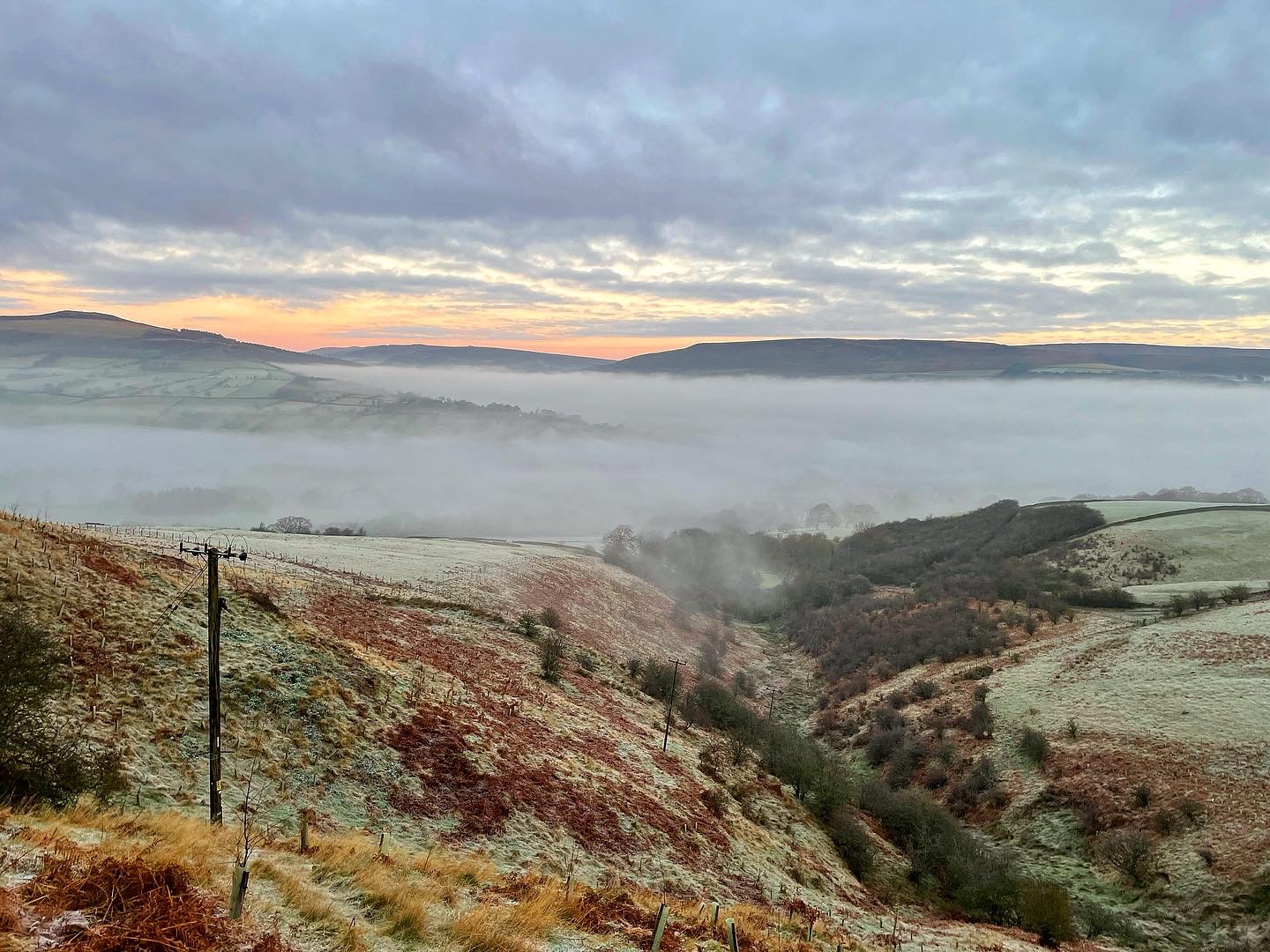
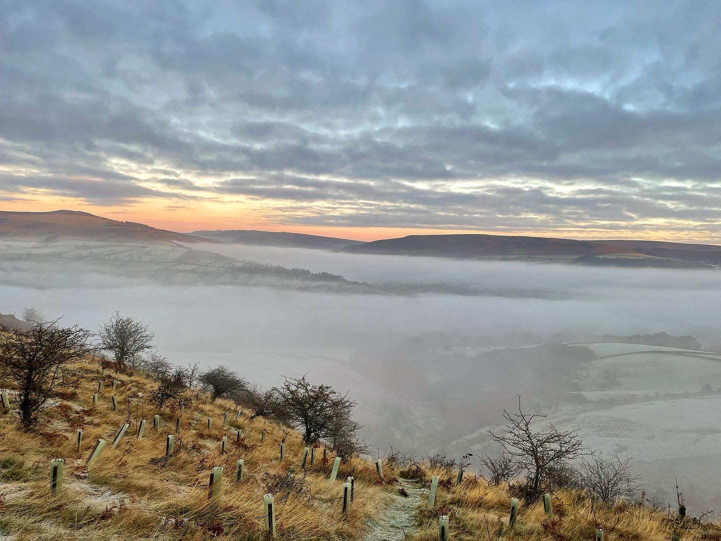
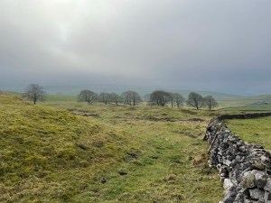
Now, as I approached Shatton Lane at the top I turned around and looked back down the valley towards Bamford and the direction I had just walked. I was amazed by what I saw and straight away, the shattering climb suddenly became worthwhile. All around me the landscape was white over in frost with the rising sunlight reflecting off in all directions. Bamford and Shatton village could no longer be seen due to a magnificent cloud inversion which completely bathed the area right over towards Hope and Castleton. As I looked on it appeared that I was above the clouds looking down on a white, milky sea, where only the black peaks of Bamford Edge and the Derwent Ridge were visible. In the sunrise, the peaks gave the appearance of being black due to the orange and red colours which stood out clearly in the background. Although from previous visits to these locations I knew them both to be nothing of the sort and totally awash with colour, it truly was breathtaking to see the sight before me and then as the clouds dispersed, the wonderful scenery of the surrounding hills which basked in a beautiful golden light as I looked on.
I pressed on along Shatton Lane which by now was no longer a real road, becoming more of an uneven cart track as it weaved around the edge of Shatton Moor. From here, I began to see views to my right over the surrounding village of Brough on Noe in the Hope Valley and the cement works which dominate the landscape in these parts. To my left were the imposing steep crags of Shatton Moor which looked beautiful in the now risen sun. The track led on, weaving round the hill alongside a drystone wall. Looking around me now at this moment in time, when the sun was high and there was not a cloud to be seen in the sky, it was hard to imagine that it was Christmas in just over a weeks time. I sat for a moment on the stone bench at a small junction at the foot of Abney Moor enjoying the landscape with the warmth of the sun on my face, having removed two layers of top clothing as the heat was intense. If it hadn’t been for the immense cold of the ice covering the seat which seeped through my clothing and appeared to penetrate my very soul, I could almost have said it was summer. I guess that notion is what makes these hikes special. No matter what the season, the weather is temperamental and any change in light will make a huge difference to our perception no matter how big or small.
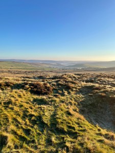
Just to my right of the stone bench where I sat and through a wooden gate is a public footpath leading the way over Abney Moor. I took this footpath and followed it for approximately half a mile before heading off piste and cutting across the moorland until I reached the summit of Bleak Knoll. There was nothing at the summit except mounds of heather which was deep in hibernation at this time of year yet there was a splendid view straight over the landscape towards the prominent Durham Edge which housed Abney Moor Trig Point. My plan had been to skirt around the trig and maybe photograph it from a distance from the safe confines of the gliding club up on Camphill. However, as I approached the club I noticed that I was in perfect luck that day. There was not a glider in sight nor any form of aircraft activity and instead just a silver van and two workmen doing some maintenance on a fence. I took this opportunity to be bold and enter the club grounds in the hope to take some photographs.
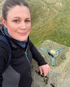
The Derbyshire and Lancashire Gliding Club is situated on Camphill, Great Hucklow and is best utilised by glider pilots around the Peak District. Quite often in the Spring and Summer months it is a hive of activity although it is popular at any time. If there had been any aircraft activity at the time I visited, I wouldn’t have entered however, it seemed worth attempting the trig on a day the club wasn’t in use. I noticed a wooden gate on the far side of the field which wasn’t locked and I could see the trig clearly on the hill just a short distance away. The hill in question was situated in a field which was clearly farmland and I knew prior to my visit that it was private land. It so happened that one of the workmen noticed me and we exchanged cheery hello’s as he asked me about my walk. After a pleasant chat I asked if it might be possible to visit the trig for five minutes to which he opened the gate for me. From there it was a simple jog up the hill to bag the trig and capture a few photographs. I am not totally sure if they were the actual landowners but I figured that they must’ve obtained permission to carry out their work on the field and so I accepted the help they offered. Here are some of the photographs I took that day. It truly was a stunning location despite being private land. They always save the best views for forbidden locations.
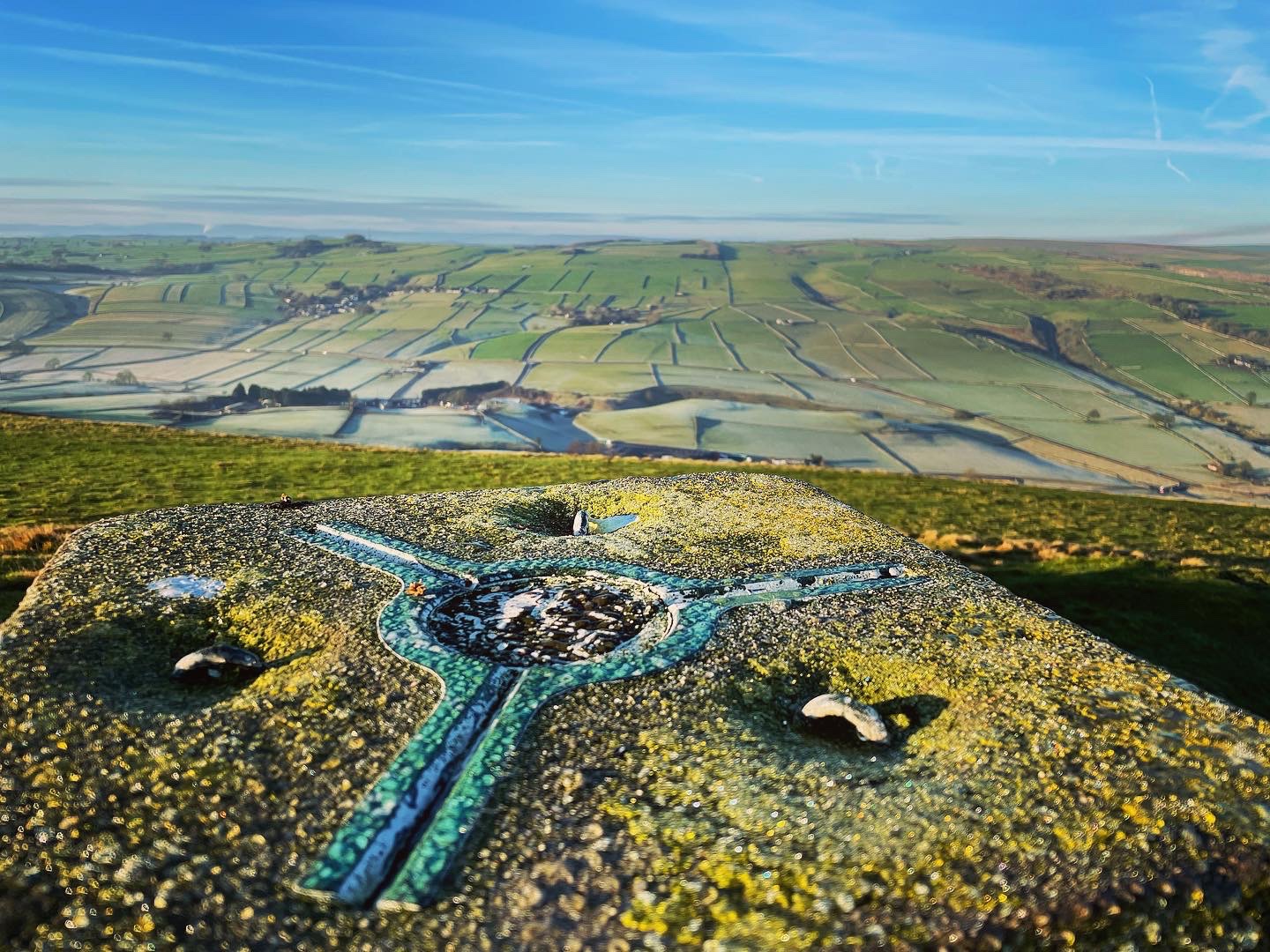
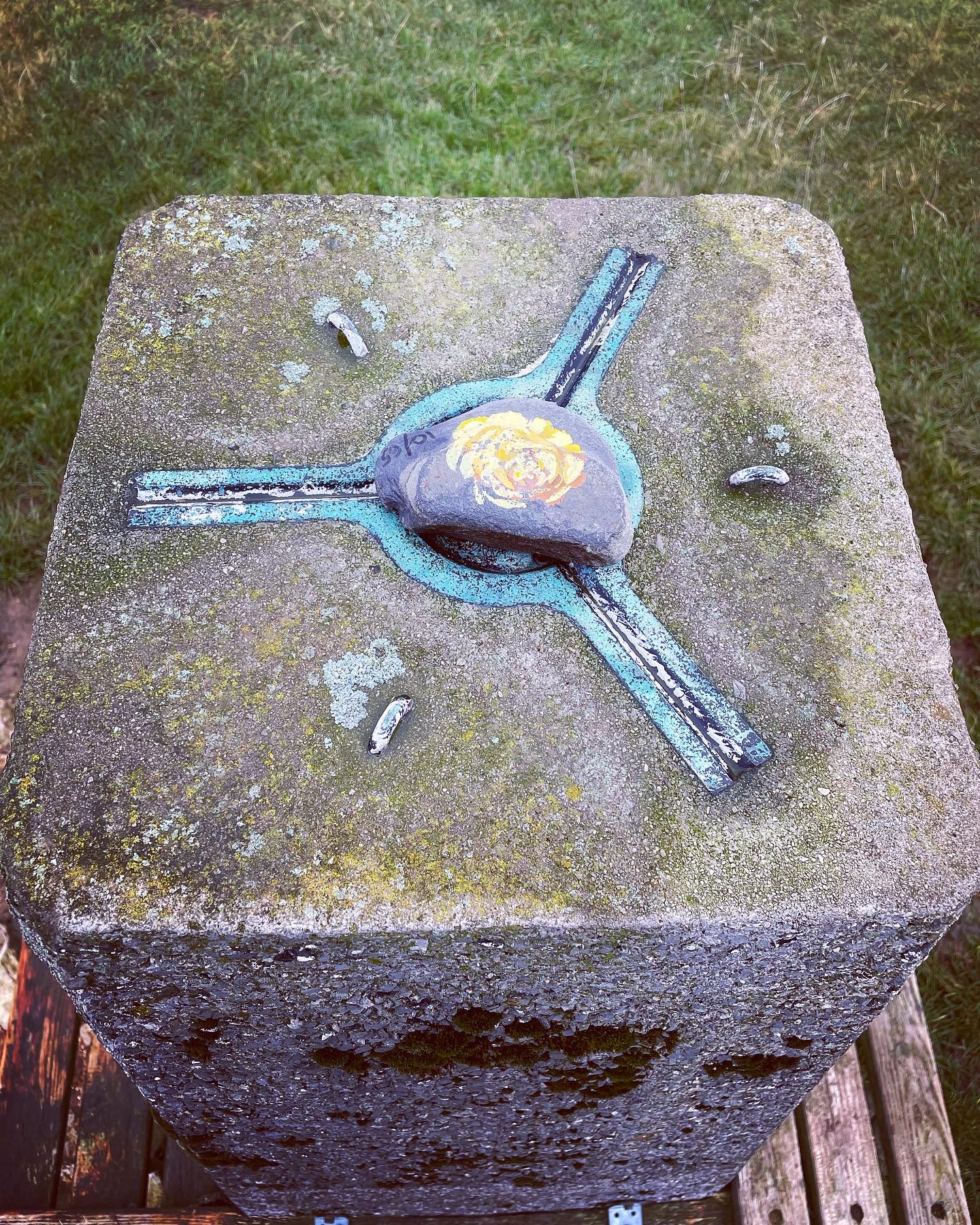
Abney Moor Trig
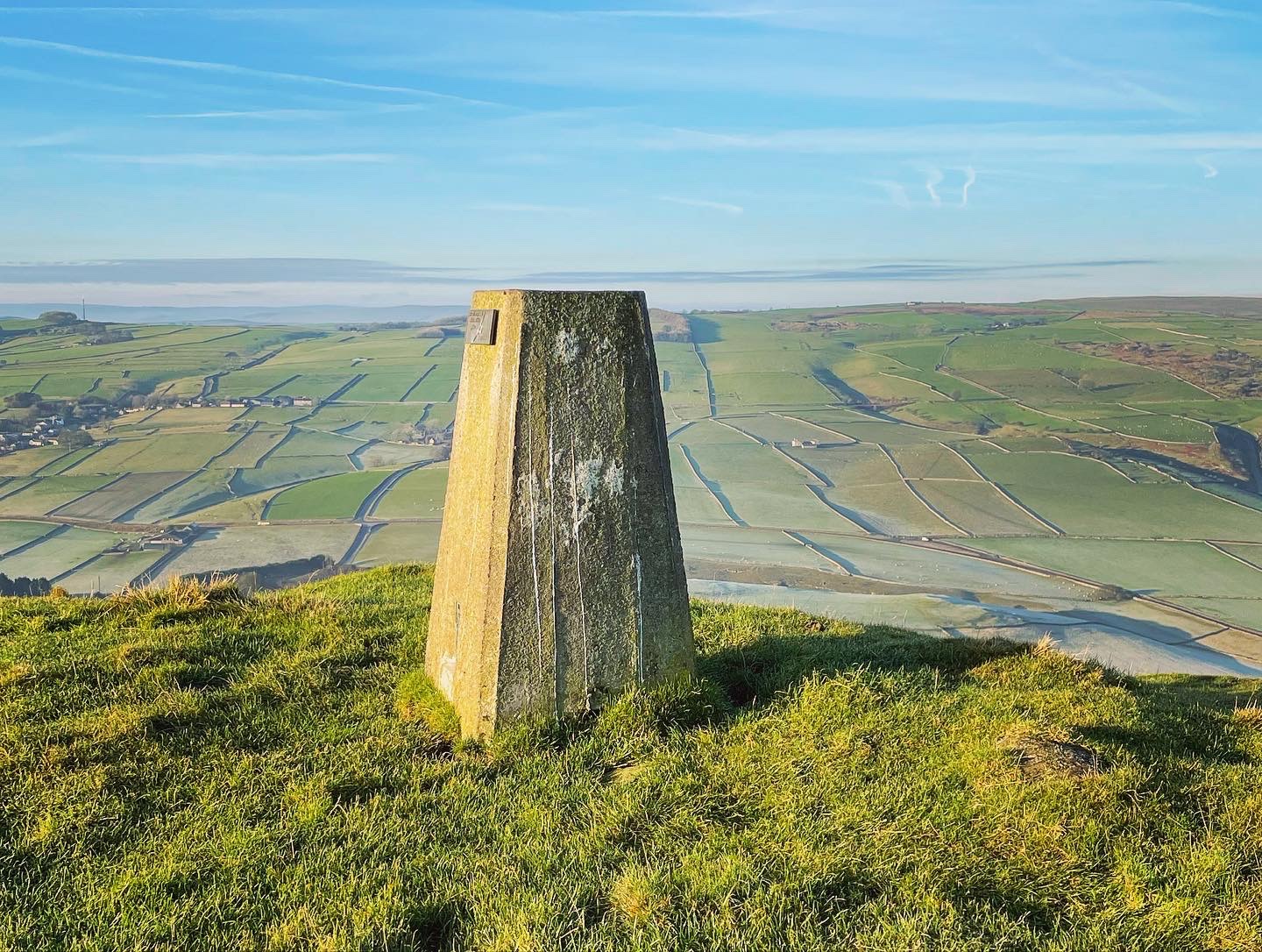
Unfortunately on this occasion, my visit to this trig was a shorter one than normal. Due to it being located on private farmland, I took only a brief 5 minutes in order to capture a few photographs.
The trig is located just a short walk through an unlocked wooden gate leading from the airfield and up onto a raised hill just a short distance away. From the top, the views are tremendous and on a clear day such as the day I visited, I could see all the surrounding villages in the bottom of the valley such as Hucklow, Bradwell and Windmill and also all the spectacular stretches of fields and farmland for miles around.
Abney Moor to Bradwell Moor
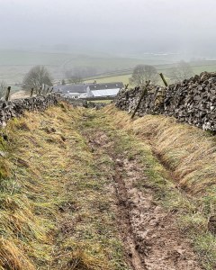
Leaving the trig behind, I decided to take an alternative route down into Great Hucklow by leaving the airfield and heading down the grassy embankment to the right of the main path, my intention being to pick up a footpath in the bottom of the valley. This small trek ended up being far trickier than I imagined. Firstly, the route down has no direct footpath and so involves climbing over rocks and long grasses which whilst on a descent, required keeping my wits about me as I picked my way down. When finally reaching the path through Great Hucklow Woods, I discovered that it was hardly a path at all and took every ounce of my concentration to ensure that I didn’t stray from it. The ground underfoot was extremely muddy in places and as I walked, I remember thinking that this section of the route was perhaps not the best of the bunch I could’ve chosen. It certainly highlighted in that brief moment that the choices we make when believing we are taking a short cut are not always wise and I estimate that it actually took an hour longer than planned to reach Great Hucklow. It’s just something to bare in mind if considering this walk and in hindsight, I would now recommend to walk back to the main entrance of the airfield and follow the lane into Hucklow from there.
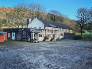
Hitting the narrow road leading into Hucklow, I followed this alongside a working farm and headed into the village. Upon my approach I noticed an old house set back from the rest down a wide driveway flanked by vast green lawns and ancient trees. I immediately stopped in my tracks as a million thoughts ran through my head. My mind became flooded with memories as I thought back to my childhood and the days I spent swinging from the solid, old branches in the trees, dangling upside down by my feet. Taking a sneaky cigarette with classmates behind the outhouses and scrabbling to extinguish it if the warning sound was heard signalling a teacher’s approach. Dancing around the communal lounge on our final night to PJ and Duncan’s ‘Let’s Get Ready To Rumble’ being one of the old favourites that remain engrained in my mind.
The house I was staring at was none other than the Foundry Centre where I had been privileged to spend three nights in late 1993 whilst on a school Geography field trip. I had never been back here in all this time since the day I boarded the coach back home, yet it felt as if I had never left. Twenty eight years had passed since that time and I was no longer thirteen but the power of the memory made everything feel like it happened only yesterday.
The building still looked more or less the same as it did back then except the old wooden hinged windows had been replaced and the front door was now modern. I could picture all my classmates exactly as they were back then. I could see them doing exactly what they did on the days we were there and even remember some of the conversations we had. I laughed out loud as I reminisced these happy times and cringed at others. Like the reaction of my teacher when myself and a classmate were caught clowning around on a flat roof which our dorm window opened onto, one can only imagine how well that went down…
Leaving the hostel behind I headed along the country lane away from the village and followed it a short distance before crossing the B6049 road to the hamlet of Windmill. Again, like Shatton it was hardly a village as such and consisted of nothing more than just a few lonely farm cottages at the side of the road. A narrow public footpath cuts through the middle of the cottages and heads out through a gate before crossing fields across the countryside.
The sky was starting to cloud over as I made my way over the farmland at approximately 1pm that day. Once more the pathway became almost non existent in the short grass which covered field after field. At this stage of the walk as I scrambled over the first drystone wall of many, I had to double check my GPS to ensure I was still on the right track. Surely Strava wouldn’t classify this route as a genuine footpath? It did though and I remember continuing on and hoping for the best. Eventually I arrived in Little Hucklow, a quaint and picturesque village which again gave the impression of being sleepy. There was not much there apart from a public house, a farm and an old red telephone box containing one of the few installed Peak District defibrillators.
The steep climb along the road and up out of Little Hucklow was a sharp one. I made a left turn onto Washhouse Bottom and followed this a short distance before turning left at the junction onto Forest Lane. Upon reaching the part where the hill levels out, I decided to stop for lunch. Setting up my camp stove on a verge of grass at the side of the road I figured this was as good a place as any. Places to sit in winter which weren’t waterlogged or muddy were few and far between and at least here there was a cracking view over the surrounding countryside. The sun was still trying to make a desperate appearance through the dark clouds which hung moodily around and I knew that in just a short while, the best of the weather today would’ve left us. If there is one thing hill walking has taught me it’s to grab an opportunity while you can. You just never always know when the weather can suddenly change.
Todays meal was Tagliatelle Carbonara consisting of pasta which I had packed dry and bacon, mushrooms and onions which I had fried the night before. Once the pasta was cooked, I added the vegetables and bacon to it and stirred in a Dolmio carbonara sauce. It was the first time I had properly prepared a meal on my stove whilst out hiking, with my usual choice of hiking food being freeze dried meals where the only task to prepare it meant adding hot water. I have to say that the meal was very filling and enjoyable, the only downside was the length of time it took for my dry pasta to rehydrate and the sheer cold I felt upon stopping moving. Needless to say I was packed up and ready to continue onwards as soon as the last piece of pasta passed my lips.
The following section of the walk consisted of several miles of road walking along Forest Lane before taking a right turn up a narrow farm track which stretches on for what seems like forever. I have to admit that I found this section to be the most tedious and uneventful part of this hike mostly due to the fact that everything looked the same for extremely long periods. As I have mentioned in many of my previous blogs, continuous road walking for long periods are not my forte for a number of reasons. One being that I am a lover of path discovery and the feeling of being free of traffic and other everyday hazards. I find it a bane to any hike when I am forever having to look over my shoulder or constantly be on the watch for approaching traffic, preferring the solitude of the open landscape where I can become absorbed in my thoughts. The therapeutic aspect of hiking is as important to me as the physical. However, it is not always possible to fully irradiate roads out of the picture no matter how much I try.
Many areas around the Peak District are made up of non access land which greatly restricts where people have the right to roam. The White Peak in particular contains vast stretches of farmland and private fields reserved for livestock and other farming amenities which are not open access. It is largely because of this that I had to make use of the roads and tracks in this location as there simply were no options available to avoid it, therefore there is limited discussion about this section of the hike.
The trail then involved following a faint public footpath across the fields at Bradwell Moor before meeting up with the Limestone Way.
The Limestone Way is an official trail spanning 45 miles in distance beginning in Rocester in Staffordshire and ending in Castleton, Derbyshire. It is well documented, attracting walkers throughout the year and promises spectacular scenery over the vast limestone and White Peak territory. Although only using a short distance of it on this hike, it is a trail I hope to experience in the future. The remaining 4 miles of today’s walk however are spent on the Limestone Way as I followed it right the way into Castleton Village.
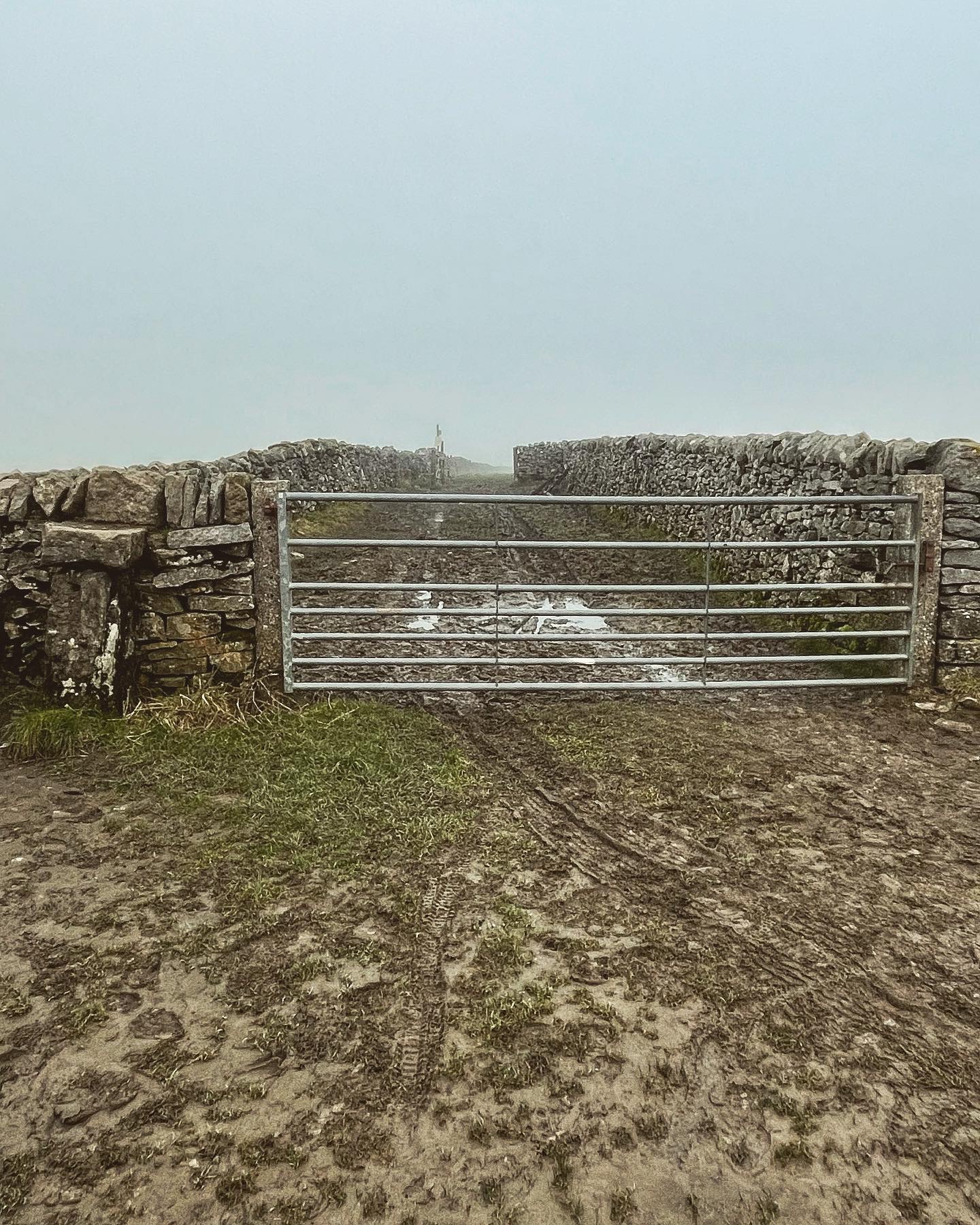
It was at this stage that the mists really began to thicken as I picked my way slowly up the steep, muddy pathway. That coupled with the drastic drop in temperature made for a difficult section of hike. The landscape here in this location is heavily dominated by limestone crags hence the name given to the trail and makes for some beautiful scenery especially in the spring and summer months, however in winter with the deep mud the limestone rocks on the pathway were treacherously slippery underfoot. Extreme care needed to be taken to prevent falls along this section. The views of the surrounding countryside from high up were also severely obscured by the mist as I made my way up to the summit of Bradwell Moor which housed the second trig of the walk.
Bradwell Moor Trig
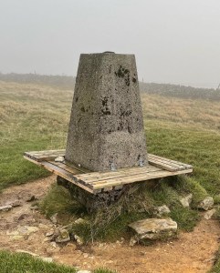
Bradwell Moor trig point (grid reference SK 13179 80133) stands just on the brow of the hill to right of the Limestone Way if heading in the direction of Castleton at approximately 471 meters (1535 feet) above sea level. The trig is quite distinctive in that it has a wooden seat running all around it which is very much appreciated after such a weary climb to the summit. The plaque on the trig clearly states that the seat is in dedication to William David Martin and I attempted to research a little of who he was, however nothing could be found regarding him and all searches proved unsuccessful.
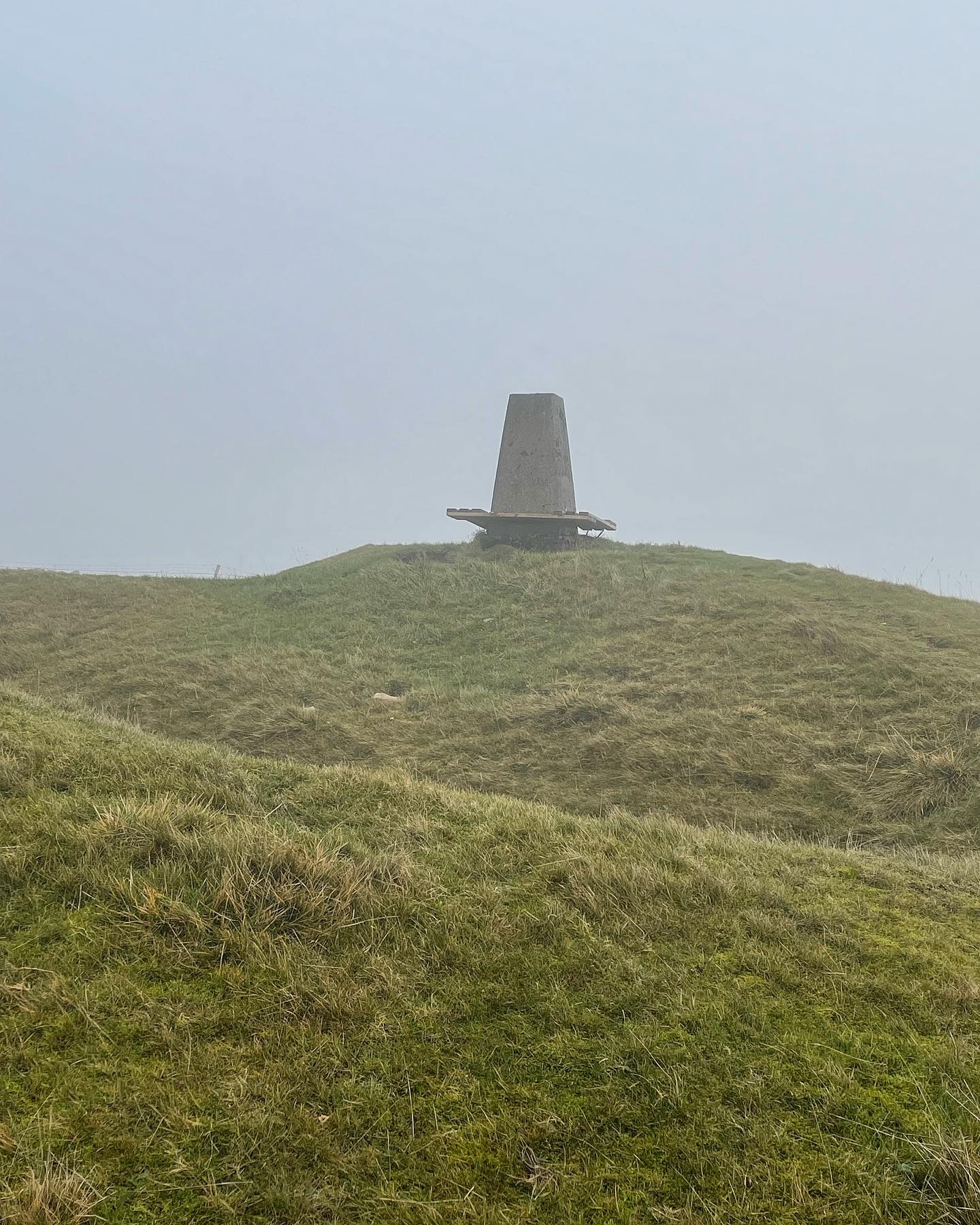
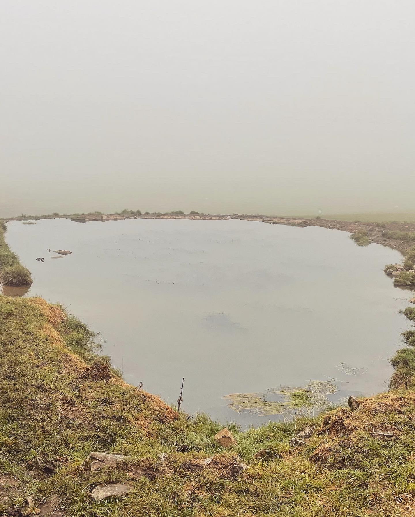
I only stayed a short time at the trig due to the poor weather and sweeping mist which appeared to come over from the direction of Kinder Scout. I have to admit that I was a little disappointed that I could not enjoy the views from this spot, as many photographs I had seen showed literally miles of splendid scenery which captured both Dark and White peaks and much of the High Peaks within the Peak District National Park. I made up my mind that I would need to revisit this location again at a later date in order to witness this for myself.
Back on the trail once more I headed down off the summit and rejoined the muddy Limestone Way heading in the direction of Castleton.
Cave Dale into Castleton
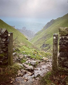
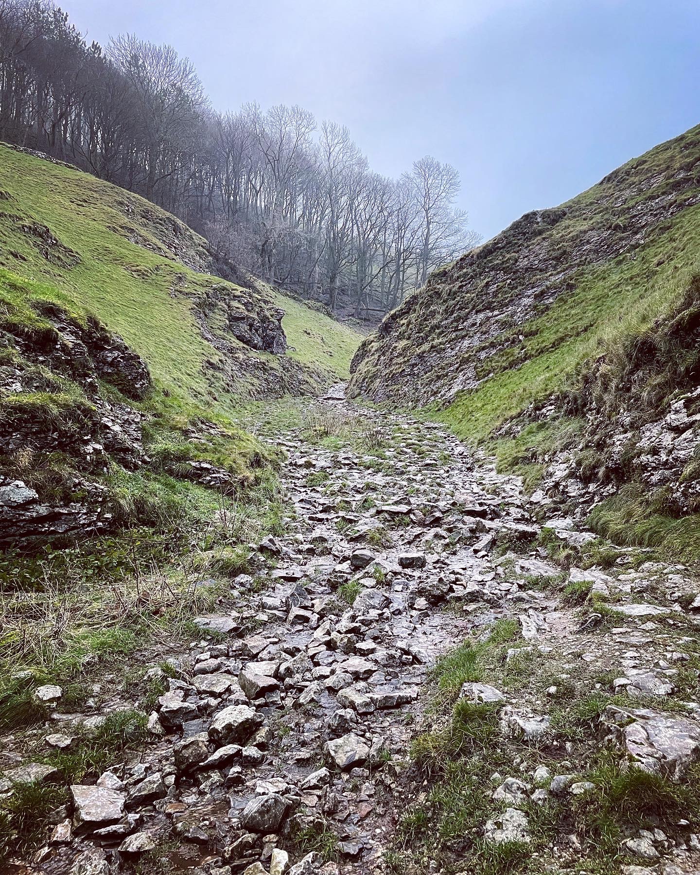
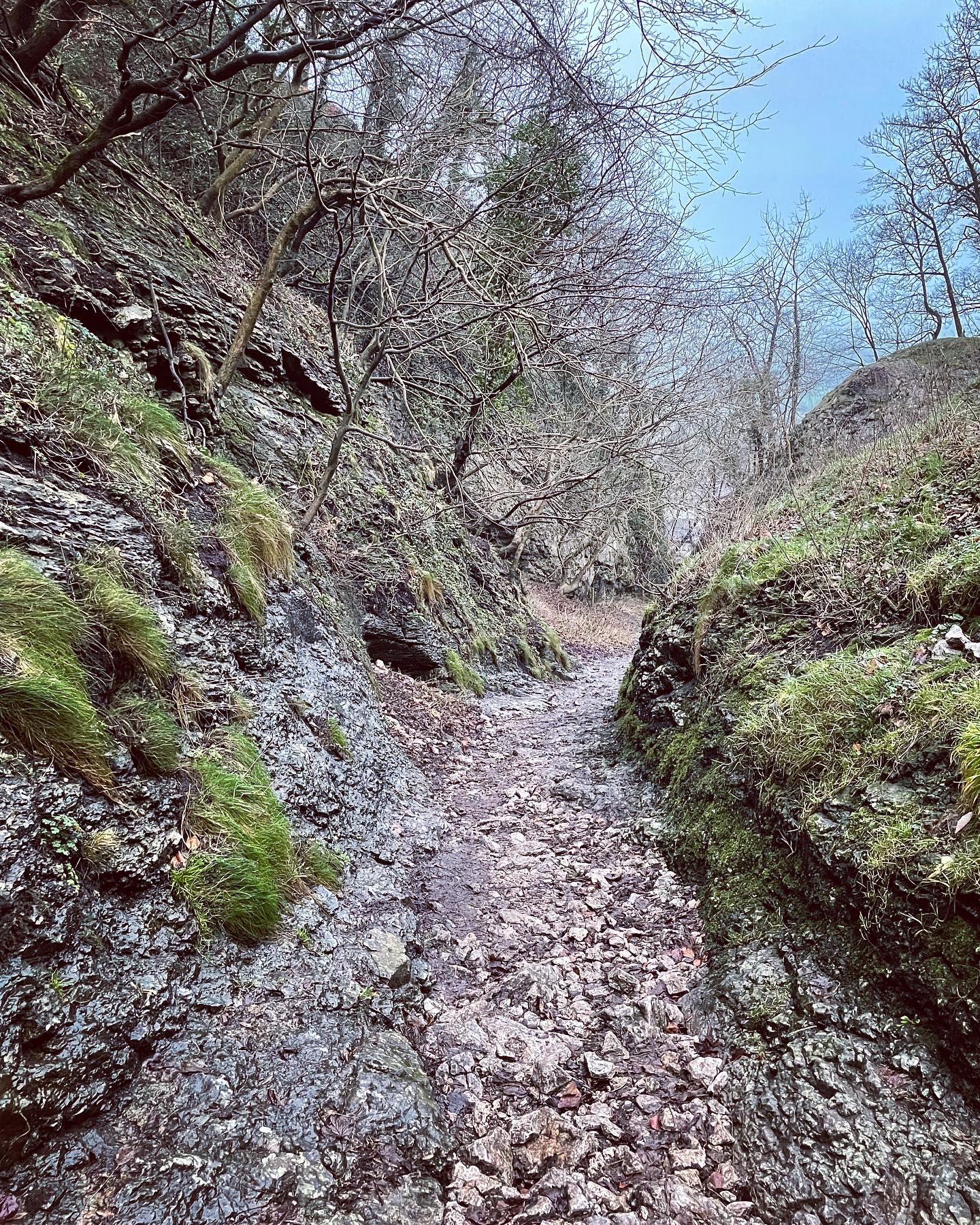
The following section of trail down through Cave Dale on the very outskirts of Castleton was probably the most treacherous descent I have ever attempted. Care has to be taken to find decent footing at the best of times but during winter months it was particularly hard going. I remember walking up this route in the summer of 2006 whilst on a day trip and I couldn’t help but smile at the memory of myself and friends scrambling up the limestone crags to reach the summit before descending the opposite side towards Peak Cavern aka Devil’s Arse. Now as I stood for a brief moment staring down through the gateway at the top I couldn’t believe the transformation. How different the conditions were now! That summers day in 2006 had been so easy underfoot that we had got away with wearing trainers, the only hazard being the occasional tiny white limestone which entered our socks and proceeded to cause maximum discomfort when we least appreciated it. On this day in December 2021, the steep pathway reminded me of a trickling brook which tumbled down over the polished rocks, it’s waters tinged with mud and ice which had formed like a film over the rocks surface. Any step could’ve resulted in a fall and a nasty end to my day if I hadn’t taken my time as I lowered myself from the crags as carefully as I did.
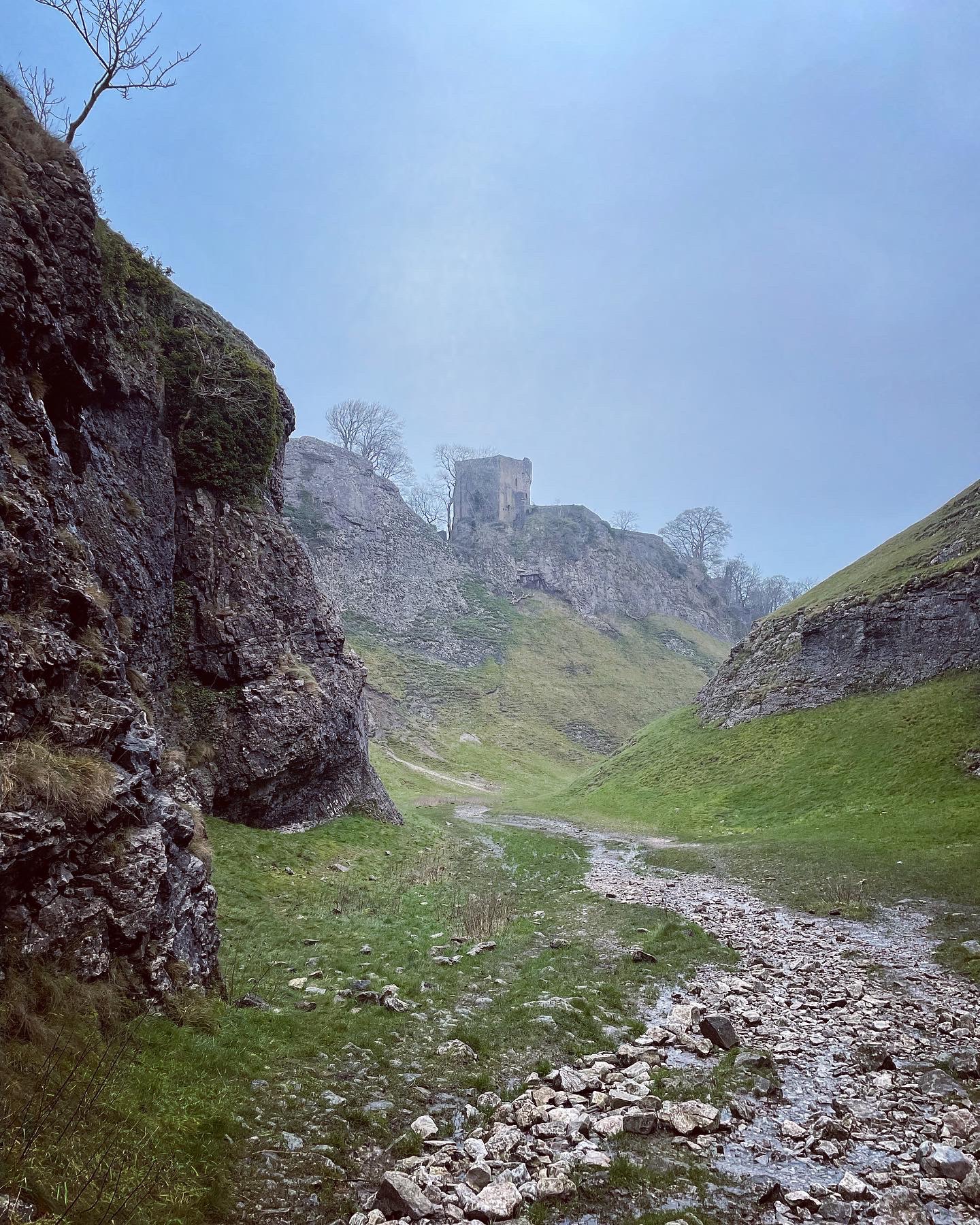
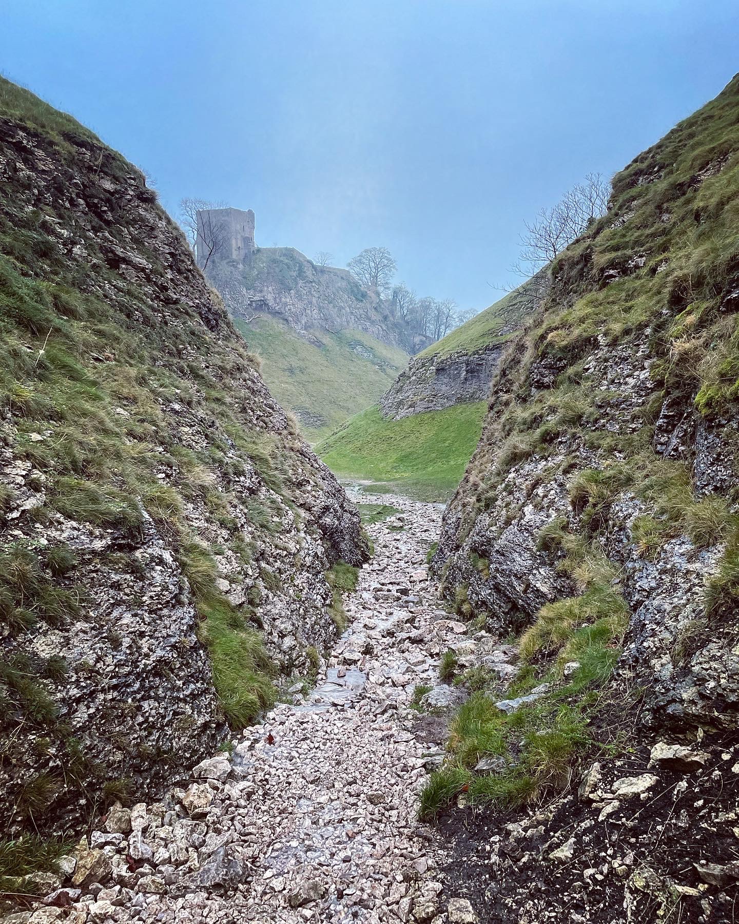
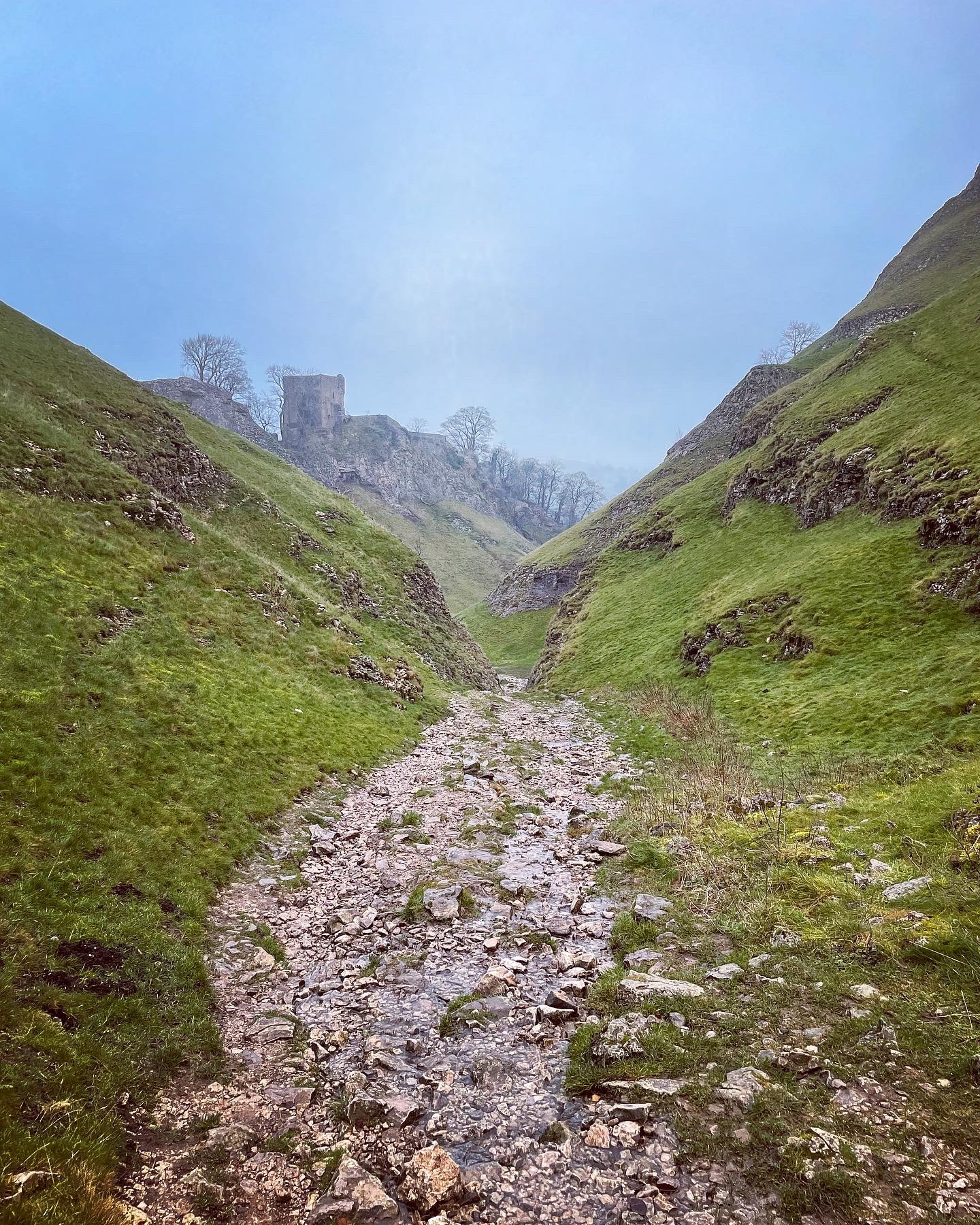
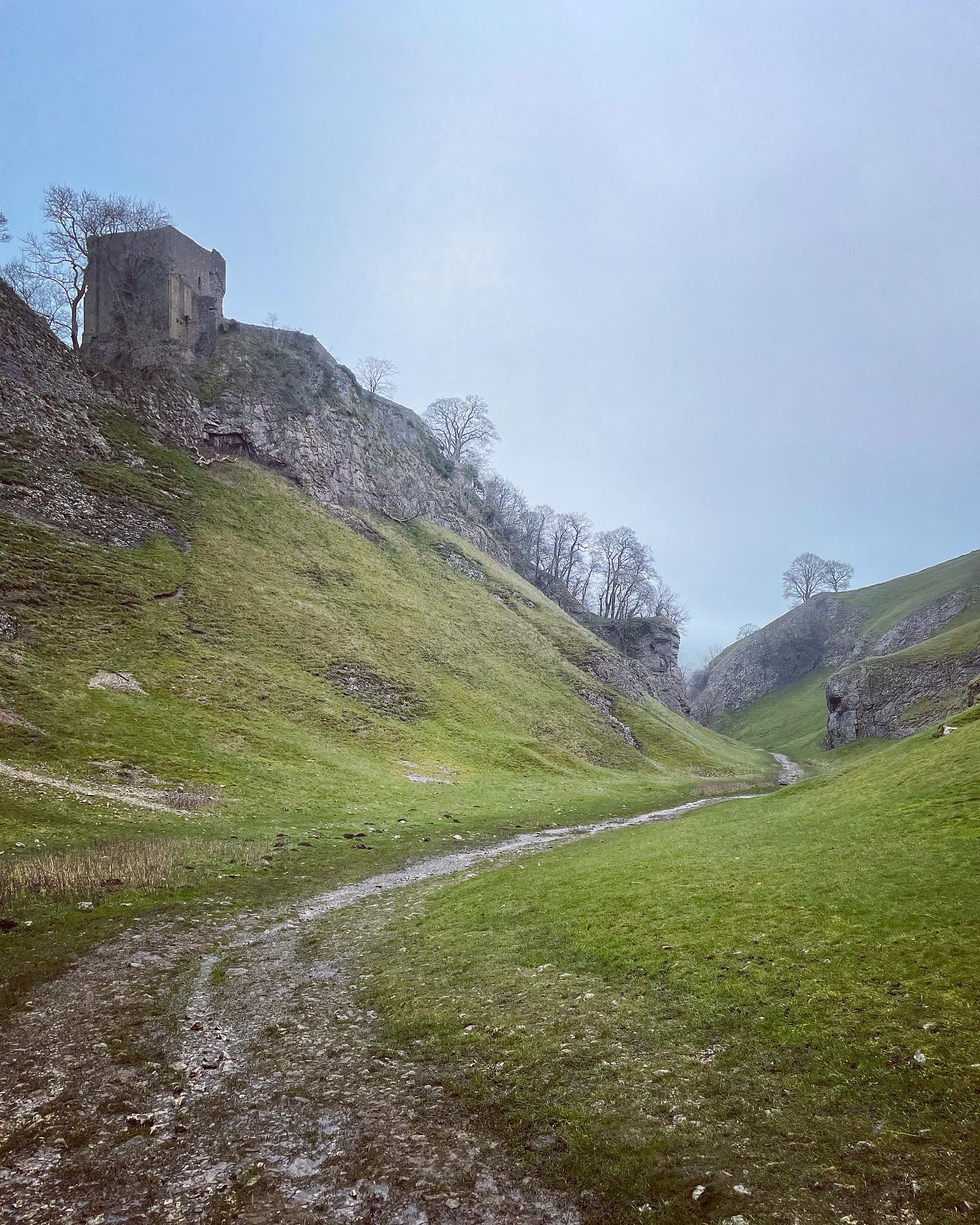
The mists were still ever present but I could just make out the distinctive shape of Peveril Castle on the hillside just ahead of me. The path down had literally become a stream with this being common from early autumn right through to the hot summer months. Although a stunningly beautiful spot to be at in the High Peak/White Peak border, it is clearly underestimated when taking into consideration the safety involved.
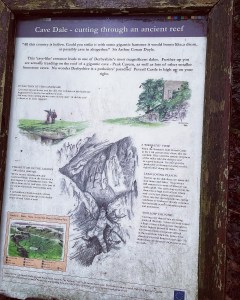
Cave Dale is located behind Peveril Castle in Castleton, Derbyshire and is a limestone reef thought to have been formed by post glacial melt water. The water formed a river which then formed a deep, steep sided valley in the limestone over the years. Eventually over time, the water disappeared as it found its way into deep underground tunnels below the valley leaving behind this magnificent reef which cuts through dry limestone. The land below Cave Dale and it’s surrounding areas were heavily used for lead mining and some of the caves and holes seen in the limestone rock face date back to these times. Many of the small caves and fissures eventually lead into the bigger caverns that run deep underneath the limestone reef.
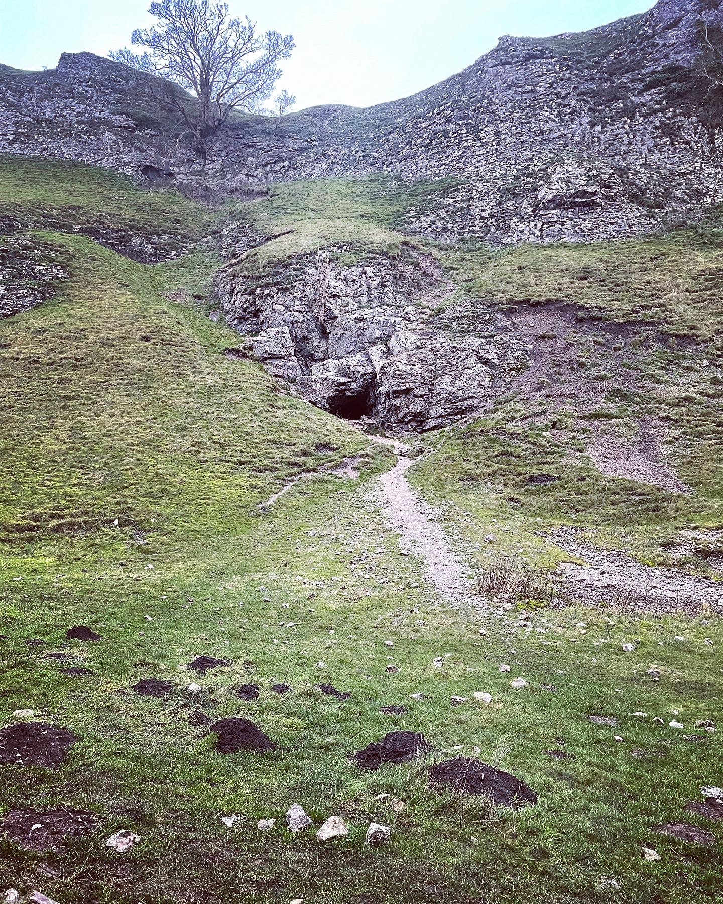
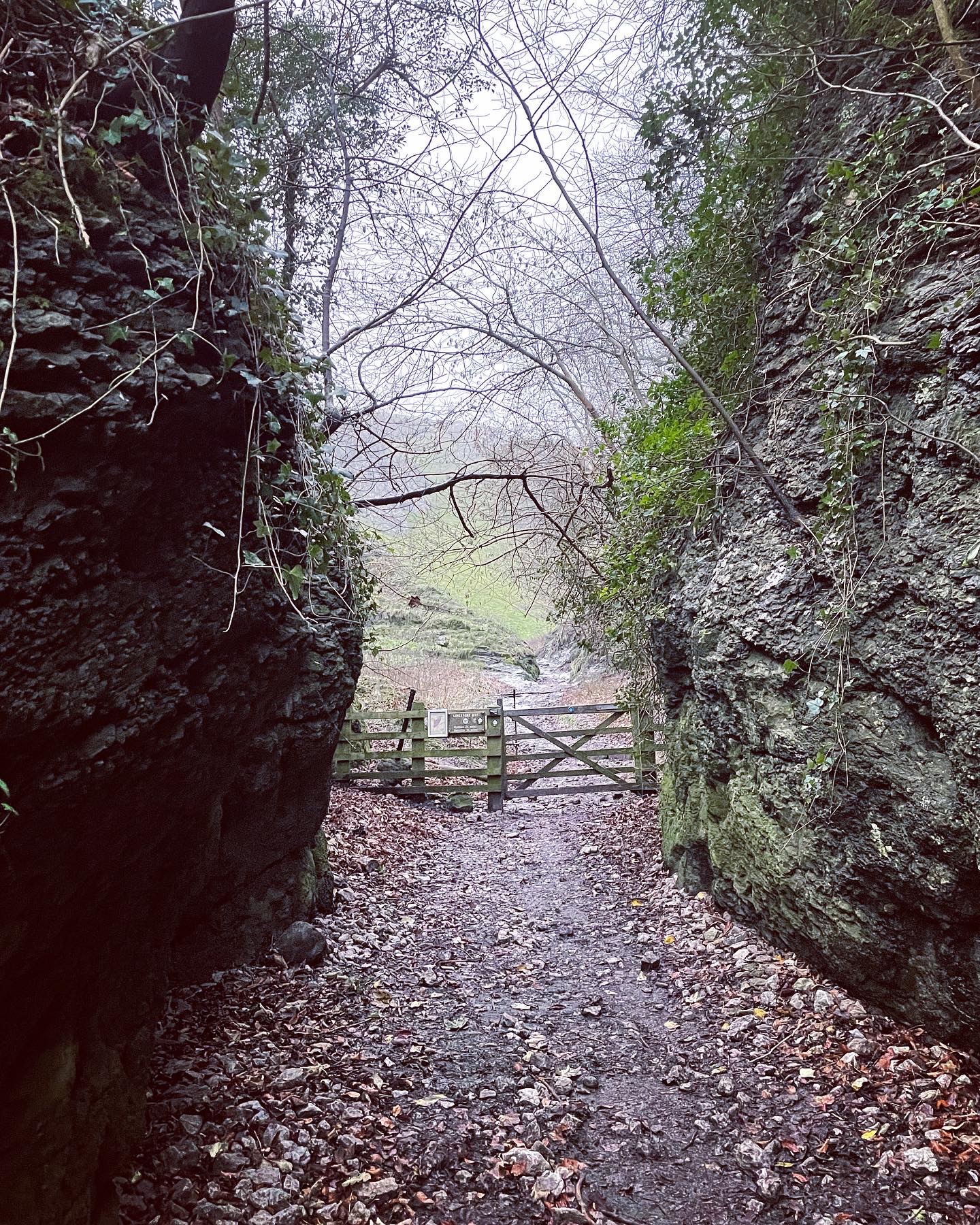
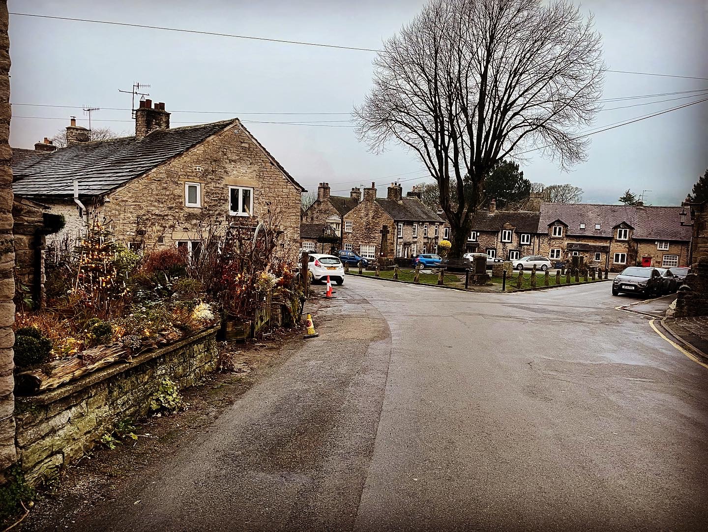
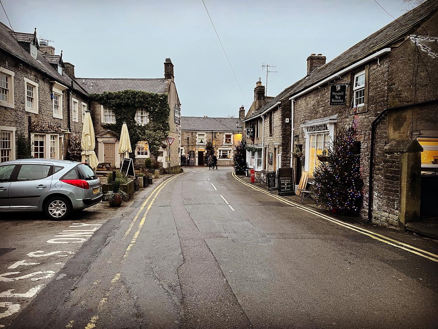
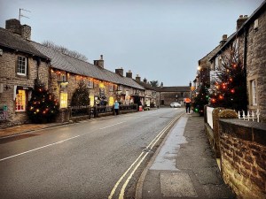
I eventually arrived in Castleton a little after 3.30pm that Saturday afternoon. Emerging from the foot of Cave Dale where up until approximately 200 years ago, a magnificent, naturally formed, limestone archway had once stretched across the entrance, I noticed that darkness was beginning to fall. Christmas lights twinkled in the cottage windows and all around were decorated Christmas trees and garden walls. The village, although approaching darkness was still a hive of activity with people visiting the local pubs and gift shops and generally enjoying the Christmas festivities.
I had considered having a meal to celebrate my Christmas hike in my old favourite public house, Ye Olde Cheshire Cheese Inn in the heart of Castleton but upon opening the door, I saw that everyone was sat inside wearing their best clothes and considering I was in muddy, damp hiking gear and boots, I decided to give it a miss. Ye Olde Cheshire Cheese Inn is a wonderful pub which serves delicious food and is a true hiker friendly pub where usually wearing hiking gear is acceptable, however with Christmas just around the corner and the outpour of visitors to the area, the atmosphere on this day appeared more sophisticated. It really didn’t bother me in the slightest though and I knew the pub would be waiting at a more suitable time.
So, it leaves me to say that my Christmas adventure drew to a close that day outside Ye Olde Cheshire Cheese Inn. As I made my way over to the bus terminal, I thought all about my day trig bagging in Derbyshire and what a mixture of experiences it had been. I smiled to myself as I crossed the Christmas tree lined street…. and battened down the hatches, by heck it had gotten chilly.
Walk Summary
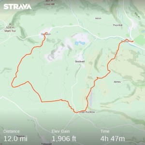
Distance: 12.2 miles
Elevation: 1,906 feet
I have to admit that this is not the first trig walk I have done. The trigs bagged on this occasion are actually my 21st and 22nd trigs of the Peak District Trig Point Challenge however I felt it necessary to introduce these with today being my Christmas hike.
The Peak District Trig Point Challenge is a fun and fulfilling way to add some excitement to a hike. I will not delve too much into the information here as the website mentioned above already gives a lot out in regards to the principles of it however, it is worth giving it a look as it provides grid references for the trig points and usefully states which ones have public right of way and private status.
Although I enjoyed many aspects of this walk, there were sections which lacked interest and enthusiasm with me, largely because of the amount of road walking, the same old scenery and the lack of opportunity to venture across the open land. Bagging the trigs was definitely a highlight to my adventure but if you take them out of the picture, I had to ask myself if I would visit the location at all. Bradwell Moor maybe, but Durham Edge probably not. In saying that though, I don’t regret trying the locations as I would never have known what the area was like without it. As mentioned previously, the beauty of not knowing encourages us to broaden our scope and try new places.
When I first started out on this trig challenge, I was lucky that my first trigs were in beautiful locations surrounded by lots of stunning scenery and character. This fact however, made me assume that all the trigs would have the same to offer. It isn’t true…. Not all of them are situated in interesting places and not all are easy to reach. A lot, particularly in the White Peak are on private land and involve trekking miles over boring landscape with no interesting distraction in between. I now understand why it is called a ‘challenge’.
My favourite aspects of this hike were definitely the cloud inversion which I was privileged to witness early on in my walk from the top of Shatton Edge, spotting my childhood youth hostel and the stunning yet treacherous Cave Dale. They were definitely what these walks are all about and I feel I got a lot from these experiences. Finally being able to see Castleton all lit up at Christmas though was probably my most favourite part of the day. It has always been on the cards to visit at festive time and I loved the real sense I got of Christmas as I passed through. In a world where the last few years have been dominated with social distancing and the Covid 19 pandemic, it felt that a little normality was gradually returning. I remember thinking to myself on the journey home about the future and whether it would last. For the sake of emotional well-being, I hope so.
Once again, I would like to Thank you all wholeheartedly for your continued support and for continuing to read my blog. It means more than you can possibly imagine and I appreciate it so much. I have received messages asking when my first trig walk post would be drafted and although this was a Christmas walk, it is a month late being released. I’m hoping to complete more posts covering the trig points I have visited over the next few months. So to end this blog post with it being my last of 2021, I hope you all had a very happy and magical Christmas. Xxx
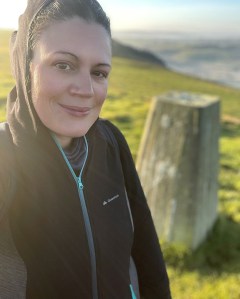
All photographs and images used in creating this blog are my own and have been taken and edited by myself Lucy Bailey using an iPhone 12 camera. All images have been sourced from my Instagram account at Soloexplorer23 and edited using Instagram editor tool.
