9th May 2022
They say your life is never the same again after you’ve walked the West Highland Way. I’m not just saying it, it’s what everybody says. You set out from the obelisk on an ordinary day in your ordinary life, feeling no different apart from the familiar ordinary build up of excitement that comes with all the other hikes you’ve done countless ordinary times before. It’s just another ordinary long distance hike, right? I’m not sure when the mindset changes exactly, but somewhere along the way it does. Maybe it’s the place where we realise that at some point, we left a piece of ourselves behind. Or maybe it is at that very moment itself. By the time we reach Fort William, our feet beyond sore and our whole body in tatters, in our collective minds we know we’ll be back. It might be the end now but it won’t be for long…. and we all know it. We cannot adequately explain the drive to return when we’re desperately trying to put it into layman’s words. The words are just too trivial. We might not even understand it ourselves. Yet for anyone who has walked the way for whatever reason in their lifetime, will know wholeheartedly how we feel. Maybe the way really does get into your blood as people say. Maybe there is more to it in terms of being not only mentally and physically aware but also spiritually too…. Or maybe, it’s because we all leave a piece of our hearts along the way.
Fundraising
The following long distance trail was done for charity in which I raised funds for MIND.
MIND provides unbelievable support for people suffering with mental ill health and is a cause which has always been dear to my heart. Last year I hiked the Loch Ness 360 as a through hike which is an 80 mile circular route running full circle around Loch Ness in Scotland. Unfortunately, due to lockdown restrictions not being relaxed in time, I did not have enough time to raise funds for it. I decided that this year with the West Highland Way things would be different.
I chose this charity as I felt it fitted with the current state of affairs both here in Britain and on a global scale. Mental health is deteriorating in general with a noticeable increase in mental illness in particularly during and after lockdown. Charities such as MIND and others do try their best to provide support but at times have struggled to keep up with rising demands. They rely on donations made by the public to ensure they can access the services and resources to provide the help that is needed. Without the funds, charities like MIND might not be able to continue providing people with the support they need.
Mental health affects everyone, some more than others and is non discriminatory in who it affects. It doesn’t care if we are male or female, fat, thin, black or white. It doesn’t matter if you are rich or if you are poor or even what age you are. Mental Health Matters!
I’m pleased to say that I raised money for MIND by hiking the 96 mile West Highland Way and would do it again in a heartbeat if it makes all the difference.
Overview: What is the West Highland Way?
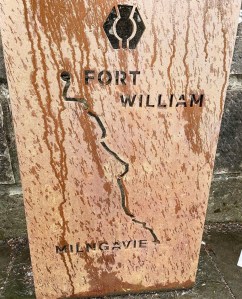
The West Highland Way is one of Scotland’s greatest long distance trails and is a 96 mile trail stretching from Milngavie near Glasgow in the lowlands all the way to Fort William in the Scottish Highlands.
The trail uses a variety of terrain varying from countryside and grassy parks to forestry, moorland and rolling hills and mountains. It passes alongside lochans and sandy beaches and also gives a slice of rocky, treacherous crags and edges. Basically, there’s a bit of everything thrown into the mix.
Despite the trail being 96 miles from start to finish, my adventure will be nearly 100 miles as I plan to summit Conic Hill on day 2. This adds distance on to what is already a long and challenging walk. The trail can be completed by anyone of all ages depending on fitness and capability, however according to the Official West Highland Way Trail Guide, it should not be taken lightly. The guide does give a suggested itinerary but these are encouraged to be modified to suit individual capabilities. It may be necessary to extend daily mileage or shorten it if it is deemed a better option.
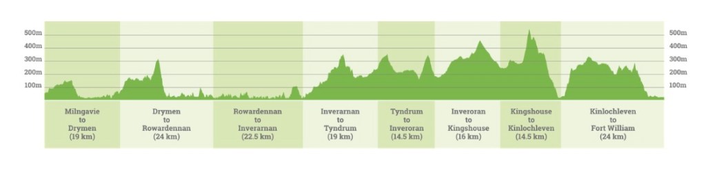
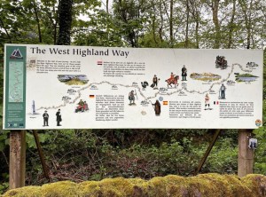
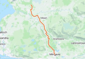
Below is a trail map of where the trail goes. This was taken from the Official West Highland Way Trail Guide and is not a GPS hiking log.

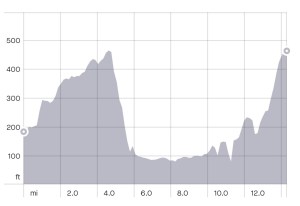
The walk was conducted by walking south to north which was recommended by the Official West Highland Way Trail Guide. This is due to the fact that the earlier stages are deemed to be easier terrain and elevation levels. Below is an example of what to expect from an elevation point of view throughout the West Highland Way adventure.
Hike itinerary for my West Highland Way adventure
- Day 1 – Milngavie to Garadhban Forest
- Day 2 – Garadhban Forest to Rowardennan Youth Hostel
- Day 3 – Rowardennan Youth Hostel to Beinglas Farm Camping
- Day 4 – Beinglas Farm Camping to Bridge of Orchy
- Day 5 – Bridge of Orchy to Kingshouse
- Day 6. Kingshouse to Blackwater Hostel Kinlochleven
- Day 7 – Blackwater Hostel Kinlochleven to Fort William
Trail Head
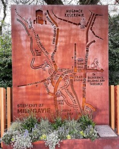
The official trail head for the West Highland Way begins at this obelisk in the centre of Milngavie, East Dunbartonshire.

The following photograph is a marker located at the start of the trail. The thistle motif at the top is the symbol for the West Highland Way and can be clearly seen on the marker posts and signs throughout the trail. It is this symbol that you should always look out for and follow if you want to stay on the West Highland Way. The trail is very clearly marked and signposted everywhere throughout the way and in my opinion is very difficult to get lost in high season due to the high amount of people doing the walk, however, it is not impossible. None the less (and I know it’s hard) but try and follow the thistle, not the people, to ensure you stay on the right track.
Below is a photograph of the clean water tap located at the starting point of the West Highland Way. There are a number of these taps throughout the trail as well as ample other taps and opportunities to fill up with clean water. This however is the first one of the hike. Keep a look out for the water taps throughout the adventure and if you play it right, you can easily get away with never having to use a water filter at all.

Day 1 walk route
The aim of day 1 is to make it from the starting point in Milngavie to the Garadhban Forest where I planned to wild camp that night. The approximate distance of the walk is around 14 miles and will pass through the following areas of interest:
- Milngavie
- Mugdock Woods
- Mugdock Country Park
- Craigallian Loch
- Blanefield
- Dungoyne
- The Beech Tree Inn
- Gartness
- Drymen Camping
- Drymen
- Garadhban Forest
Gear/kit
- Vango Nevis 100 tent
- Vango Sherpa 60/70 litre rucksack
- Sleeping bag
- Vango additional ground sheet
- Alpkit Cloud Base sleeping mat
- Alpkit inflatable pillow
- Dry bags (assorted sizes)
- Hiking leggings x2
- Base layer t shirts x3
- Mid layer hiking jacket x1
- Rab Alpine waterproof jacket
- Waterproof trousers
- hiking socks x3
- Trainer socks x1
- Underwear x7
- Running trainers (a change of footwear for the evenings after getting pitched up
- T shirt for sleeping in
- Fleece trousers for sleeping in
- Toiletries (as less as I can get away with)
- Sawyer water filter with water bags
- Food (freeze dried meals)
- Jet boil flash cook system
- Cup and spork
- Coffee, Mocha and Hot Chocolate sachets
- First aid kit (fully stocked) and additional supply of blister plasters
- Power charging devices x2
- Water bottles (1x 1000ml and 1x 750ml)
- Karrimore walking poles
- Walking boots
- Carrier bags for rubbish
- Map and compass (not needed at all on this route but there as a rule always
Ok, so I’m all set…. Let the adventure begin!
Milngavie to Mugdock Country Park
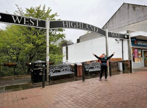
Ok, so they said the archway is something else. They were not wrong there! If anything, I will state here and now that the West Highland Way has probably the best starting point ever created in Britain for long distance trails. I have heard many hikers describe its grandiose, the way it sets the scene from the very outset for what is yet to come. It truly stands as a gateway into what is valued as the epiphany or the greatest of journeys and symbolises how highly thought of amongst its people the West Highland Way really is. The feeling I got now as I passed underneath it really set the scene in my mind.
Up until this moment, I hadn’t fully been able to accept that I was starting the West Highland Way. Yes I had planned all year, bought travel, accommodation and booked a campsite. One would say given the price of everything that alone should’ve made it real enough, yet travelling such a long way before I even reached the starting point still hadn’t properly awakened my senses. However, as soon I passed underneath that arch, rucksack firmly on my shoulders, waved goodbye to Costa and cruised past the wooden cladding adorned with milestones and places of interest throughout the journey, that is when it hit me for real. I was setting out on what was stated to be Scotland’s greatest long distance trail. That in itself is something to be in awe of.
It was 9am on Monday 9th May, 2022. After a brief look around at the trail head and a few pleasant greetings from other West Highland Way walkers, it was time to hit the trail and begin the journey. The weather this morning had not looked promising with the sky overcast and the ground still wet from heavy rain overnight. Arriving at the obelisk it looked bleaker by the minute as dark black clouds rolled in and right at the moment that I began heading along the footpath towards Mugdock Country Park, the heavens finally opened. I had put on my waterproof overcoat and trousers early as I had a feeling that rain was on the cards and in that moment I was grateful I had. It certainly saved prolonging the walk any further by having to stop and put them on.
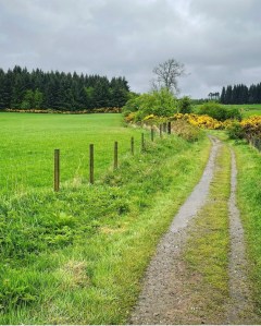
At the bottom of the entrance for the West Highland Way trail I immediately met up with the Allander Water river and followed the trail as it runs along this a little way towards Mugdock Woods. It was lovely to see the trees finally in bloom and the pretty wildflowers which adorned the path edges and the grassy sections beneath the trees. Spring was finally here even if it didn’t seem like it today but it certainly had taken its time to surface this year.
The rain grew heavier as I pressed on but it did nothing to dim my spirits. Neither did it dim anyone elses by the looks of things. Everyone I met at this point appeared cheerful and excited to be finally on the way. I remember meeting 2 women here who were lovely to chat to. They were hiking the way together and were surprised that I was hiking solo. As mentioned in previous blogs, I prefer to hike long distance trails solo for no other reason than it is one less thing to worry about. The idea of taking on these adventures for me is that it gives me time away from life’s stresses and gives me sufficient time alone to explore and reset my mindset and really appreciate what is out there. Something I cannot always get with distractions. In saying that though, it hardly seemed I would be alone on this trail for any given length of time as already, there were droves of people setting out, far more than I had expected. I had never quite seen anything like it.
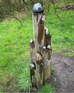
A short distance through Mugdock Country Park I came to a place where the path splits and I began heading up a sharp incline on the right. Leaving the Allander Water now, the path begins to head away into the park and it is here that I found my first feature of interest along the way. The Scholars Rocks.
Scholars Rocks are a collection of wooden posts with ledges that are placed in various locations around Scotland with Mugdock Country Park being just one area they are in. On the ledges are placed and secured attractive and colourful rocks which have been polished and glazed. On closer inspection I found that these rocks are located across rural sites and make connections to East Dunbartonshire geology and industries that once utilised resources provided by the landscape. Further inspiration came from ceramic artefacts of the area such as medieval and Roman pottery as well as the more recent Allander pottery and Campsie ware. These influenced the colourful glaze effects which were combined with a unique homemade glaze created by grinding lime kiln waste that was collected in the landscape. The rocks act as way finding and reflective points within the landscape.
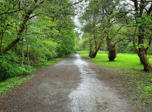
The section of trail through Mugdock Wood and Country Park is easy going with the route clearly signposted in the appropriate places. Ground underfoot here is a combination of flat concrete, gravel and mud making walking less of a challenge. It was still raining heavily but I was lucky of the shelter of the thick trees on either side which saved me from the worst of the weather. Plant life, vegetation and wild flowers commonly seen in this location at this time of year are the likes of oak, sycamore, rowan, ash, birch, beech, hazel, bird cherry and hawthorn with ground plants such as wood sorrel, bluebells, bracken and various grasses and ferns.
Eventually after a few miles of walking, the woodland gives way to open countryside where I was able to enjoy clear views across Craigallian Loch. The rain had stopped temporarily but the skies remained dark and cloudy. Despite this though I was suddenly filled with a flooding of energy most likely from the fact that my muscles were truly waking up for the day.

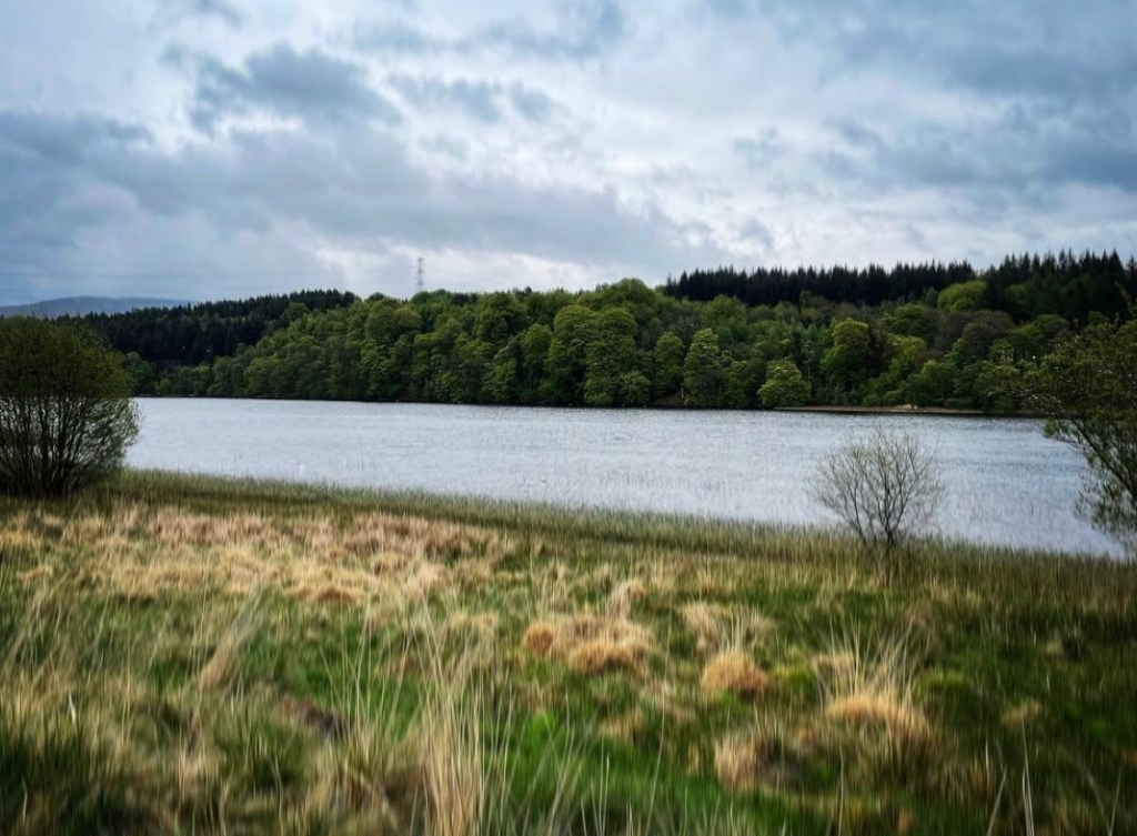
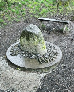
Craigallian Loch is just one of many in these parts but an interesting one at that. For just to the left of the main footpath is the Craigallian Fire Memorial which I had heard so much about. It was also here that I decided to take my first short rest stop of the day on the quaint wooden bench so conveniently placed. Whilst I was sat here watching the world go by, I was struck by the amount of hikers who walked past in that short 15 minutes that I was there. There must’ve been easily 100. All with full rucksacks packed for a good week on the trail. It is in that moment that it really hit me just how popular with hikers the West Highland Way trail really is and I felt somewhat overwhelmed to finally be part of it.
The fire memorial although in current times is nothing more than a stone fire statue, was erected and formally opened on the 15th September 2012 having been in full agreement with the landowner Duncan MacFarlane. It has now become a well known, documented landmark of the West Highland Way.
The memorial tells the story of the time of the Great Depression in approximately 1930, when many young people were out of work and living in considerable poverty. Working and living off the land and what could be found rather than earned became the norm. A fire was made here at this site and was kept burning throughout the day and night. It became a beacon of hope to many who would sit around it with a mug of tea, grateful of its warmth and would tell stories of walking and adventures in the wilderness of Scotland. Knowledge was shared of the surrounding open lands which many had never even heard of. These stories and the bonds formed with other likeminded people formed the inspiration for the later walkers and climbers. Some of the fire sitters went on to become pioneers of the movement to allow Scotland’s wild places to be made available to all people.
It goes without saying that many of the current hill walkers, climbers and venturers of the West Highland Way as well as all the surrounding Scottish Highlands all recognise the dedication which went into the freedom movement and where it originally started.
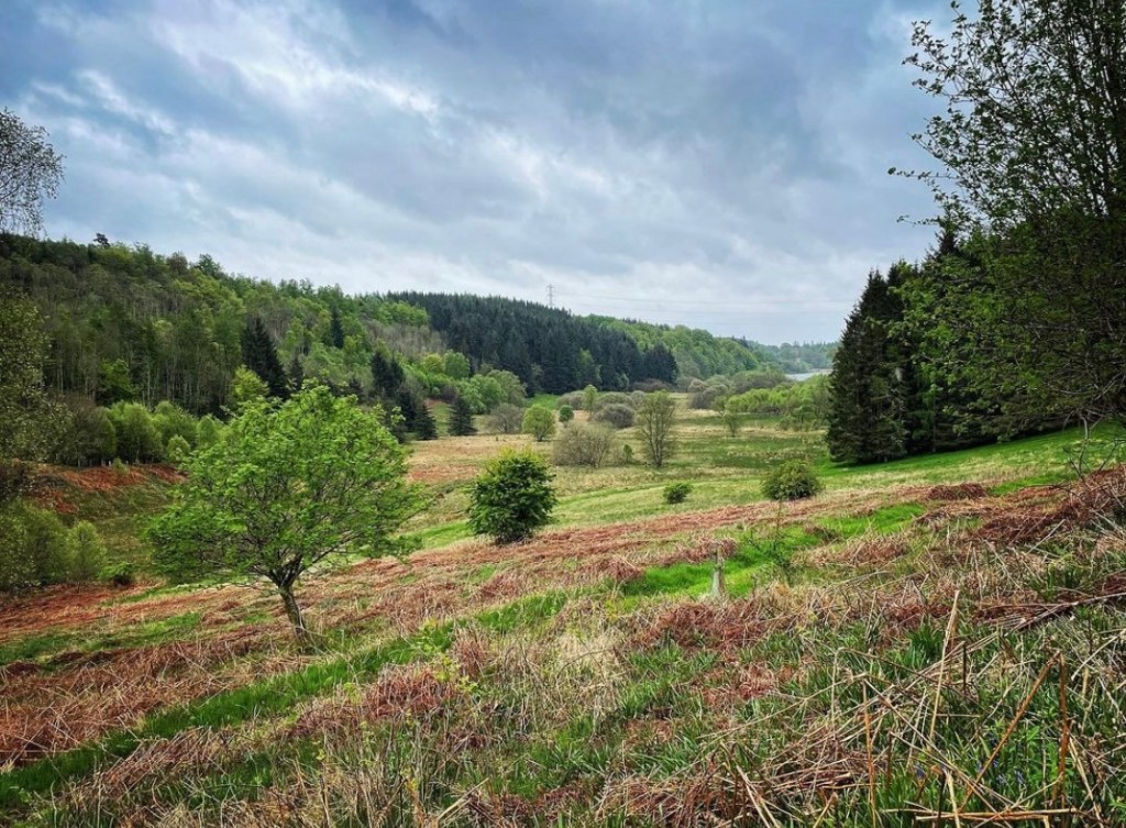
Continuing on from the memorial, the trail heads past Carbeth Loch and onwards through the beautiful lush valley and countryside towards the tiny hamlet of Blanefield. The rain which had momentarily stopped around Craigallian Loch had now become a steady drizzle once again as I trudged onwards along the great path.
Mugdock Country Park to Dungoyne
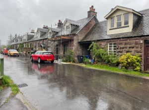
Arriving at the hamlet of Blanefield was interesting. The isn’t much there in terms of shops and amenities, in fact there isn’t anything of that nature. It is literally a tiny cluster of cottages on either side of the track. What struck me was the decorative features and gimmicks which people had left outside in dedication to the West Highland Way. They were fantastic in my opinion and certainly cheered up the gloom of the heavy rainfall and obscured views which were slowly but surely creeping in.
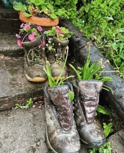
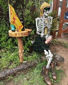
First there was the house with the pretty steps leading up to its entrance where upon these, each step was adorned with old hiking boots which had been conveniently turned into plant pots. It seemed fitting and certainly worked to give the way a little character. Then came one of my favourite gimmicks of the whole way, a skeleton with clothes on holding a can. From various photographs I have seen on social media over the last year, the skeleton wears different clothing every week or so and on the day I visited it was dressed in a kilt, bandana and hiking boots.
A gentleman was in the garden at the time I walked past and called a cheerful “good morning” over his fence. It was a lovely moment realising that the locals around the way acknowledge the hikers as it is quite often something which we do not always bare in mind when our thoughts are on the impending journey ahead. Blanefield is still only the beginning of the trail really and the journey ahead is long and daunting. The sight of the skeleton was comical, an excellent piece of art display which not only lightened the way but stamped Scottish humour all over it. In other words, ‘you’re on the best walk but this is how you’ll feel afterwards’ sprung to mind.
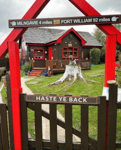
Last but not least was this impressive cottage painted in bright, eye catching colours and littered with garden collectibles and various decorative features. The signs ‘keep going’ and ‘haste ya back’ only add to the curiosity which is gradually building at this stage. Just how hard is this walk? Is it really as challenging as all that? These were definitely questions that I was beginning to ask myself. As the sign above the gate says, I was only 4 miles along the way at this stage and it is usually here in any walk that I begin to feel satisfied that progress is starting to be made. I certainly felt rewarded here even if the hard work wasn’t yet upon me. Although only a brief slice of humour here, Blanefield remains a fond memory of the way which I will treasure greatly.
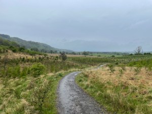
Just a slight walk past the cottage, the trail meets up with the first A road of the walk, the Ballachalairy Yett and it is this we follow after taking a left turn for a short distance before taking a narrow footpath through a gate into open pasture. Arriving at the second gateway further along I had hoped to be blown away by the first real scenic views of the day as here holds the iconic scenes of the hills to come. Unfortunately though, due to the rain, the best views were obscured by drizzle and mist.
I remember feeling a little disappointed here at this point as I stood a moment looking out over the metal gateway. Only a month before I had watched a friend on YouTube as he too had passed through this gate and captured everything that was there. I had thought at the time of just how I would feel at this moment when it was my turn to see it, how this was such a special moment of the West Highland Way as it marked the real beginnings of the open land on the trail. The fact that I couldn’t share in that experience made me, for a brief time, feel cheated somehow. Yet I quickly recovered myself from this setback as I continued on, quietly reminding myself how lucky I was to be here and not at work. It was an amazing feeling to be out doing what I know my heart loves best and sometimes we have to remind ourselves that there’s beauty in everything even when we cannot always see it.
From here on, the trail heads over an incline before dropping down to the river Blane Water. After a short rest overlooking the river which no doubt would’ve looked beautiful if it wasn’t for the torrential rain, it was time to head onwards. The following section I have to admit was quite uneventful as the trail becomes a straight footpath crossing endless muddy fields and so many gates I actually lost count. However, my journey from here on became less bleak when I got chatting to a couple from Worksop who were also on day 1 of their West Highland Way adventure. We struck a cord immediately which was definitely bonded by the fact that Worksop is not that far from where I live in Sheffield and it was interesting to discuss our local walking locations and previous adventures. They remained with me at various sections of the way throughout the next few days of the hike.
Before reaching Dungoyne, I spotted the Dungoyne Whiskey Distillery across the fields on my right which is a popular stop off during the first day of the way. I considered visiting but quickly decided against it. The rain was incredibly strong at this point and I felt that it would just add time and distance onto my journey. With this in mind, I pressed onwards towards the Beech Tree Inn, my lunch spot of the day.
Dungoyne to Gartness
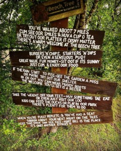
The above sign which I noticed just to the left of the trail on my approach to the Beech Tree Inn is probably one of the most photographed of the way. Not only does it let hikers know how far they have walked and what is on offer at the Beech Tree but also casually reminds them that there is still another 87 miles to cover. Yet another drop of typical Scottish humour.
It was one of the best feelings ever to finally get inside the Beech Tree Inn after trudging 7 wet and muddy miles in the pouring rain. The Beech Tree Inn is a popular stop off point of the way and provides food, drink and some supplies for the journey ahead. On a pleasant day, it is nice to sit outside at the tables and enjoy a rest stop amongst the variety of animals they have on site. In enclosures they have rabbits, guinea pigs, ducks as well as birds and chickens and in other larger enclosures, there are small ponies and horses. However, it was highly inappropriate to sit in the rain today and so we opted for a table in the back of the restaurant.
Peeling off my waterproof trousers which were stuck to my leggings felt like bliss as I seated myself at the table, glad to finally rest my aching shoulders of the rucksack. It might only have been 7 miles of the hike covered so far but I was definitely ready for lunch. As tempting as it was to go for a full slap up meal in the warm comfortable setting of the Beech Tree, I opted instead for a jacket potato with tuna mayonnaise and cheese filling so as not to over-face myself for the further miles I had planned. I certainly wasn’t disappointed with my purchase as it was much bigger than I had anticipated and came with freshly chopped peppers and salad. It was filling and revitalised me well for continuing on. The hot chocolate also did wonders for lifting my spirits.

I have to say I really enjoyed my time at the Beech Tree Inn. It came at just the right time in the day for lunch and was a very comfortable and enjoyable experience. The staff were very welcoming and catered for our needs well and were very friendly. I would highly recommend the Beech Tree Inn to anyone doing the West Highland Way and will definitely be back when I take on the walk again in the hopefully not too near future. It is worth mentioning that there is a handy water tap here at the Beech Tree. It is located round the rear of the building as people make their way off the trail. I made use of this tap to my full advantage before hitting the trail once again after lunch.
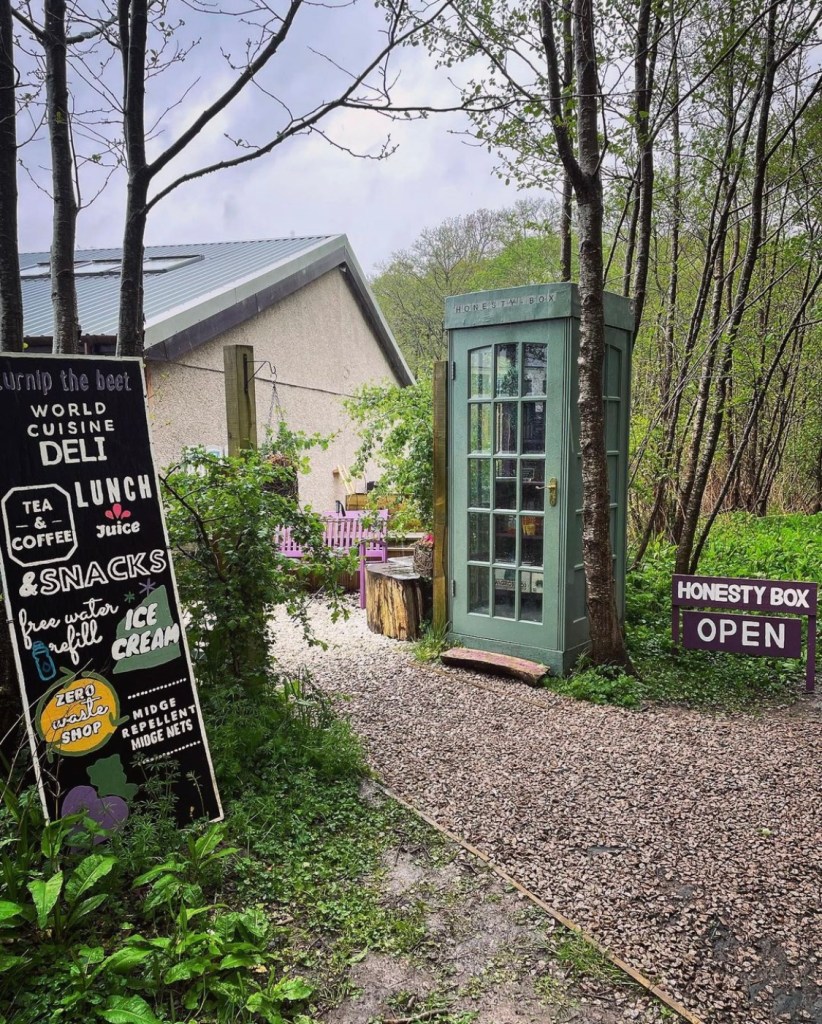
It was still raining heavily as I left the Beech Tree Inn and crossed the busy A road outside. Continuing onwards, the trail passes through more fields and gates for a considerable distance until Turnip the Beet comes up on the left. Here there is a well stocked honesty box placed at the side of the path as well as a shop and deli cafe.

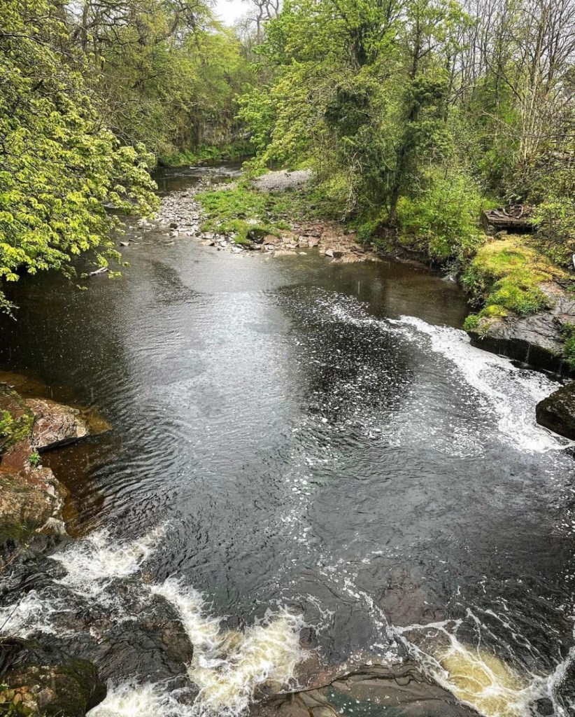
Approximately 2 miles along the track I came to a place where a large bridge crosses the trail at Station Road. This gave me a welcome break from the rain for a short time whilst I grabbed a drink. Then it was onwards through more fields before finally hitting the road at Gartness. Crossing the Endrick Water river, I felt a real sense of satisfaction as I knew I wasn’t far now from Drymen where I hoped to call in for my final break of the day.

Gartness is another tiny hamlet which the trail passes through with quaint cottages and the Endrick Water river flowing through it. Again, there is nothing really to be had here apart from the scenery which on a fine day would no doubt be beautiful. However there is a well stocked honesty box outside one of the properties as hikers pass by on the road. Some are also fridges with cold drinks and ice creams on offer.
The way continues from here onwards on road which was quite unforgiving on my now tired back and feet. A million thoughts swam around in my mind at this point as the rain relentlessly pelted down as I pondered the route so far. Excited as I was to be on the West Highland Way, I have to say that this section of the route was quite uneventful. It was difficult to enjoy the endless sprawl of farmland and country lane especially when there was no view to be seen and after long sections of seeing the same thing, it made for quite a boring walk in all honesty.
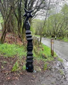
Heading closer towards Drymen, I spotted an interesting sculpture at the side of the road in which I stopped to take a look. From what I gather it was the Millennium Statue where a number of these have been erected in different parts of Scotland. Although I have attempted to search for information about these statues, I have been so far unsuccessful in finding any which tell of what they exactly mean. If anyone knows what they are and can shed some light on them, please drop me a comment in the comments section of this post.
Drymen Camping
Drymen Camping located approximately 12 miles along the West Highland Way shortly before arriving at the village of Drymen, is a popular and well known camping location on the way and is the recommended ending for day 1 of the hike. As well as camping pitches, it has a converted barn containing all facilities and is well equipped to serve every hikers possible need.
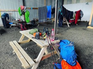
On arrival at Drymen Camping, I cannot begin to describe my relief. By this time I was absolutely soaking wet, my waterproof clothing finally starting to give in due to the heavy and prolonged rainfall. Although I was not actually camping at Drymen (I had other camping plans), I decided to take a considerable rest stop here to grab some food, have a cup of coffee and take a little respite from the weather.
Upon entering the converted barn, I quickly found myself a table and settled myself down. It was the perfect place out of the wind and rain to set up the Jetboil and get coffee on the go. Inside the barn is a worktop area where food can be prepared with power sockets to charge devices. Several washing lines are hung inside to dry wet coats and other clothing and there are clean toilet and shower facilities. Although basic, this is a perfect place to stay on the West Highland Way and provides every welcome comfort for hikers. Fresh water taps are also installed in order to fill up water bottles.
It is worth noting here that due to the popularity of the West Highland Way, the pitches here get filled very quickly and pre booking in advance is definitely recommended in order to avoid disappointment.
I ended up staying an hour and a half at Drymen Camping, not actually leaving until past 5pm that day having becoming comfortable seated at the table enjoying hot drinks and snacks and chatting to other hikers I met there. It certainly was a hive of activity and some interesting stories of the way were shared here.
I learned that at some point along the way, there had been seen a naked man hiking the way for charity with his 15 year old daughter! I have to say that I never saw this man or anything of this nature, however I couldn’t help but wonder how cold he felt during his time on the way and he certainly had more guts than me!
Then there was the family I met who had a young girl with them trying to dry out a sodden sleeping bag on the washing line. The bag had got wet during the hike after the girl mistakenly thought the stuff sack it came in was a waterproof dry bag. I remember looking at the sleeping bag on the line dripping wet and felt really sorry for her. It would never be dry by nightfall and it was a very cold and wet day. It was certainly going to be a very uncomfortable night in store for her and whoever else she was sharing with.
Drymen Camping to Garadhban Forest
I have to say that I was sad to leave Drymen when I did. After my wet hike during today I was beginning to feel exhausted and the thought of venturing back out into the cold and rain really didn’t sound appealing, however, I hadn’t pre booked a pitch here and so all the camping pitches had been taken. In saying that though, where I had chosen looked fabulous on photographs I had seen previously and from what I had heard, it was a popular wild camping location. I was looking forward to arriving there and getting set up for the night.
Heading outside I saw to my delight that it had finally stopped raining but everywhere was very wet indeed. Heading along the road as it dropped down the steep hill into Drymen village, rain water was forming a river which trickled quickly downwards in the direction I was heading.
It was at this moment that I realised I was more alone today than what I had been throughout the whole day. The droves of people I had passed or who had passed by me had been vast and I cannot say I ever felt alone at all. Now, as I left Drymen Camping the feeling was more prominent than ever. It is a memory that will always stay with me. I knew why this was of course. Most people had opted to camp at Drymen and so had finished their first day of walking.
I usually hike solo and thought I was comfortable with being alone on the hike. Yet it felt very strange to suddenly be alone on the trail which I had very quickly gotten used to always having another hiker near. It’s fascinating when you think about it carefully, it just shows how much we become accustomed to our environment in such a short space of time that we never give it much consideration, yet when circumstances suddenly change it can unexpectedly change our perception and expectations of how something is supposed to be.

At the bottom of the hill, the way suddenly takes a right turn off the road and begins heading across open field where it meets up with the military road at main Drymen. This was a very boggy section indeed after the rain during the day and careful navigation was required.
Crossing the road, I began heading along a narrow passage with attractive hedges lining the walkway for a considerable distance as it followed the road.
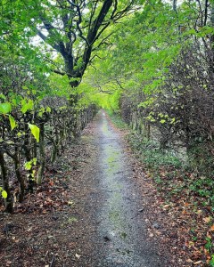
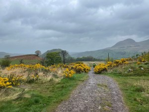
Then leaving the road, I followed the signposts along a left turn up an attractive farm track adorned with bright gorse bushes towards the Garadhban Forest which I could clearly see in the distance on my approach.
Knowing my walk for the day was approaching it’s end, I followed the track as it skirted the forest. On careful inspection, I noticed a couple of tents already pitched in the edges of the trees so I felt instantly relaxed knowing I wouldn’t be totally alone that night. Now all I needed to do was find a suitable pitch myself.
Camping Spot
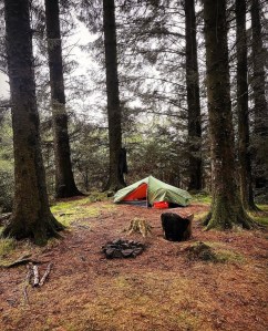
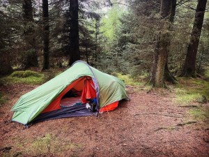
I finally discovered the perfect pitch to camp shortly after my arrival at the Garadhban Forest, and what a gem of a spot it was! Out of all the places I camped or saw along the whole way, this has to be my favourite of all. The above spot is located just inside the forest, just off the main trail and just a 5 minute stroll along the wide path after turning left off the farm track.
The Garadhban Forest is a popular wild camping location especially for backpackers of the West Highland Way and it is common to see other campers in the location. After pitching my tent, I had a small wander around the section of forest I was in to see how many other potential pitches there were. There were literally loads I could’ve chosen and were all everything I could possibly have hoped for and more.
In my opinion, the Garadhban Forest was so perfect that it appeared that it had been purposely made for camping rather than being the secluded wild forest it was. It is a proper pine forest with dense, close growing, super tall pine trees. The further I walked into it’s depth, the darker and more mysterious it became. Under foot everywhere is a thick carpet of pine needles covering springy wild grass which gave the impression I was walking on springs as I felt bouncy. There was a section of forest where a lot of trees had toppled in the harsh winds but I steered clear of that area preferring to camp where the trees appeared sturdy. The only issue I will mention is that I didn’t spot a water source in the forest. Fortunately, I still had lots of water in my bottles which I had refilled back at Drymen Camping.
My pitch for the night was in a tiny clearing in the middle of a circle of pine trees. It had excellent ground with easy peg access, no mud and stunning forestry surroundings. What made it even better was that the ground was very well drained and felt bone dry despite the torrential heavy downpours I had experienced all day on this hike and it was extremely well sheltered from the wind and rain.
You will notice that there is a campfire in the photographs. I’d like to state here and now that although I camped in this location, this fire was NOT made by me. It was already there and long since extinguished before my arrival. Despite a fire pit being present, I still loved the pitch due to the ground being perfect and it was this alone that drew me to the spot. If the truth be known, I do not agree or support woodland or forestry campfires.
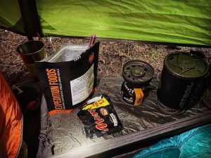
As the night drew in I peeled off my damp clothing and changed into warm fleece. After a Basecamp Foods meal and cup of hot chocolate it was soon time to crawl into my sleeping bag and relax. The hard part of the day well and truly over.
Laying all snuggly warm as darkness closed in around the Garadhban Forest, I couldn’t help but think back through all the events of the day and all that had occurred in such a short space of time. It was only day 1 of my West Highland Way hike and already I had met some fabulous people. Being able to chat as I went with likeminded people had been fun, something which had lacked so early on in my previous adventures. Hiking solo, although great can have it’s disadvantages in regards to this, so it was nice to be able to mix it up especially in the testing times like when the rain and wind was bad. Today’s hike also had opened my eyes further to how well documented the trail is on a global scale as I lost count of how many foreign people I met just on day 1. I think I met more groups of American people than I did British which was perhaps one of the best aspects.
The hike today had seen me complete approximately 14 miles of the West Highland Way having made it further than the recommended distance by 2 miles. This I figured would make day 2 shorter. In saying that, I felt that stopping when I did was the right decision to make as despite the route being a relatively easy section, I was feeling a little stiff and tired by the time I reached Garadhban.
Turning out my lamp in the stillness of the night I was plunged into pitch black darkness. Nothing could be heard but a gentle breeze blowing through the high tops of the trees and the heavy pine branches creeking and swaying above me. It had gotten cold though and the chill could clearly be felt seeping in from the outside. Out of all the things I could’ve thought about just before sleep consumed me (and there was plenty), it was none other than the young girl at Drymen Camping with the soaking wet sleeping bag I had met earlier. Here I was all cosy warm after my day of hiking but how was she feeling right now? I closed my eyes at the thought and turned over. Then there was blackness….
Hike summary
Distance walked: 14.35 miles
Elevation: 1,057 feet
To summarise day 1 in general, I would say that it has been a fabulous introduction to the trail. I always find it difficult on the first day of any long distance hike to find bad aspects as I never have anything to compare it to so early on. I tend to stick with overall thoughts and feelings and then evaluate as the journey continues.
I will say though that nothing changes for me in regards to starting an adventure. It is still as magical as when I first started hiking and trying out new locations from the build up of excitement at knowing I am starting a new adventure, to the planning and carrying it out after many weeks or months of waiting. The suspense in the last few weeks before setting out is what always gets me and the thrill of not knowing what to expect does nothing but add to the excitement. Nerves are always at their wildest too as I always begin to question myself and wonder if I have taken on too much. Then I have to remind myself that not every adventure will end in success, it’s about getting out there and trying which makes all the difference.
The weather on day 1 was not the best and it meant hiking in torrential rain and wind for most of the day. Everyone got soaked that day and there was not one dry person on the walk. Visibility in many places along the way was effected unfortunately. That said, I wouldn’t say that day 1 was a write off, it just changed it and meant there wasn’t much opportunity to hang about and sight see in a particular location for long. I had long prepared myself for rain as I have hiked in Scotland before, knowing full well how temperamental and fickle the weather can be at the best of times. In Scotland I guess it’s about making the most of what opportunities you do get no matter how brief.
Overall, I feel that the way was relatively easy going on day 1. I managed to make my required mileage and camping spot that I had planned without any great difficulty. If anything, it was the carrying of the rucksack and all the gear that made me tired at the end, not necessarily the distance. The first day consisted of easy going pathways, road and farm track with small sections of elevation. The way was clearly signposted and the markers easy to spot.
There were plenty of places to buy food along the way with shops and cafes in Milngavie, the Beech Tree Inn and various honesty boxes at Turnip the Beat, Gartness and Drymen Farm. There were also water taps in Milngavie, Beech Tree Inn and Drymen.
One of the best parts of today for me was the people I met along the way. People of all ages, some walking solo, others in groups. There were also families who had travelled from all over the world. It also dawned on me that first night that these very people were the hikers I would most likely be sharing the trail with for the duration of this hike. It might’ve only been early days but I had already experienced something on this walk that I hadn’t yet on all my previous solo adventures. This was an instant bonding and feeling of security whilst in the company of so many other likeminded hikers. The words of encouragement I received were comforting and I will treasure that sentiment forever.
Finally, my camping location. The best place to end the day was definitely there in the Garadhban Forest. Of all the places I could’ve camped, I believe I chose the best place for me. Day 1 of the West Highland Way is often reported to be the least scenic of the route, in fact many knock it completely and say it’s a drag. Personally, I really enjoyed the route on this day and it set me up for a nice little ‘break me in’ for the longer, more strenuous days ahead.
So it leaves me only one thing left to say at this point and that is massive Thankyou for taking the time to read my post about my experiences on day 1 of my West Highland Way through hike. You may even be someone I met whilst on the way and remember me from your hike. If so, leave me a message or comment in the comments box. Being able to relive my experiences and put them into words once again means a lot to me. If I take nothing away from my adventures but good memories then that is a job well done but I can assure you, it’s much more than that.
I welcome and appreciate constructive feedback so if anyone has anything to say regarding this post or if anyone wishes to ask questions, please do. I will try and help as best I can. If you enjoyed this edition then Thankyou and I look forward to posting again soon for day 2. Take care fellow hikers and see you soon. Xxx
Information sources used
Mitchell R.J., Broome A, Hewison RL, Stokes V. (2019) Protecting Oak Ecosystems: Managing oak woodlands to maximise support for oak associated biodiversity. Case study: Mugdock. Available at http//www.hutton.ac.uk/oak-decline
West Highland Way Trail Guide (2022) http://www.westhighlandway.org
Craigallian Fire Memorial Site. Accessed in May 2022. http://www.strathblanefield.org
All photographs included in this blog post are my own and have been captured using an iPhone 12 camera device. They have been sourced and edited by myself Lucy Bailey from my Instagram account found at SoloExplorer23 using Instagram editor tool to enhance clarity and quality of the image. Any map images other than the Strava images have been sourced from the West Highland Way Official Trail Guide as referenced in the post. All distance and elevation images as tracked on Strava GPS are my own and were live recorded on the day in question.

Having completed the West Highland Way recently myself, I thoroughly enjoyed reliving the first section with you here.
Thank you for sharing your experience.
I am already looking forward to reading about Day two.
LikeLiked by 1 person
Hi Sam,
Great to hear you have recently completed the West Highland Way and Thankyou for your comment. When I set out on this adventure, I had already heard so much about it but absolutely nothing could prepare me for the true scale of how awesome it really is. I have done other trails which have been spectacular and I’ve loved them too, but this one is my favourite by far. There’s so much more to it than what I initially thought. The day I finished I was in bits literally as I wild camped the majority and carried all my own gear but the next morning on the bus back to Glasgow, I passed everyone still on the West Highland Way and I felt as though I shouldn’t be leaving. I truly felt I had forgotten something and should still be on the trail. It was so strange I cannot describe it.
I loved every minute of the way, even though it threw it down most days and I lived in wet clothes lol. That says something for definite. I cannot wait to come back. Xx
LikeLike
Hi Lucy, you’re blog inspired me to do the West Highland Way and I’ve just completed it (Sunday 9th June). Thank you so much. It was nice to have you’re blog to check back on and see you’re thoughts. You’re comment about leaving Milngavie and the walk feeling special not too far in is so true. I loved camping in the Gabradahn Forest and am going to head back. I did it as a mix of wild camping, campsites and hostels, using you’re blog as a guide.
I live in Fort William (been here about year and a half – I came across you’re blog seeing you’re thoughts on walking the Ben), but am originally from Staffordshire. As someone who lives in the Highlands (and a keen hill walker), I went into this thinking been there… done that… I was so wrong! I also for the night before and just before setting off was very nervous. Doing the WHW feels very special, unlike anything I’ve done before. The sense of community along the route is something else, and I loved the people I met and walked with. Coming back into FW I had a cry as I didn’t want it to end.
I wish in Fort William there was a visitors book by the sore feet statue or a meeting place for everybody you’ve met to say goodbye. I feel Milngavie has a grand opening but it can be a bit underwhelming once you’ve finished.
Please finish you’re thoughts on the route. I think it more than deserves it. Who knows who else you will inspire? I am not sure what’s next, another Scottish long distance route (I wouldn’t mind doing the Moray Coast Way) or elsewhere in the world. Only the beginning huh?
All the best,
Jack
Ps if you ever do the Ben again, do it via the CMD Arete, it’s brill. It’s not that hard a scramble, and going up the back of the Ben is pretty cool. Very steep! Snow up there at the moment.
LikeLike
Hi Lucy,
it is now 11th July 2024 and I have really enjoyed reading the 1st day of you walk on the WHW from Milngavie to Drymen. My husband and I have planned to start the walk from Milngavie to Drymen this September 16th . We are now in our 70’s and have done the Way twice, once for our honeymoon in 2000 and again for our 3rd anniversary in 2003. It certainly gets under you skin as we have done many of the “ways” over the years and this is our favourite by far! We still do sections of it for memories sake. Last September we walked from Ardlui to Crianlarich, stayed overnight then walked to Tyndrum. Then in May this year walked from Tyndrum to Bridge of Orchy. We were on holiday in Oban at the time. We are looking forward to re- living the Milngavie to Drymen stage in September, so thanks for your post and pics. Hope you are well and enjoying your walking!
Kind regards, Sandra. PS we live in North Yorkshire nr Skipton.
LikeLike