14th May 2021
They say a backpacker’s main demon is lack of sleep… Without that or even the means to allow a reasonably comfortable night, the consequences are extreme fatigue and low mood which in turn can jeopardise a whole day. Travelling long distances on foot, carrying a full rucksack, enduring difficult terrain and living in virtual solitude for long periods of time are all challenges which are, almost welcomed as part and parcel of ‘hitting the trail’. It becomes seen as being part of the very furniture which forms a very unique home from home adventure which we set out to conquer. I had expected to suffer inadequate sleep long before now, the sounds of the forest and it’s abundant wildlife being the main issue, however, my first real experience of hiker insomnia came on night 4 of the Loch Ness 360 adventure.
After having tea the previous evening and settling down in my sleeping bag, I had fallen asleep extremely quickly. It wasn’t to last though as not even 2 hours later I was initially woken by Deer outside the tent. This was not an issue and it was comforting to lay in the stillness listening. A luxury I had never experienced back home in urban Sheffield. However, as the minutes ticked by, they quickly became an hour. Then 2 hours and then 3. My thoughts began to wander about how secluded my location was. How exposed I was in comparison to my previous nights and of course, how exhausted I would feel in the morning. By the time I finally dozed off, my mind was alive with thoughts going ten to the dozen and the remainder of my night consisted of broken sleep by nightmares. As my wake up alarm sounded at 8am I hastily switched it off and went back to sleep. Due to this, I slept way longer than I should, finally awakening properly at nearly 10am. A very late lie in indeed!
The weather this morning although slightly cloudy, was warm and the sun was up shining brightly. Such stark contrast to the freezing and extremely windy night which had befell me. It was mornings like this though which really made up for any discomfort.., and I certainly had been blessed weather-wise so far on this trail.
Considering the distance I needed to cover in today’s hike and the fact that I had woken up late, I decided to pack up sharply and get on my way without breakfast. The village of Foyers was only approximately 2 miles away from where I had set up camp and I figured that upon arrival there, the local shop and cafe would be a perfect treat. I was fortunate to know that Foyers Cafe was an adequate place to buy food as I had visited previously in 2010. It didn’t disappoint then and I knew it wouldn’t now.
Packing away took approximately 20 minutes. As I did so, many thoughts flew into my mind about this incredible journey so far, how I was only days away from completing it and all I had experienced so far. I had seen so many incredible sights and stepped foot in places I never had thought possible only a few months ago. Most of all I was actually succeeding in getting closer to my goal to complete the whole official Loch Ness 360 Trail which I have to admit here and now, when I first set out I could only imagine. I had only hoped at the time that I would complete it… yet a tiny glimmer of me still had a niggling doubt.
Leave No Trace
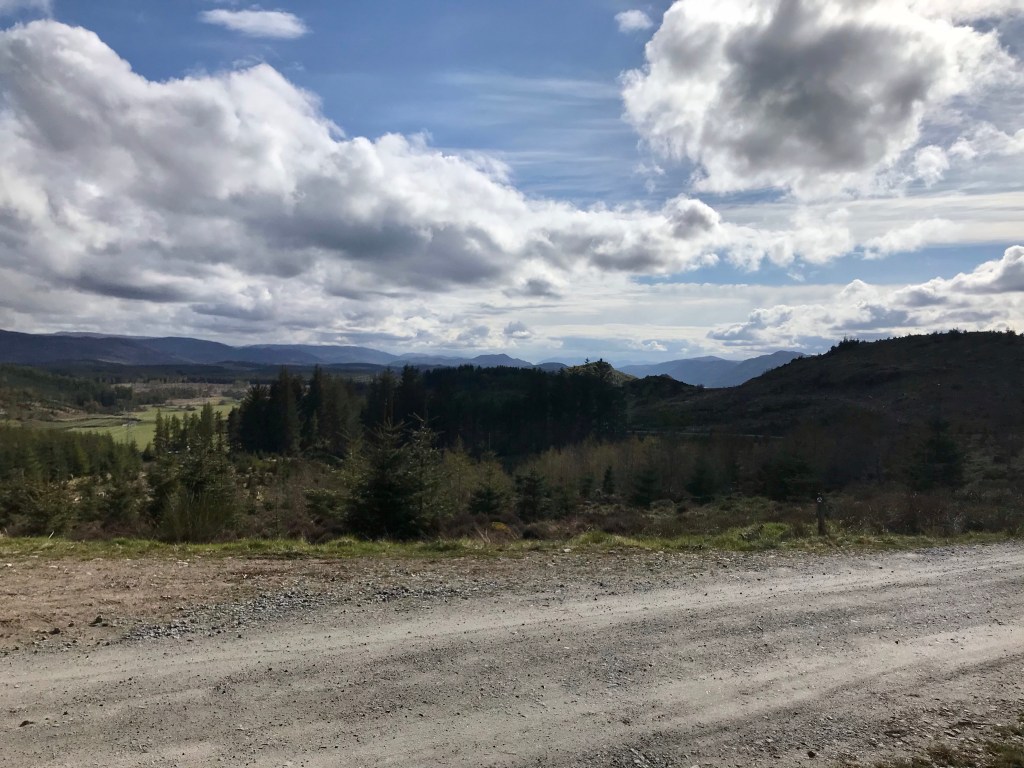
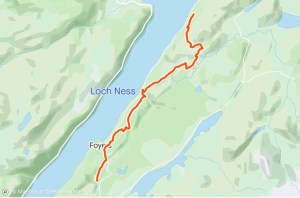
Overview and Day 5 walk route
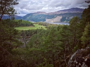
The route today would take me through the village of Foyers where I planned to break for breakfast and take a wander down to the famous Falls of Foyers, a large and beautiful waterfall 165 feet deep which feeds Loch Ness. From there, the route leads through forestry heading out of Foyers, across boggy land and into more dense forestry at Inverfarigaig. Upon completing this section of trail, it arrives at Farigaig Forestry Commission Trust where there is a visitor centre with public toilets, picnic tables and various walks to choose from. The trail continues along main road for a short while before turning off to the right up a steep and windy farm lane which takes people through various fields and farm land and gives views of Dun Dearduil, a large hill containing the remains of an ancient fort.
The trail continues to follow farm track for a considerable distance before turning off to the right along asphalt road into vast grey areas of deforestation. Upon climbing a long and relentless track, the trail continues along the Fair Haired Lad’s Pass, a forest path flush with beautiful vegetation and forestry scenes which climbs ever higher through the mountains encasing the hidden Loch before opening up to amazing and spectacular views over Loch Ness and across to Urquhart Castle. The trail then heads downward steeply through forestry at Torness.
My plan was to camp somewhere around this location although I wasn’t sure exactly where at this point. From looking at the trail guide and consulting my Strava app, I felt confident that the forestry here would provide a good spot, however my only worry was whether or not the ground would be suitable based on my experiences so far. The total journey today would be approximately 11 miles. I felt after my long walk yesterday, the expected ascents of around 2000 feet and the fact I hadn’t slept well the night before that this was an acceptable distance to cover. It would then leave me an easy to achieve distance the following day for my final hike into Inverness to complete the Loch Ness 360 Trail.
Whitebridge to Foyers
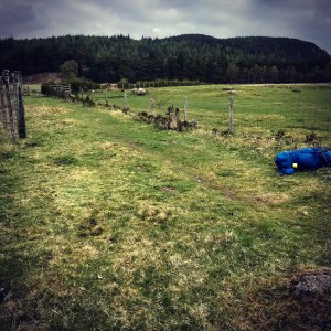
I set out along the picturesque lime stone trail at 10.30am heading alongside the dry stone walling which separated the livestock from the walkway. After a short while, I hit open field and crossed this by following the faint pathway in the grass which could barely be seen until it met the public footpath on the opposite side leading into woodland. At the side of a large metal farm gate which was locked and unusable was an extremely narrow swing gate, encased all the way round from roof to ground. It was such a tight squeeze that I couldn’t get in it with my rucksack on my shoulders. I had to take it off and post it over the top of the locked farm gate before walking through. I remember meeting a couple here who were out for a morning bike ride and said they cycled this route regularly. Despite this, they still found it challenging lifting their bikes over the gate and mentioned that they’d hoped a new and more accessible gateway would have been put in place by now considering the different ways that the trail could be completed.
That obstacle out of the way though, I found myself standing in a really stunning piece of woodland which was rich in various types of plant life. There were forest firs, different long grasses and thick heather lining the sandy pathway in front of me. Due to the time of year, the heather wasn’t flush with its rich purple flowers just yet, but I could clearly see the dark burgundy tones of the wild plant and could almost envision its overwhelming beauty come the Summer time when it properly woke up. The ground in this location was flat and grassy and would’ve made an ideal camping spot if only I had known about it the night before. It is definitely something to bare in mind for future reference if ever attempting this route at a later date.
The walk into Foyers village from my camping location took approximately 1 hour. During my walk through the woodland late in the morning, I observed rabbits playing on the grassy mounds as I passed and was amazed by how close I could get to them before they ran away. There must have been at least 20 rabbits at one time, all bold as brass and brave as they darted between the heather tufts. It was a surreal moment which was just the lift I needed at the start of my journey.
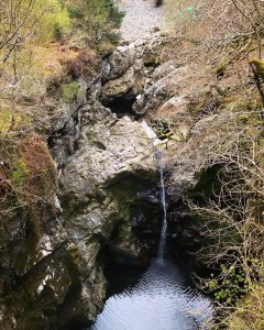
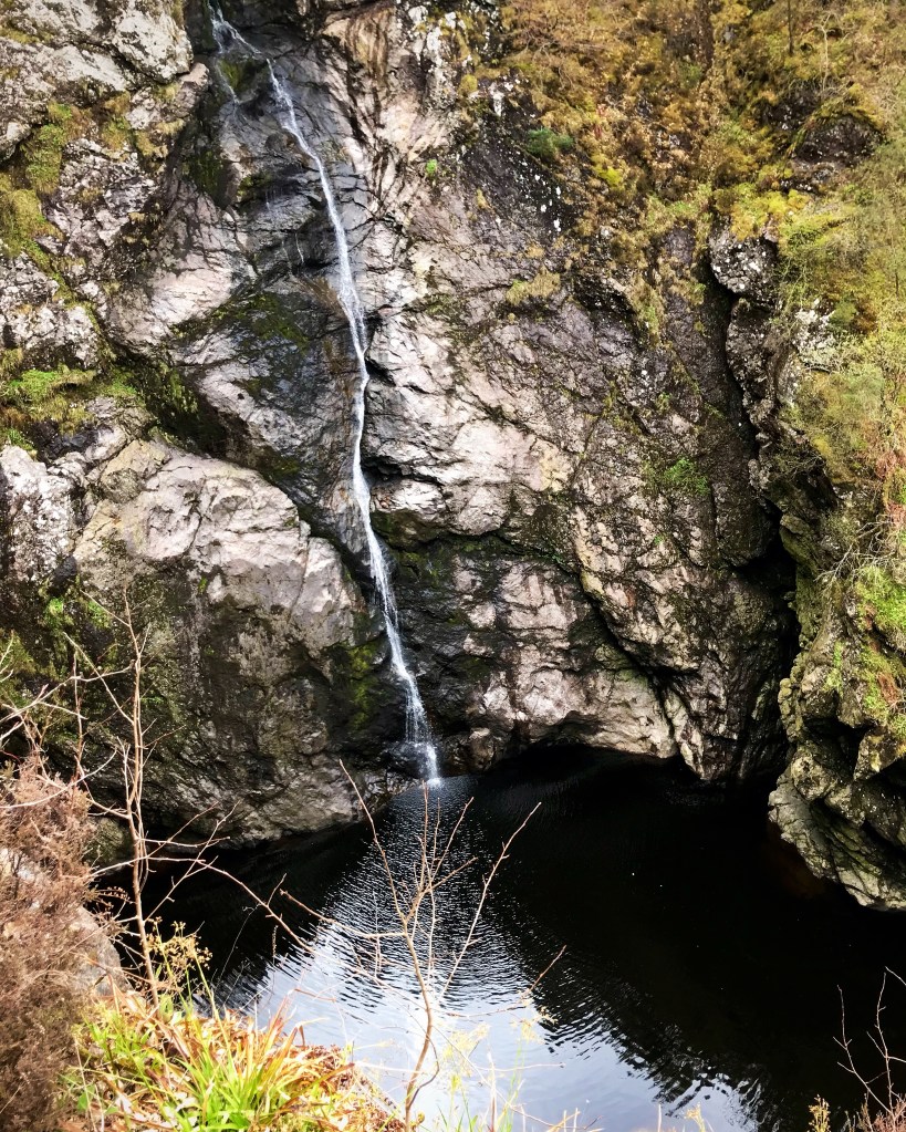
It wasn’t long before I heard the familiar rumble of cascading water and upon leaving the woodland and could see the tops of cottages and houses as I neared Foyers. Crossing over a stone bridge over the River Foyers, I gazed down over the edge. The following photograph is one taken at this point and clearly shows the beauty in this location. The pool of water which this smaller waterfall tumbles down into is just one of many here, and walkers are spoiled for choice in places to explore and make adventure. It is at this stage that the trail meets main road once again and follows this right into the heart of Foyers village. Just a short distance from here on the right hand side of the main road, I arrived at the Waterfall Cafe and Foyers Stores which is located directly opposite the Fall of Foyers.
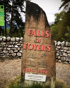
The Falls of Foyers
Foyers is a village located on the B852 military road approximately 10 miles northeast of Fort Augustus with a population of approximately 276 residents. Known in Scottish Gaelic as Foithir meaning ‘shelving slope’, it is renowned for it still having a large number of Gaelic speaking residents even in current times. Apart from the Waterfall Cafe and General Stores there is also a school, crafts shop, hydroelectric station and a number of hotels and accommodation. There is of course, the stunning Falls of Foyers and a number of walks and cycling routes around the location. On the whole though, Foyers is a quiet village without the hustle and bustle of major entertainment.
I settled on breakfast at the Waterfall Cafe and due to the weather being fine, I sat outside at the pleasant tables on the front decking. I have to say that the staff here are very friendly and supportive and I chatted to them about various aspects of my hike as I bought supplies for the remaining journey ahead. I selected an unusual breakfast that morning in that it consisted of chocolate cake, Irn Bru and Pringles! I justified this to myself as I sat eating it overlooking the views across to Lower Foyers that my body was in desperate need of sugar and considering the distance covered so far, I deserved a treat. Well… it’s the excuse I used anyway and one I will use again whenever the need is felt.
Before packing away my supplies for the day, the gentleman in the cafe kindly offered to mind my rucksack for me giving me a comfortable opportunity to briefly visit the Falls. I was aware from my previous visit that there were a considerable number of stairs to navigate in order to get down to the imposing viewing platforms and the thought of lugging a heavy rucksack up and down them really made my heart jump! I really cannot Thank the gentleman enough for his kind offer that day. Upon chatting further, he went on to say that he had worked in the cafe a long time and actually knew the creator of the Loch Ness 360 Trail who happened to reside right here in Foyers village. He mentioned that although he had met various hikers as they passed through, he tended to see groups rather than solo hikers. The Loch Ness 360 Trail despite officially opening at the beginning of 2019, is still not hugely popular especially on the South side with lockdown likely to be playing a big part. Apparently I was the only female solo hiker that he knew of or had met so far who had walked the 360!
He went on to describe how he had also hiked the 360 trail but in the winter of 2020 when everything was white over in deep snow. The winters here are very long and relentless beginning as early as late October and ending as late in the year as April! This year in particular had been ruthless with snow only disappearing just a few weeks previously. It was hard to imagine now in the warm spring sunshine and whilst among the plants and wildlife. Loch Ness is known for its vast cloud immersions which look spectacular when viewed from high places. However, it is largely due to this why Loch Ness and it’s surrounding villages suffer such harsh winter conditions. What a strange thing it would be to see the weather forecast as rain but then see it falling as snow when it hits the freezing clouds…

The location of the Waterfall Cafe and Falls of Foyers offers some really beautiful opportunities for walking and cycling with various routes signposted close to the sign for the Falls. Many of them wind down the shelf of rock where the falls cascade and head down through Upper and Lower Foyers leading down to Loch Ness. There are ample chances to view the scenery in the various woodland all around and each route offers varying levels of difficulty. There is a notice board located at the Falls of Foyers which gives details about each route making it easier to choose the one to suit people’s needs.
The Falls of Foyers (Eas na Smuide) is a large waterfall said to be 165 feet in depth which is located on the left hand side of the B852 road if coming from the direction of Fort Augustus and is directly across the road from the Waterfall Cafe and Stores. It was given the nickname ‘horrid cauldron’ (which had a tendency to smoke), by Scottish icon Robert Burns in 1787. The waterfall at times has been known to gush high volumes of water which tumbles down into a deep cavern in the cliff side. Just before it flows over the top, it is directed through a natural spout of rock which is responsible for the way the water flows down. Rather than being a spaced out spray of water, it is a solid, narrow fall which splays outwards near the bottom depending on how much water there is.
It has been noticed on occasion that the flow is now much smaller and less impressive than it used to be. This was felt by a number of visitors to the site who travelled there after recent heavy and prolonged rainfall in the hope of catching it in full flow. They were unfortunately left disappointed when they found to their dismay, only a tiny trickle of water. After researching the Falls in detail, it was found that the local hydroelectricity power station uses high volumes of the water to generate electricity which supplies the local villages. At different times, the flow of water to the waterfall is greatly reduced thus explaining the trickle, however, there are times when the flow to the station is switched off resulting in visitors catching the waterfall in its finest glory. In 2010 when I last visited, there was a much faster and bigger flow. This time in 2021, only a tiny trickle was seen but still didn’t appear any less beautiful and enchanting.
The waterfall is accessed through a wooden gate at the side of an impressive boulder of rock baring the sign for the Fall of Foyers. From there, the route down is by wooden stairs built into the mud pathway. Please note that access is not possible for wheelchair users or people who have unstable footing and there is no alternative route down to the Falls. The pathway zigzags through forestry as it heads downwards and becomes extremely narrow in places with steep drops down the hillside.
The Falls can be viewed from two viewing platforms (one upper and the other lower) although I feel the lower one gives a more spectacular view of its sheer size. Apparently, on the occasions when the supply of water to the power station is switched off, and the waterfall is much faster and bigger, it has been known to completely fill the cauldron making it possible to view the waterfall from the higher viewing platform only.

Foyers to Inverfarigaig
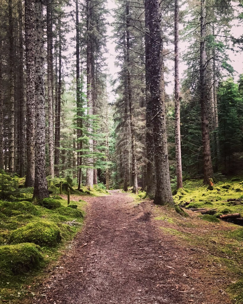
After viewing the Falls it was time to hit the trail once again and I headed along the main road away from the Waterfall Cafe. It was now approximately 12.30pm. The road begins a descent from here onwards as it drops down further into the village but I continued along the road until I reached Foyers Primary School. At this point, the trail takes a right turn off the main road and begins heading uphill into dense forestry. The track is a well trodden one and easy to follow with other smaller tracks leading off it to form other walks, however the 360 trail requires you to continue on the main walkway.
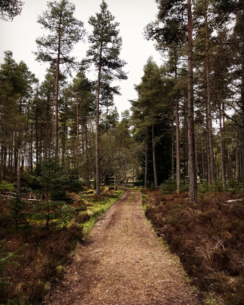
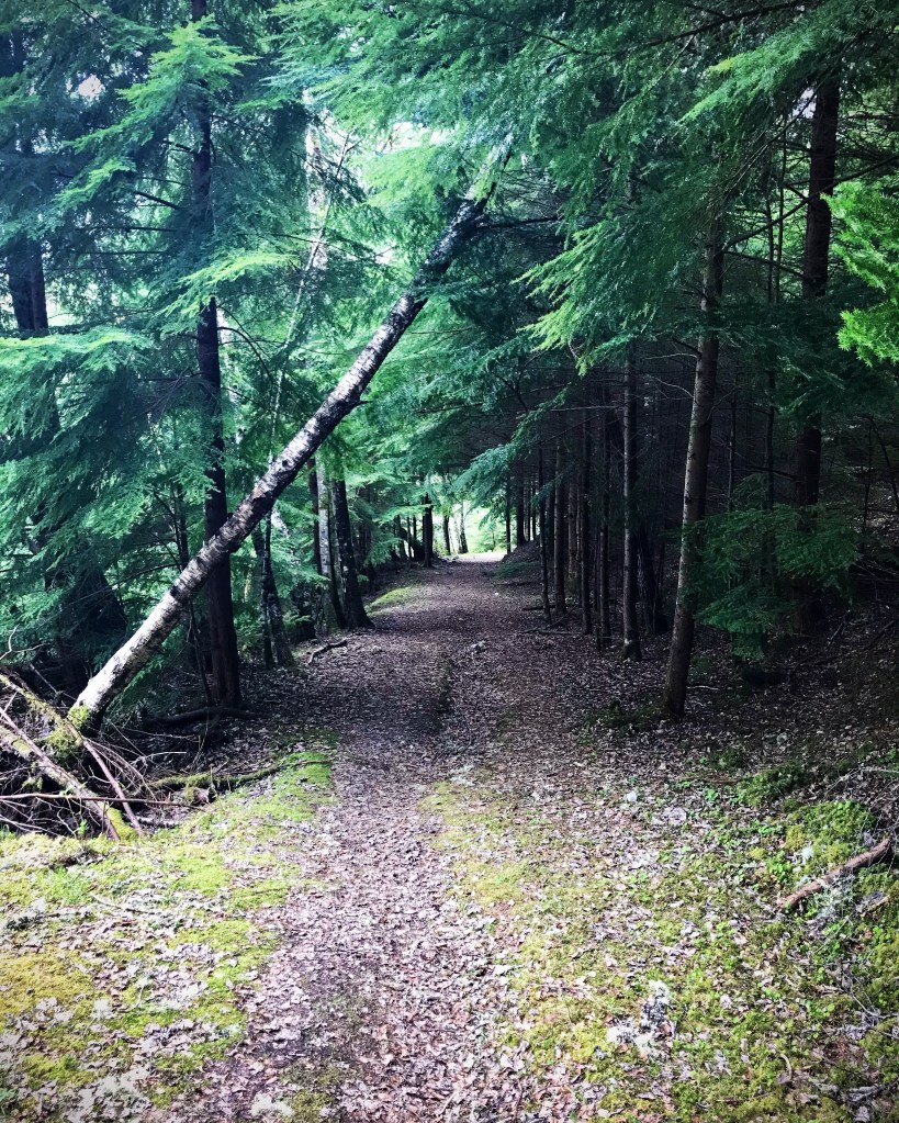
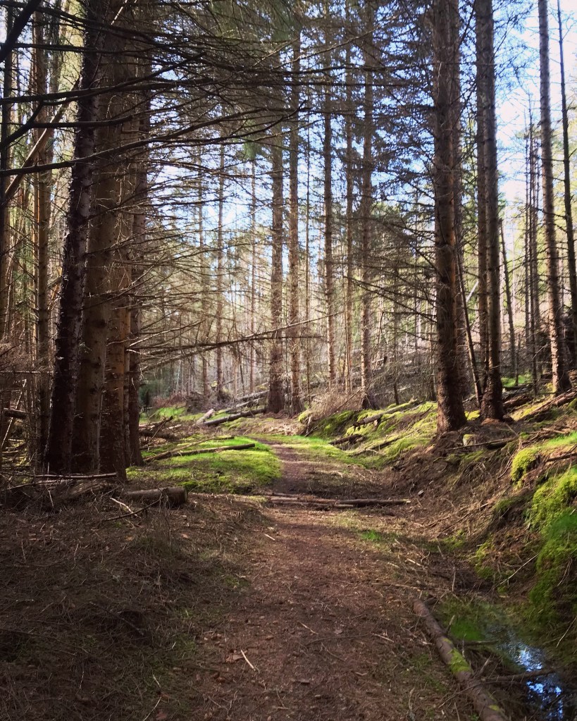
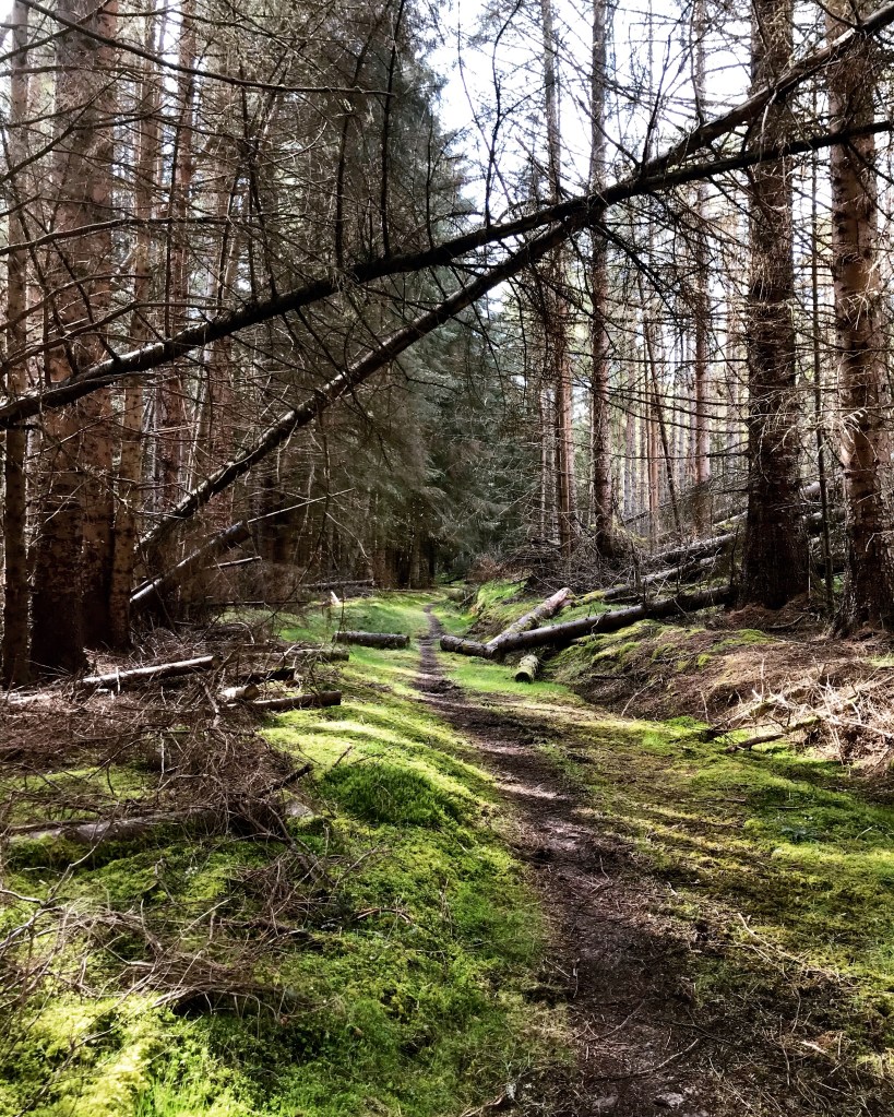
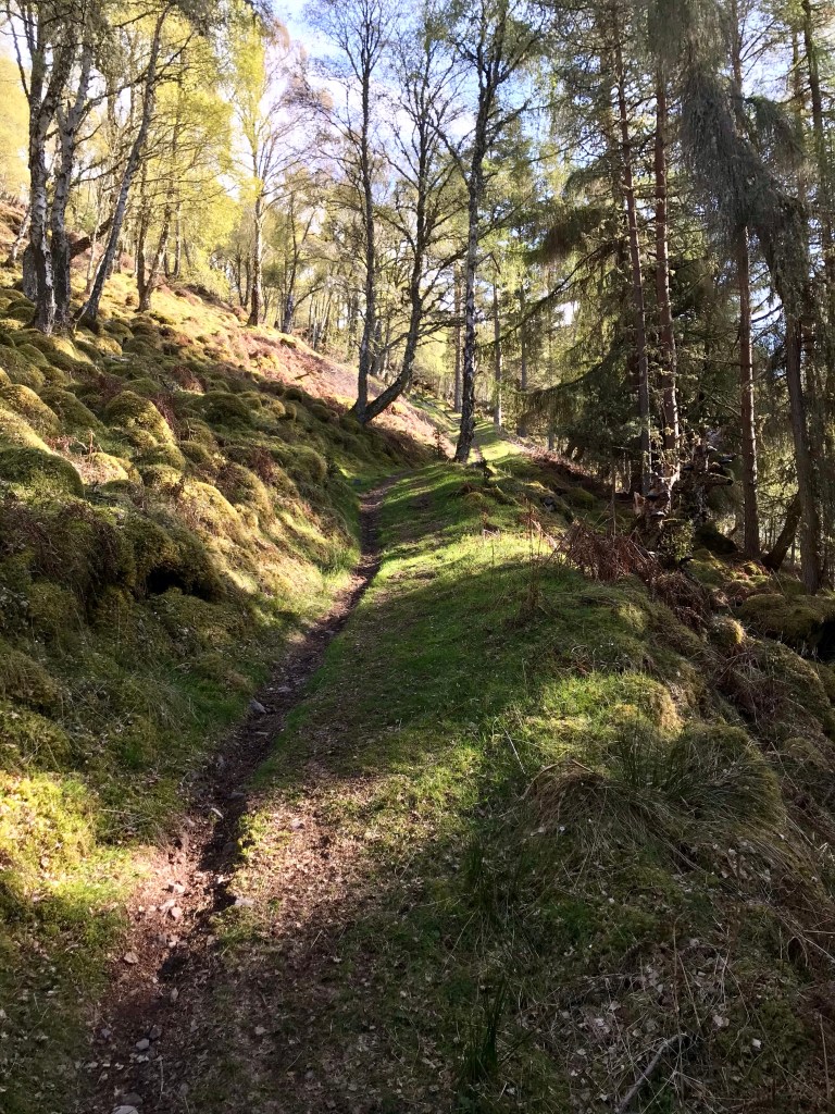
Upon reaching the top of the incline, there is a South Trail marker directing people to take a left turn and follow the track heading deeper into the forestry. A notice board at this point states ‘Foyers Forestry’ and is a very attractive section of trail. I have to say from here on I was gifted to perhaps the best forest scenery of the whole Loch Ness 360 Trail. I had witnessed throughout some amazing sights and I do not disrespect any of it in the slightest, however here was the very epitome of forest life. If I was to suggest a perfect location for a true forest experience it would be this section of the hike.
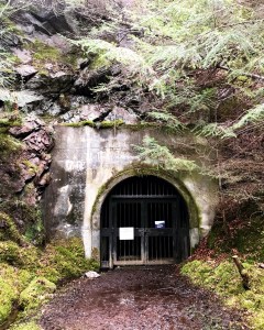
Around this point, I noticed a large gated tunnel just to the right of the track. The gate was locked up and secure however I did wander off the trail to check it out. The tunnel was a properly built archway leading into cliff side which ran the length of the trail adding to the dark and mysterious setting I found myself in. Due to recent rainfall, stagnant water had collected around the entrance to the tunnel and was very wet underfoot. The water extended into the tunnel for quite some distance. As I gazed in, it was so dark that I half expected some monster to grab me and pull me in, to which I found myself taking a step backwards from the entrance. I myself do not believe in monsters but I have always found it strange how certain locations change your perception and create an overactive imagination in some instances.
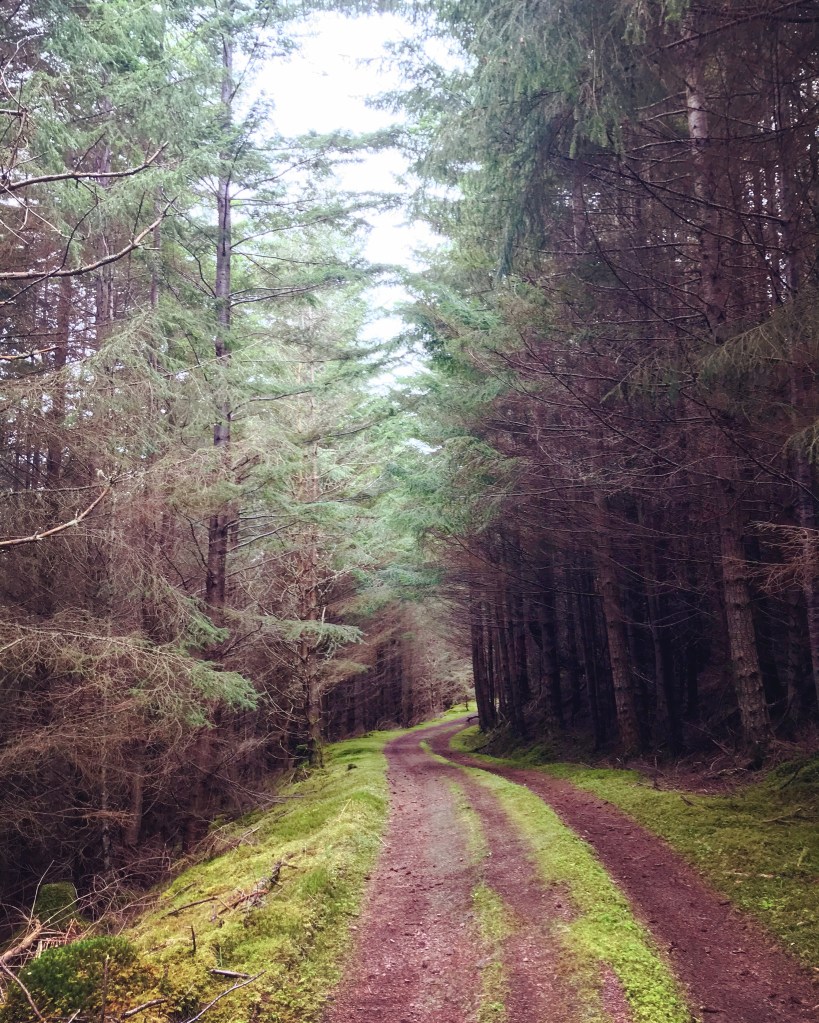
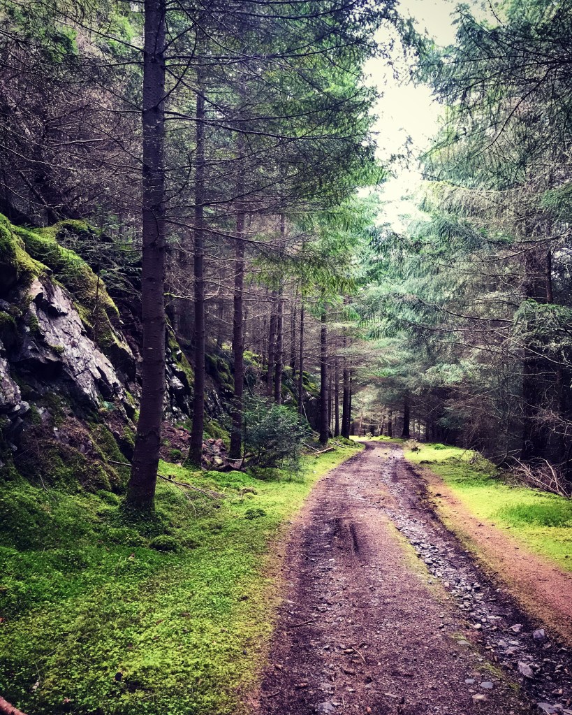
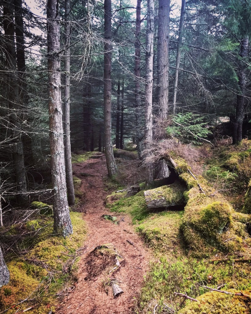
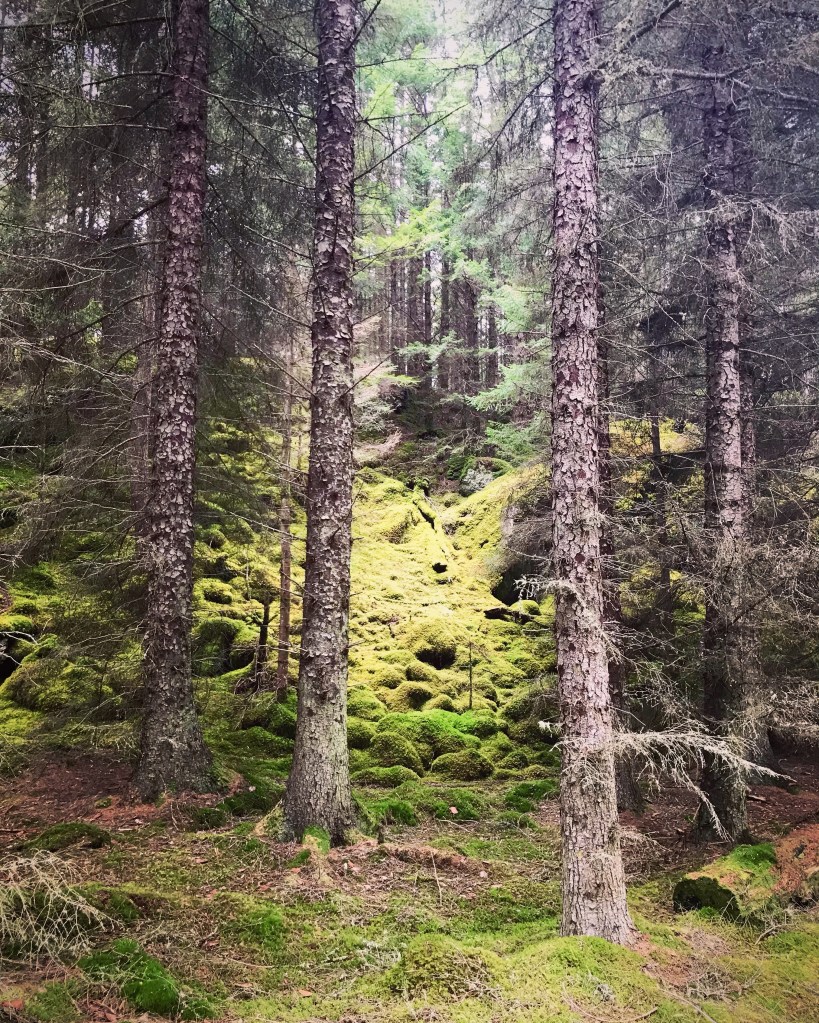
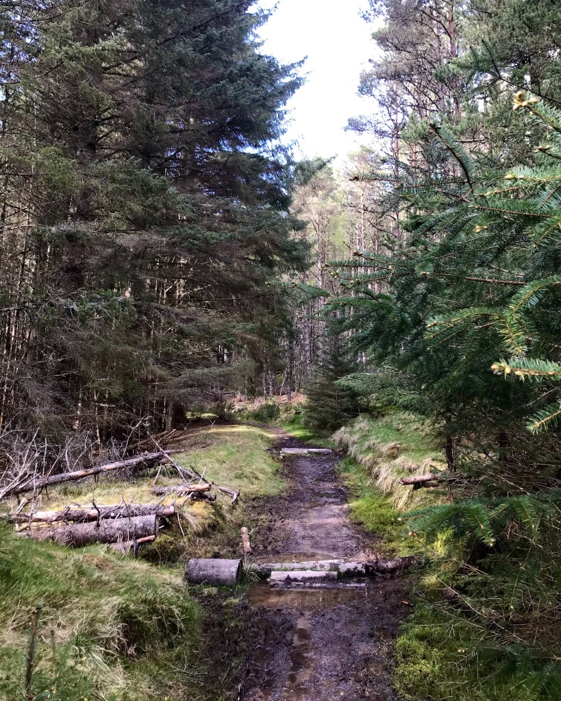
The following photographs are what I experienced as I followed the trail through Foyers Forestry. This section was extremely dense with hardly any light apart from shafts which filtered through the occasional gap in the firs. It definitely added to its beauty with the changes in light captivating the many astounding colours brought out in the photographs. I will leave you with these as there are truly no words to further describe what a magical piece of forest this is. I would not say that this is a particularly easy section to hike as it is very hilly with steep and uneven terrain, however, the scenery all around certainly makes up for it.


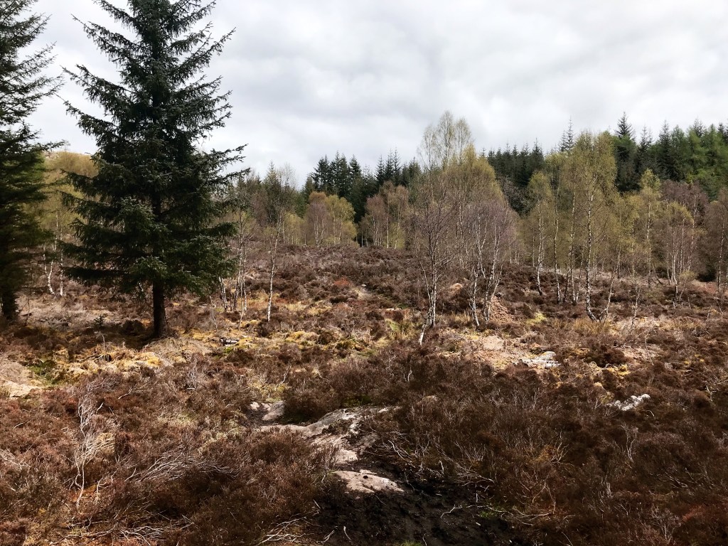
After following the trail for a considerable distance, I reached a part where the path dipped down steeply through the forestry and headed into very wet and boggy terrain indeed. Although still a very heavily wooded area, the vegetation here tended to be dry in appearance. This did surprise me that the ground was so marshy yet everywhere appeared almost lifeless with lots of heather and long grasses which were yellow in colour giving the area a feel of almost being barren. It was a mixture of being part forestry and part clearing with lots of rocks and boulders dotted about. I definitely felt that if conditions were like this now in May, then this location had great potential to become overcome with deep mud in the Autumn and Winter months. This section of trail, as stated in the official Loch Ness 360 Trail Guide is unsuitable for horse riders and cyclists with an alternative route set out going by way of Glen Lia (Gleann Liath).

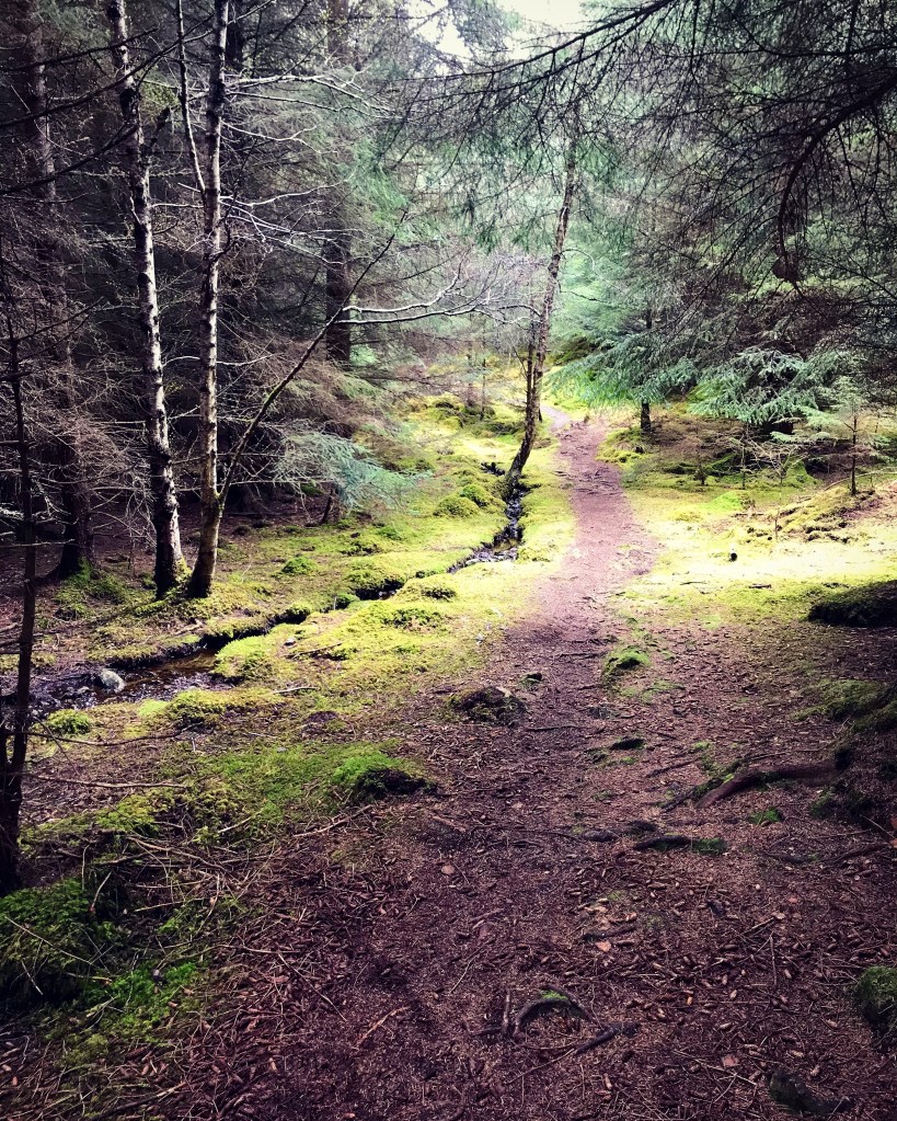
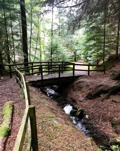
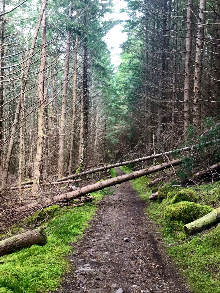
Upon reaching the end of the marshland, the footpath heads back into thick forestry at Inverfarigaig. As I passed through here, I was once again blown away by the beautiful scenery which awaited me. It really was a fairytale location with tall, unrelenting Fir trees, thick mosses and fungi highlighted brightly in the sunlight which occasionally cut through the darkness. Logs dotted the landscape, some old and others new from the various felled trees in which mosses and crawling plants covered these too, adding to its wonderland appearance. Just off the main path were various other pathways, all leading off no doubt towards another adventure just waiting to be explored, however the main trail descends downhill all the way through. After a time, the path forks with the right path heading over a small wooden footbridge and the other carrying on straight forward downhill. I continued on the straight path which eventually leads to the visitor centre at Farigaig.

Inverfarigaig to Fair Haired Lad’s Pass


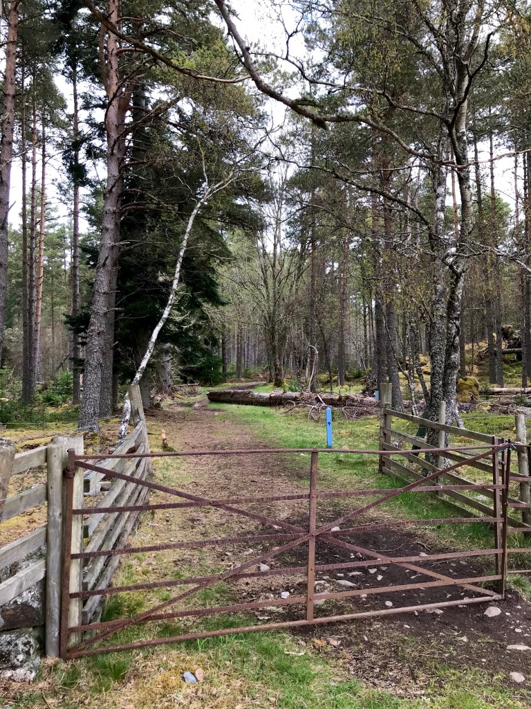
Farigaig is a visitor centre located at Inverfarigaig and forms part of the Farigaig Forestry Commission. It is a walking and hiking hotspot with several trails beginning here all with differing distances and difficulty ratings to suit a variety of needs. The facilities found here are public toilets, car parking, a well designed picnic area and a notice board containing walk routes and walk information. Farigaig is a very popular location and is used all year round by people locally and from afar.
Due to the recent Covid pandemic of 2020/21 at the time I visited, the car park and public toilets were closed to the general public. Despite lockdown restrictions being lifted only recently, the Forestry Commission had still not opened all the facilities. However, the walk routes were now being utilised by members of the public and there were a good number of hikers hitting the trails today. It was a welcoming sight for me as it had been a long hard slog of a walk through the forest without seeing anyone. As much as I enjoy solitude, it was nice to break up the day with a little company. Just seeing people was enough, without actually having a physical conversation…
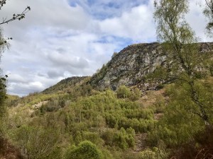
Sitting at one of the picnic tables, I decided to stop for lunch. It was now 3pm and I figured this might be the only proper bench I would come across today on the trail. After approximately 30 minutes , I packed away once again and continued onwards down onto the main road. Turning right here, I followed the road a short distance over a historic bridge crossing the River Farigaig and took a right turning up a narrow lane heading steeply uphill named the ‘corkscrew’. The corkscrew is a series of sharp, steep bends in the lane as it winds and twists upwards until it eventually becomes a long farm track leading into miles of fields and farmland. This is an extremely long stretch which at times can get quite tiring. Even so, I was rewarded for my hard climbing exertions with views over the Farigaig Forest and the Dun Dearduil which is a particularly high hill said to contain the remains of an ancient fort.
Although I didn’t visit Dun Dearduil on this occasion, it is something I wouldn’t mind doing in the future on a short walk perhaps. It is said to be an actual mountain summit standing at 235 metres high and is in the Eastern Monadh Liath to the Moray Firth region in the county of Highland, Scotland.
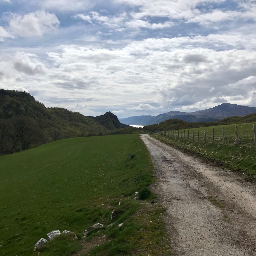
The track leading away from the corkscrew is a long an unforgiving one in that it goes on and on for what seems like hours! Landscaping around here is farmland with lots of livestock grazing in the fields around. At one stage, a large group of cows were almost blocking the road and care was needed to skirt around them in order to continue on the trail. They eyed me nervously as I approached and even stopped to watch me. Although nothing untoward happened, a tingle of fear stayed with me until I was safe at last behind the metal gate and out of dangers way.
Most livestock that roam the land around moorland and open access farm land are usually safe in that they are experienced in being around people and farmers do tend to place such animals close to public bridleways. However, there have been reports of people being attacked by livestock with some proving fatal in some instances. Cow’s in particular are very protective of their young and will attack if they sense danger. I always feel that extra care should be taken when crossing fields containing livestock and if in doubt, an alternative route should be sought if it is deemed the safer option.


Fair Haired Lads Pass (and if this doesn’t sound dodgy then I don’t know what does)
The Fair Haired Lad’s Pass is a public footpath leading the way across the Creag a’ Ghiubais, a mountain located in between Inverfarigaig and the village of Dores on the southern side of Loch Ness. It is intriguing in that such a name leaves one guessing how it came about. An article I finally stumbled across whilst searching the internet stated that the name came after an elderly man died on the footpath in bad weather. However, there appears to be no other history written to corroborate this story and so is lacking in factual accuracy. Still, although a sad tale it is a very intriguing tale to enlighten the journey.
The following photographs are a selection I took as I ventured along the Fair Haired Lad’s Pass in the late afternoon. The path begins at the top of the incline out of the forest at Balchraggan at a spot with Christmas trees on all sides. Despite heading off into the trees, the footpath is distinctly narrower and easily missed if it wasn’t for the signpost showing the way. As can be seen here the Fair Haired Lad’s Pass is a very attractive section of trail, shrouded in mystery and drawing the hiker in from the outset.
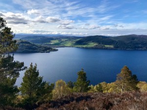
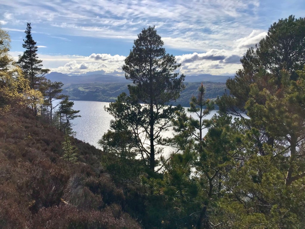
Upon reaching the top of the woodland path, the incline levels out and heads into an area cleared of trees. It isn’t until right near the edge though that the true surprise of the Fair Haired Lad’s Pass is revealed. It creeps up on you right at the last second and is as breath taking as it is exhilarating. I found myself stood right on the summit of the mountain overlooking the mighty Loch Ness with views over towards Drumnadrochit and Urquhart Castle. I could truly see now why this climb was left as a surprise in the Loch Ness Trail Guide. Absolutely nothing could prepare me for the stunning sights which awaited me here. I spent the next 20 minutes resting here as I took in the scenery and my surroundings, the perfect weather making it all the more enjoyable. Check out the views though.
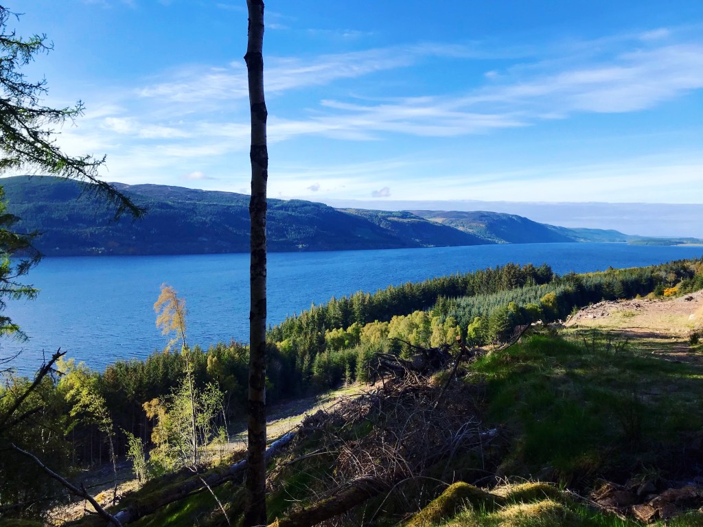
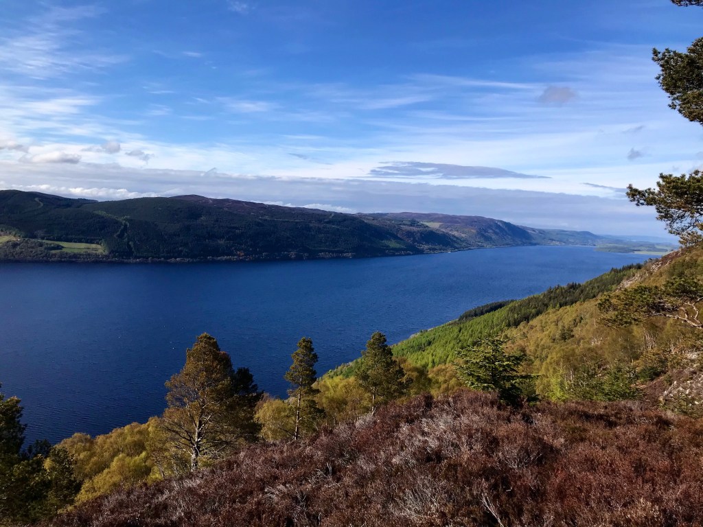
The descent down the opposite side heading down towards Loch Ness is very steep and extreme care is required, none the less, there are equally stunning views to be enjoyed even here. The trail continues onwards through woodland and is awash with heather and other lush vegetation. The grass here in this location makes perfect ground for wild camping, that is if you can find a flat spot on the way down. I did notice a few potential places but had hoped to make it just a little bit further before pitching for the night.
The area on the main pathway through the forest lower down the Pass, although beautiful and with suitable ground, was actually very dangerous as there were a lot of fallen Fir trees. The forestry just slightly along from here was in the process of being cleared as the trees were extremely old and were toppling in very large numbers. After careful consideration, I had decided against camping in this location and pressed on eagerly hoping to find a section of forest where the risk of falling trees wasn’t as high.
I also noticed that Fair Haired Lad’s Pass was the first place that I had been able to obtain a phone signal since leaving the Suidhe Chuimein which was nearly 30 hours ago! A very long time for a solo hiker to be on the trail without being able to contact anyone or even send a text message.
Camping spot
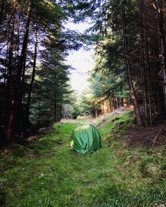
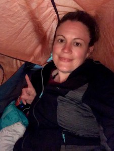
I finally discovered the perfect camping spot just a little past 7pm and slightly off the main trail. After passing the large section of deforestation at Torness, I passed a stream flowing down the hillside and noticed a small footpath leading into what appeared to be younger forestry just to the right. I decided to set up camp here and call it a day for the night. I was extremely tired with all the hill walking through the day and the poor nights sleep last night that it only felt right. In saying that, I really didn’t feel that I would have found a more suitable spot further on and within my walking distance. The location had suitable pitching ground and was in a relatively secluded spot where I felt sure that I would not be disturbed by other walkers or people passing through. Although actually on a footpath, I knew there was a small risk of someone passing but it was late in the evening and the chances were relatively slim. Close by, there was a clean water source which served me well for the night and ensured that I had enough water to cook a meal and make drinks. Perhaps my biggest bonus of it as well was the access to excellent 4G signal which made it possible to upload some photos to my social media and let family members know that I was safe. After eating supper and bedding down in my sleeping bag it was time to get some much needed rest after such a long day. Tomorrow would see me on the final leg of the Loch Ness 360 Trail which although it was getting ever closer, was a strange feeling knowing it was my last night camping on the trail.
Walk Summary
Distance walked: 11.4 miles.
Elevation gain: 2,054 feet.
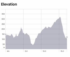
To conclude day 5 of the Loch Ness 360 Trail I feel I did well managing the distance and ascents considering that I started out today on hardly any sleep. After experiencing this firsthand, I can honestly say that sleep and the quality of it makes a massive difference to how a hike will feel as the day goes on. The section of the trail between Whitebridge and Torness is definitely one of the most fascinating and picturesque parts of the hike with plenty to see and do. I certainly feel that I made the most I could out of the scenery despite feeling so fatigued at times, I just wish that I could’ve had slightly more energy on the gruelling hills and long stretches which take a lot of energy and motivation to get past. I definitely felt the strain more so in this day at 11 miles than I did walking some other days which topped 15.
The weather and conditions again couldn’t have been more perfect. Quite often, rain and wet doesn’t bother me. I walk in all weathers throughout the year and sometimes a change in the weather gives a new perspective on an adventure. Light and the seasons changing in general all throw new colours and textures into the mix which enrich my experience and prevent boredom from seeing an area too often. I have often hiked the same route but at a different time of year when I know the scenery will have changed dramatically. That said, today’s fine weather definitely worked in my favour when considering the amount of woodland and forest terrain on the route. There were also some areas which are naturally boggy all year round and therefore are prone to flooding out. I was thankful that on my hike of the 360, this was not an issue.
So what can I say about the forestry on the Loch Ness South Trail? Well, in my opinion it is definitely more picturesque than the Great Glen Way although that in itself is not to be knocked. The Great Glen has fantastic qualities of its own and is also an inspiring forestry trail, I just feel that out of the two sides of Loch Ness, when it comes to the forest, Foyers and Inverfarigaig have the very best that the trail has to offer. The photographs I took that day really do not do this trail any justice. It is definitely something which in my opinion, should be experienced oneself and preferably with a better camera than mine!
Hiking without phone signal is a difficult one to fathom. I have done so intermittently on many occasions when out in the Peak District when I have dipped down low between the hills. The difference is that it hasn’t been for long periods and I haven’t been so far from home. Here in the Scottish Highlands there was no real way of knowing how long this period of having no signal would go on for, and for a solo female backpacker that can be extremely challenging. I have mentioned in previous blogs about how long distance hiking and backpacking in particular is mostly mental strength as opposed to physical, well this situation is definitely one of the many examples of this. It is so easy at times to let your wild imagination run away with you especially in a secluded location when you haven’t seen a soul in days. It has inspired me to write further about this subject in a future blog post which will focus on the techniques I use to prevent this happening. I honestly cannot describe the immense feelings of relief that flooded over me when I heard that first ping of activity on my phone as I crossed Fair Haired Lad’s Pass after slightly over 30 hours of no signal.
Overall, day 5 has been an enjoyable adventure for me and if anything, an eye opener in many different ways. Before this adventure it was hard to imagine seeing anything more scenic than what I had already enjoyed so far however, there is so much more adventure to be found at every twist and turn. Adventure for me is not all about the distance I walk, but also about what’s in my imagination. A certain scene or location triggers thoughts and feelings which all add to creating an adventure in my mind and propels me onwards into the world where dreams and possibilities are endless.
I would like to offer a heartfelt Thankyou to all people who continue to read my blog and support what I do. I gain great satisfaction from being able to express myself and my passion in words, as well as sharing my experiences whilst out on the trail. Your feedback is valued immensely and all contributes towards my learning experience, making it all the more enjoyable and safe. To anyone who has stuck with this series so far, Thankyou! I truly hope that it has shed some light on this particular trail and if you are hoping to make this one of your future adventures then maybe it might be of some help. As stated many times, I am no expert but have a strong passion for hiking, wild-camping and the great outdoors. Much of my knowledge has come from my own experiences, learning and making mistakes time and time again. Getting motivated and just getting out there has proved to be a game changer for me. Here’s to many more adventures.
This blog has been written and edited by myself Lucy Bailey using my own experiences and ideas and is written in my own words. However factual information regarding certain aspects of the hike such as locations, landmarks and places of interest has been sourced from the following websites:
- http://www.lochness360.com
- http://www.scotland.org.uk
- http://www.truehighlands.com
- http://www.visitinvernesslochness.com
- http://www.world-of-waterfalls.com
- http://www.scottishgeology.com
- http://www.forestryandland.gov.scot
- http://www.woodlandtrust.org.uk
- http://www.Inverness-courier-co.uk
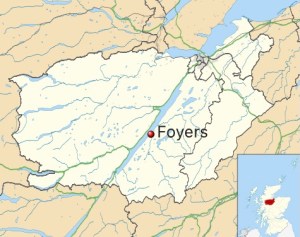
All photographs used within this blog are my own and sourced from my Instagram account @soloexplorer23. They have been taken using iPhone 7 camera only and edited using Instagram photo editor tool. The map image demonstrating the location of Foyers was sourced from Wikipedia.org/foyers and walk route and elevation data was sourced from my own Strava app account.
