2nd January 2022
There are 88 trig points which make up the Peak District Trig Point Challenge and 32 of these are located on private land. The trig which will feature in this post is Mam Tor trig point located in the High Peak section of the Peak District National Park.
Well Happy New Year everyone! We are now into 2022 and boy has it come around fast. It is something I have noticed more as time’s gone on…. with each passing year they appear to get shorter and shorter. Why this is though I’m still none the wiser.
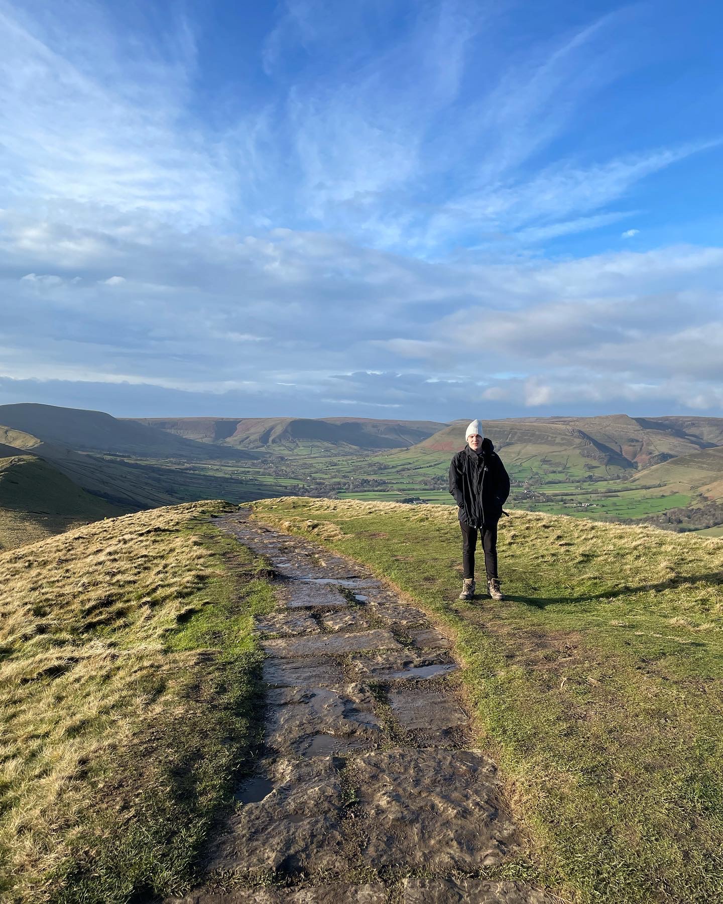
Today’s hike, to mark the fabulous start of the new year, will focus on one of the great favourites that the Peak District has to offer. A popular walking location named the Great Ridge in the Dark Peak section of Derbyshire and the breathtaking Winnat’s Pass located within the High Peak boundary. I was accompanied on this walk by my Son Jack whom I have shared the great outdoors on many occasions and made many a memory since I first started blogging my adventures almost a year ago.
A year! What a year it has been….
The morale of this post is to thank everyone who has taken the time to read my personal blog over the last year. This post is different to my previous ones in which I’m doing things the opposite way round for change and showing my gratitude before getting into the adventure. I figured that the best way in which to go about this was to use today’s walk as a celebratory outing to mark the end of such a fantastic year in blog and give an insight into why you as a reader have made this possible.
I have to say that I am completely blown away that Adventure Snatch as of the beginning of February, has received a total of 1509 all-time views to the site since this journey started. I appreciate that compared to many sites this is a relatively small number but it is 1509 more than I expected. It means a lot to me that people are actually taking an interest in the site and reading the posts. If my words inspire people to don their walking boots and get out into the great outdoors then that is what this site is all about.


When I first starting out drafting the basics for Adventure Snatch in February 2021, I saw it more as a personal reflection and a way to record memories as a personal keepsake. I still do, but I hadn’t expected to attract viewers especially in the numbers I have received plainly because of the way I choose to write. I know my blog is different to many other adventure websites. A lot focus on being descriptive, they are straightforward and give clear directions, their sole purpose being on the walk in general. Adventure Snatch however is very personal, the focus being aimed at my actual experiences whilst out on the hike as well as discussing the route.
In effect my blog posts are more like chronological short stories which detail the true events of the hike in question taking into account its highs and lows and many feelings and emotions as I experience them. Walking, adventuring and hiking blogs appear to be popular, however not everyone likes ‘personal’ blogs. As I have noticed over the year I have been active in blogging, sites such as mine do not attract the most visitors but that was never my intention. I have however attracted a solid audience with readers who appear to share much of the same passion with walking and the great outdoors as I do.
“What a great adventure! You did choose wisely. That sure is interesting looking stone. The photo of the fault makes the stone look like it was ancient bricks. Good on ya for finding something off the beaten path!”
Alisen Dopf (2021) 25th February
I have received some amazing comments and feedback from readers worldwide and even received suggestions and advice regarding upcoming long distance hikes by others who have already walked a particular trail I have had in mind. This all contributes to the success of my walks and is the reason why blogging my thoughts has become so important. Being able to share an adventure through literature is what I enjoy almost as much as the adventure itself. People have said they enjoy the fact that I talk about the parts that most people don’t mention.
“Nice post – those short, snatched trips are sometimes the best.”
Paul Shorrock (2021) March 6th
At times I have been conscious that I may ramble on in my writings and as an amateur blogger, it is still very much a work in progress. That said, I wish that I could have read more honest accounts beforehand of certain walks by others as I know from my own experiences, that not all are the great pilgrimage that we hope they are going to be. It might not be the route itself but merely the state of mind we are in at that very moment in time. We are human beings and the beautiful thing about blogging is that everyone’s experiences are different…
“Fabulous. Glad you got your midge net sorted that could’ve been an absolute game changer if those buggers decided to wake up. Looking forward to your posts. Have fun, Al”
Alan James (2021) April 29th
I am grateful that I have had a chance to express what I am passionate about in words. I never expected the support I have received so far so a big Thank you to all who continue to read and subscribe. Your ongoing support will only encourage me to develop and grow as an adventure blogger and hopefully in time, any niggling habits in my writing style will improve. People who are genuinely interested in adventures and hiking whether it be long distance or short, are who I write these blogs for and if they help or are enjoyable in any way then it has been worthwhile.
Overview
Todays hike is a short one of approximately 7 miles in distance. Beginning in Hope, my intention was to walk half of the Great Ridge from Losehill to Mam Tor taking in the stunning views from Back Tor and Hollins Cross as I made my way along. Once reaching Mam Tor where a stone trig point marks the summit, I would take a footpath which descends down towards the broken road at Blue John Cavern and venture up onto Winnat’s Pass. My plan then was to walk along the top of Winnat’s Pass before heading down and into Castleton to complete the day.
A freezing breeze rippled in the air as my Son and I stepped from the bus on Hope Road that morning. We arrived at the village of Hope in Derbyshire at approximately 10am after catching the 272 Castleton bus from Sheffield Interchange. Despite the freezing temperature all around, I was full of joy to be out hiking once again. The sky was blue and the sun shining high as we began following the main road through the village heading in the direction of Castleton.
For a January morning the sunshine and bright light all around was deceptive. At first glance out of the bus window just shortly before arrival, it had given the appearance of being warm, almost tricking the observer into believing it was spring or summer months. We knew it wasn’t of course and stepping down from the bus we were jolted back to the cold reality before our feet even touched the pavement.
Losehill Pike (Ward’s Piece)
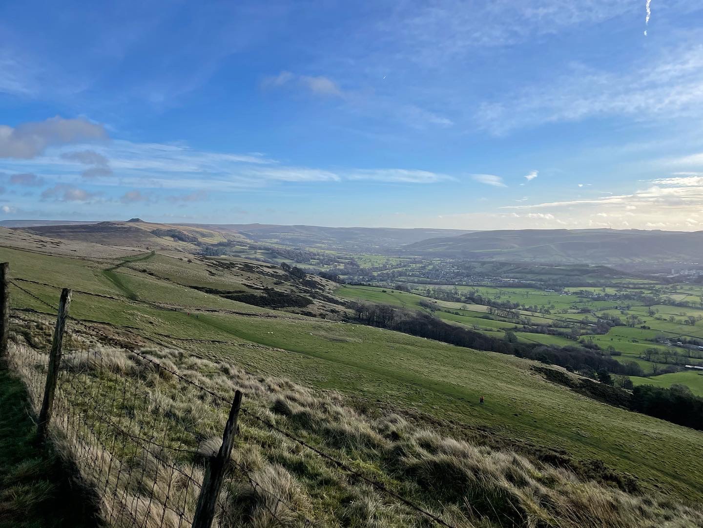
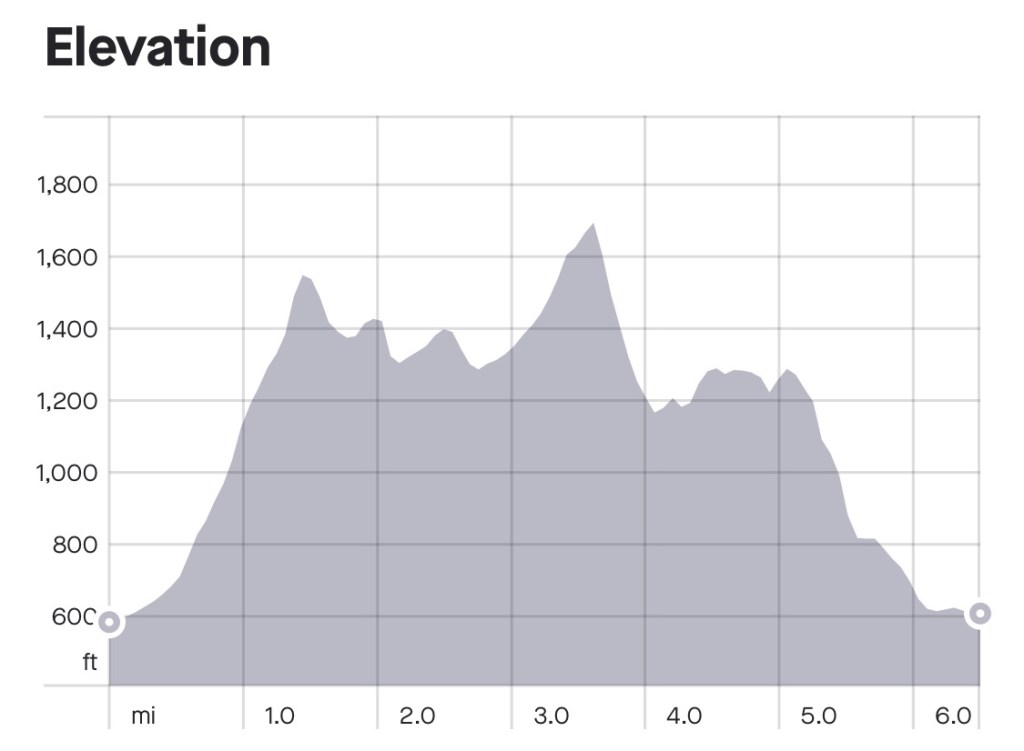
The pull up the hill via Warehouse Lane was a tester for so early on in the walk but as I climbed, I knew that the rewards at the top were well worth my effort. The single track road eventually becomes a public footpath at the base of Losehill and upon reaching the summit, I was gifted with this amazing scenery.
Losehill Pike aka Ward’s Piece stands at 476 meters (1,562 feet) above sea level and is classed as the end of the Great Ridge if walking from Rushup Edge and Lords Seat. On the day we visited, despite the glorious sunshine it was incredibly cold and windy. So strong was the wind in fact that it was almost lifting people off their feet. The Great Ridge is a well trodden hiking destination, probably one of the most visited spots within the Peak District and today was no exception even in the midst of winter. It was safe to say that there were at least 50 people on the top of Losehill on the morning that I stood at the sundial monument which marks the summit.

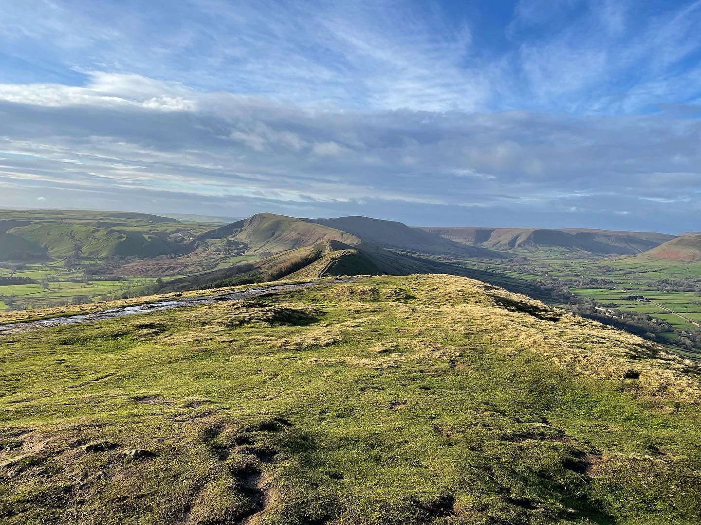
Leaving Losehill behind, we followed the single path leading the way over the Great Ridge as it heads towards Back Tor. It is worth mentioning here that there are two Back Tors within the Peak District. The first one is the one we were heading towards on this day and forms part of the Great Ridge, whilst the second is located on the Derwent Edge, another stunning location found in the Dark Peak.
Back Tor
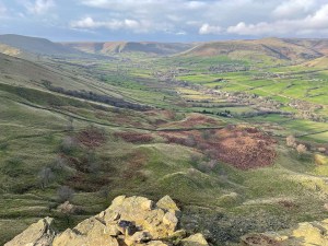
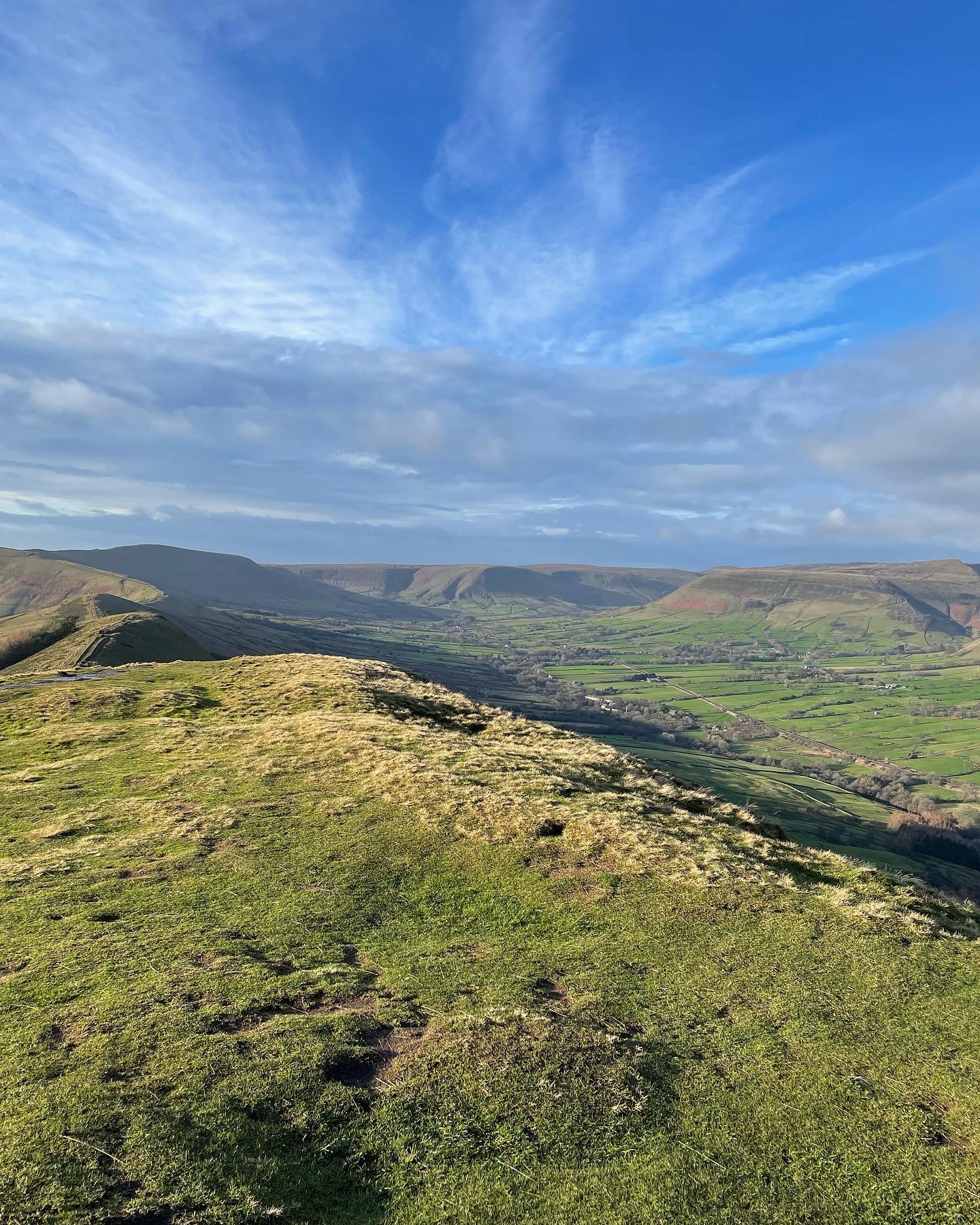
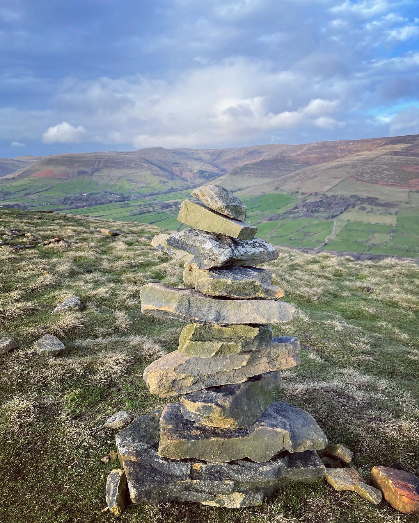
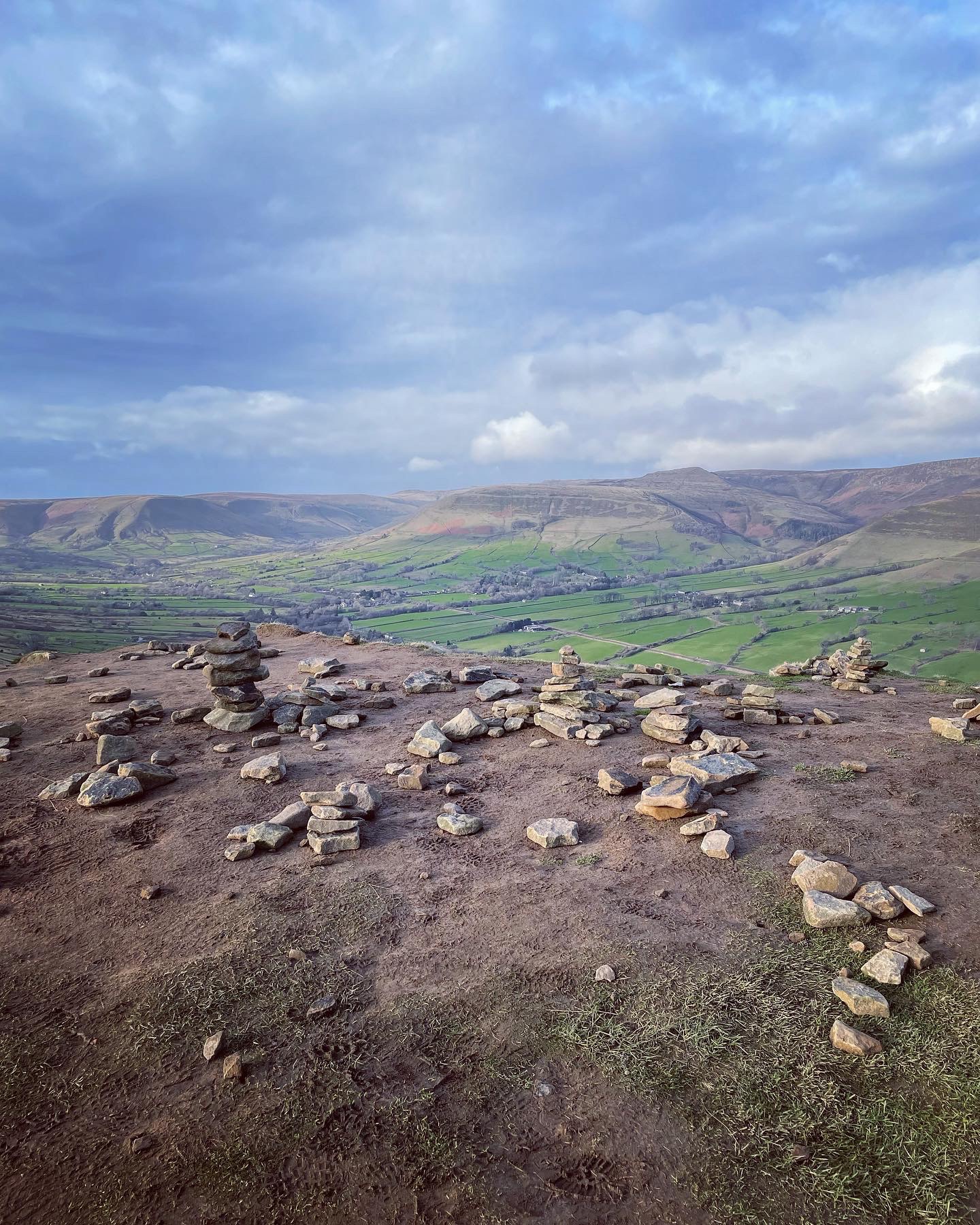
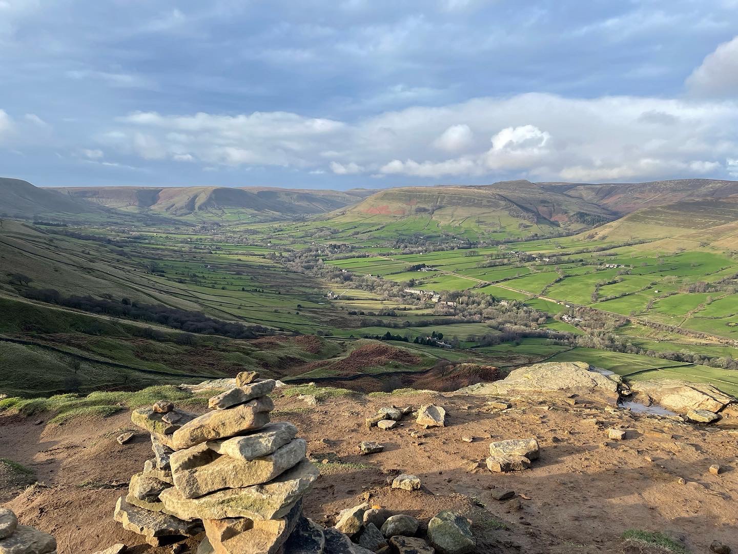
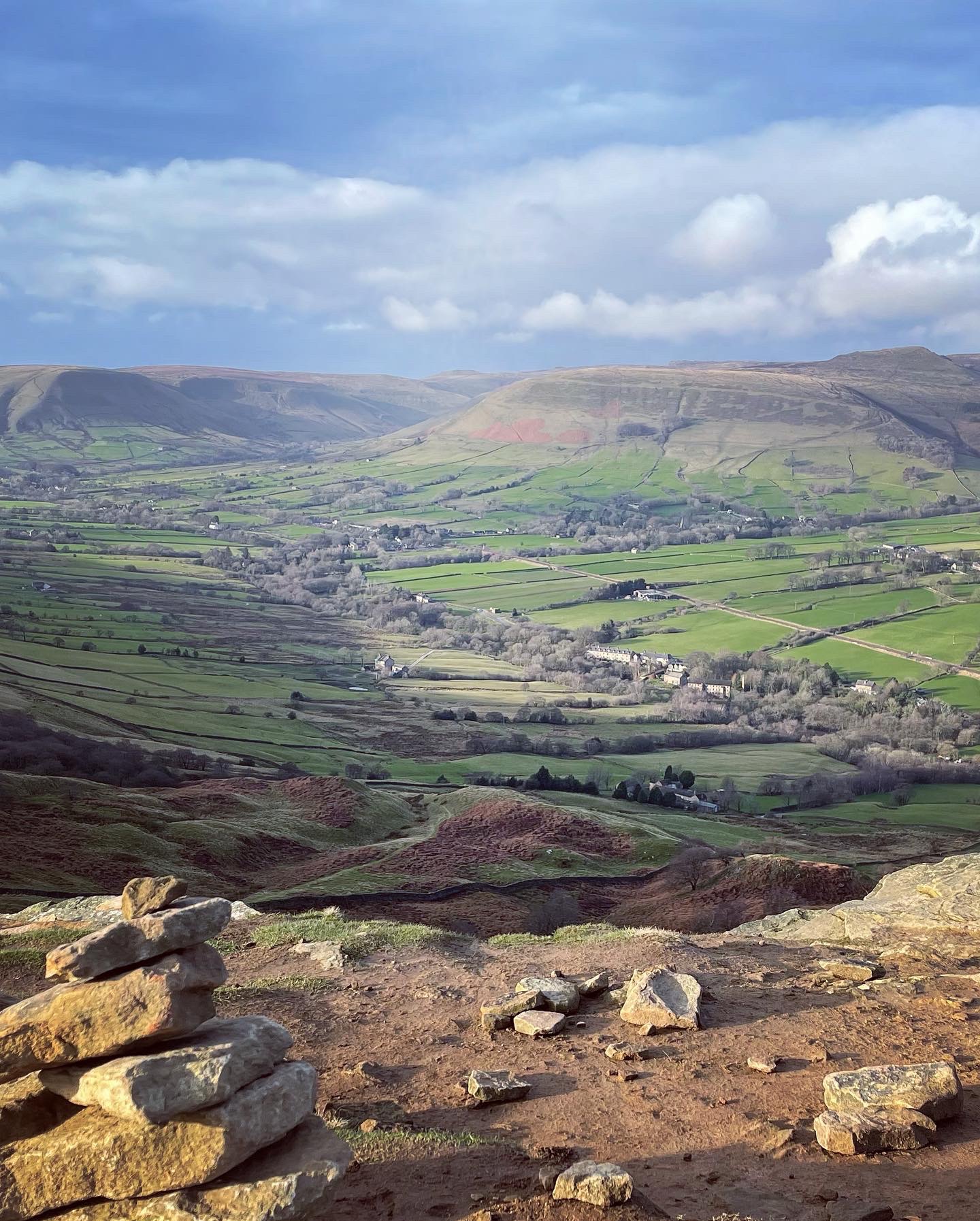
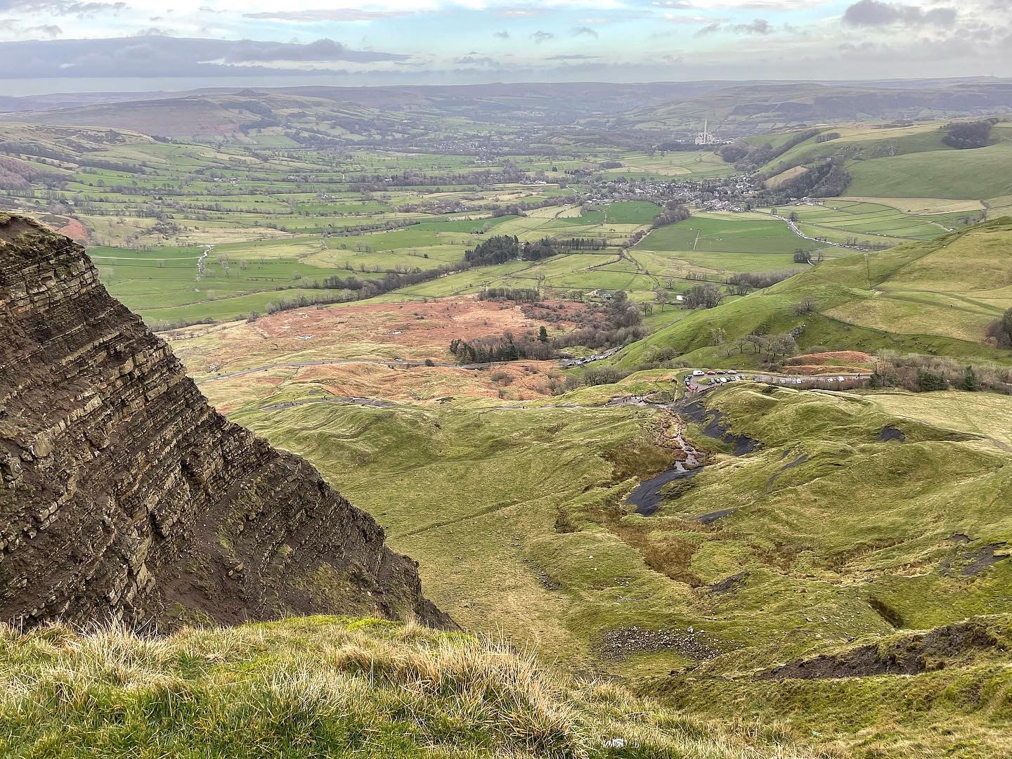
The views from Back Tor I have to say are quite extraordinary. Looking straight ahead, walkers will see the Ridge stretching off into the distance up to Mam Tor and over to the right is the Vale of Edale. The mighty Kinder Scout can be viewed in all its splendour as well as much of the surrounding Dark Peak locations.
Dotted along the summit of Back Tor are many cairnes which have been gradually built or started off by fellow hikers. Although attractive to view, cairns are built for many purposes and date back to prehistoric times. Modern cairns like the ones on top of Back Tor are usually built as a friendly gesture for fellow hikers, a tradition being that one stone or rock be added to create a stack or pile. As the stack grows taller overtime, they can become way-markers for a specific route. Many can also symbolise burial spots and warn of possible danger. It is customary to spot cairns where there is a sheer drop down from a cliff face or crag as is the case at Back Tor.
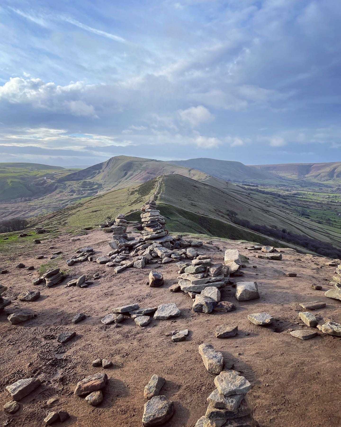

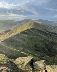
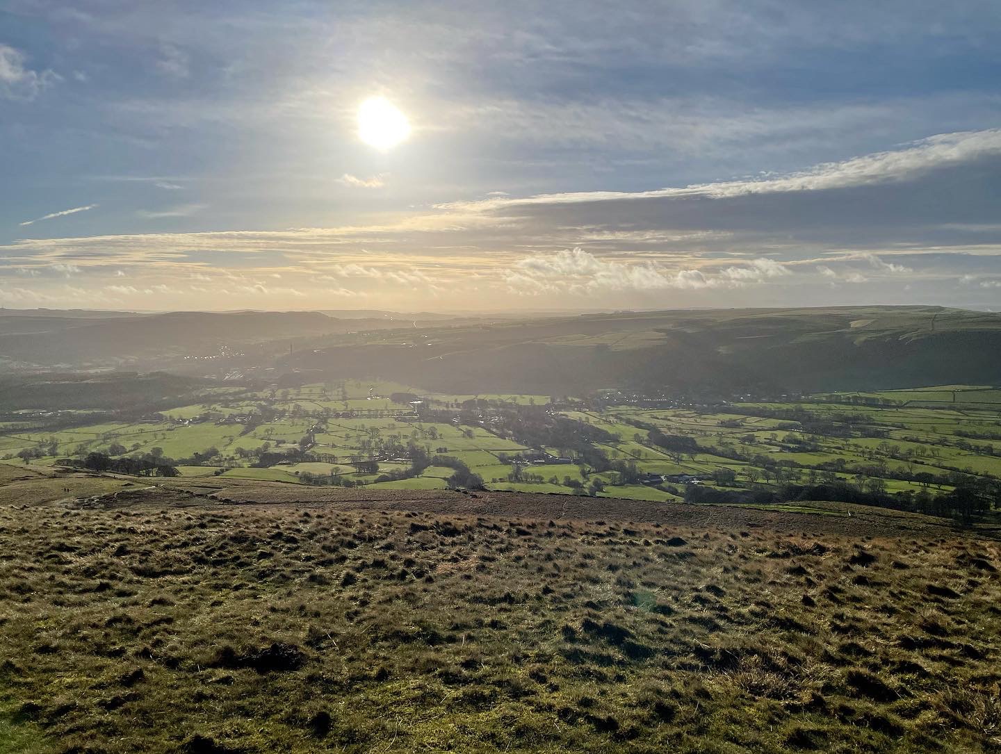
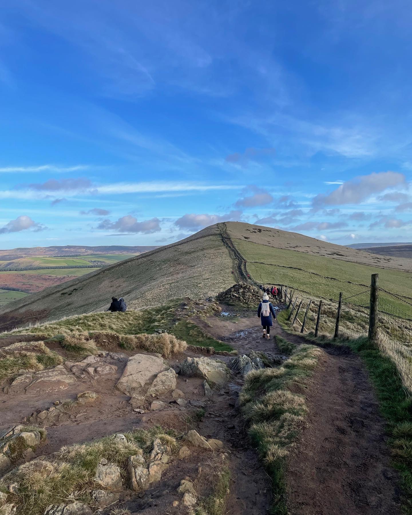
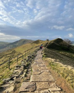
Continuing onwards after the descent of Back Tor the pathway heads towards Hollins Cross where a cylindrical pillar marks the spot. The paved pathway running the length of the Great Ridge has undergone extensive path repairs throughout the spring and summer month of 2021. During this time whilst the work was being carried out, the path had been closed off to the public. Over the years and due to wear and tear from the many tourists who frequent the location, the stonework had worn away and began to crumble and fall down the hillside making the walk dangerous. As I walked along the recently opened pathway that day, I remember feeling extremely grateful that the work had been carried out. An absolutely fabulous job had been done in maintaining the route and it meant that we as hikers could continue to enjoy the Great Ridge in safety for many years to come.
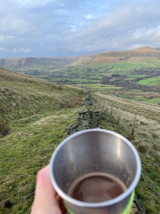
Taking a rest stop for hot chocolate and snacks upon reaching Hollins Cross, it seemed the perfect place to enjoy the views. We dropped down out of the wind and sat at the foot of a low drystone wall running right down into the Vale of Edale.
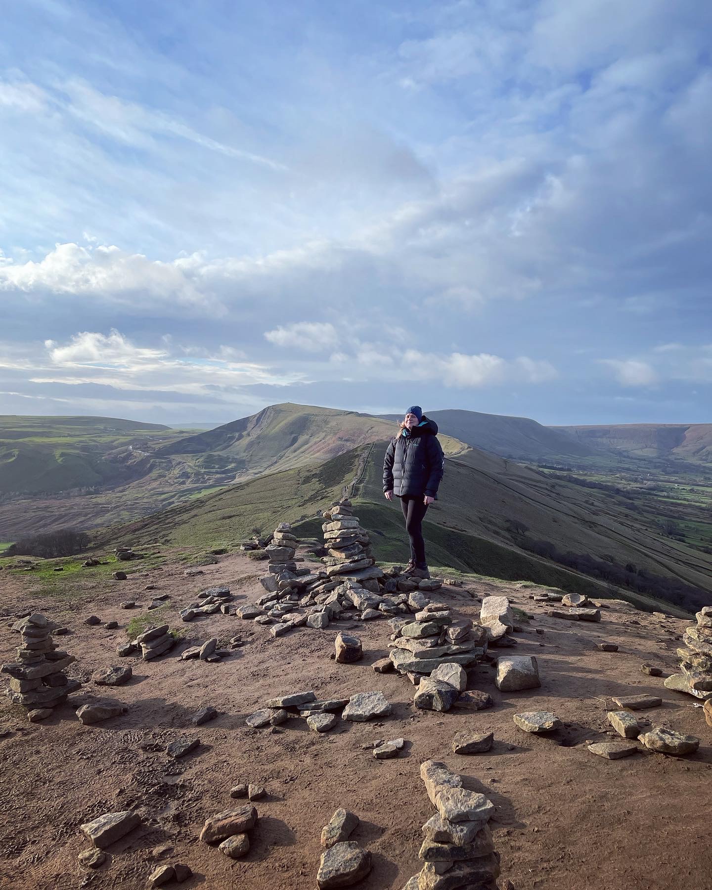
Mam Tor
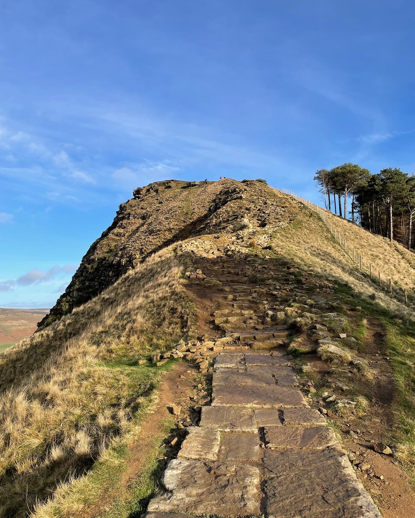
As we began the sharp ascent up towards the summit of Mam Tor, the first signs of rain flooded the skies. Dark clouds descended across the skyline and the wind was beginning to pick up speed. Despite this, the vast amount of tourists today amazed me. By now, we were approaching the most popular spot on the Great Ridge, the place most highly sought after due to its panoramic scenery and according to many writers, one of the most photographed locations in England…. Mam Tor.
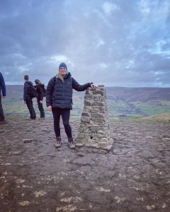
Mam Tor, meaning Mother Hill or Shivering Mountain stands at 517 meters (1,696 feet) tall. The name derives from the formation of several smaller hills on the eastern face which are the results of several land slips. The summit is marked by a trig point made from drystone and it likely the most popular trig point of the whole Peak District Trig Point Challenge. The majority of Mam Tor is made up of black shale and sandstone which dates back to Bashkirian age (320 million) years old with the majority of the land slips being caused by weaknesses in the underlying rocks. Access up to the summit can be made via the roadside which leads up from Edale where there is a dedicated stone stairway and footpath. This is probably the easiest and quickest way up. The road divides the Great Ridge into two sections, the latter being Rushup Edge and Lords Seat which continues on towards Brown Knoll and Kinder Scout.
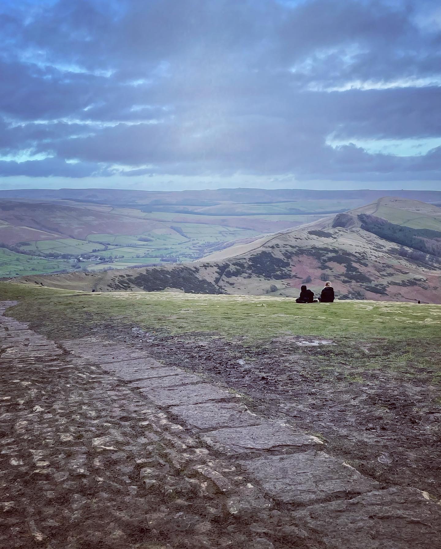
The summit of Mam Tor as always was swarming with tourists and after managing to capture a few photographs, we headed off down a steep footpath leading in the direction of Winnat’s Pass.
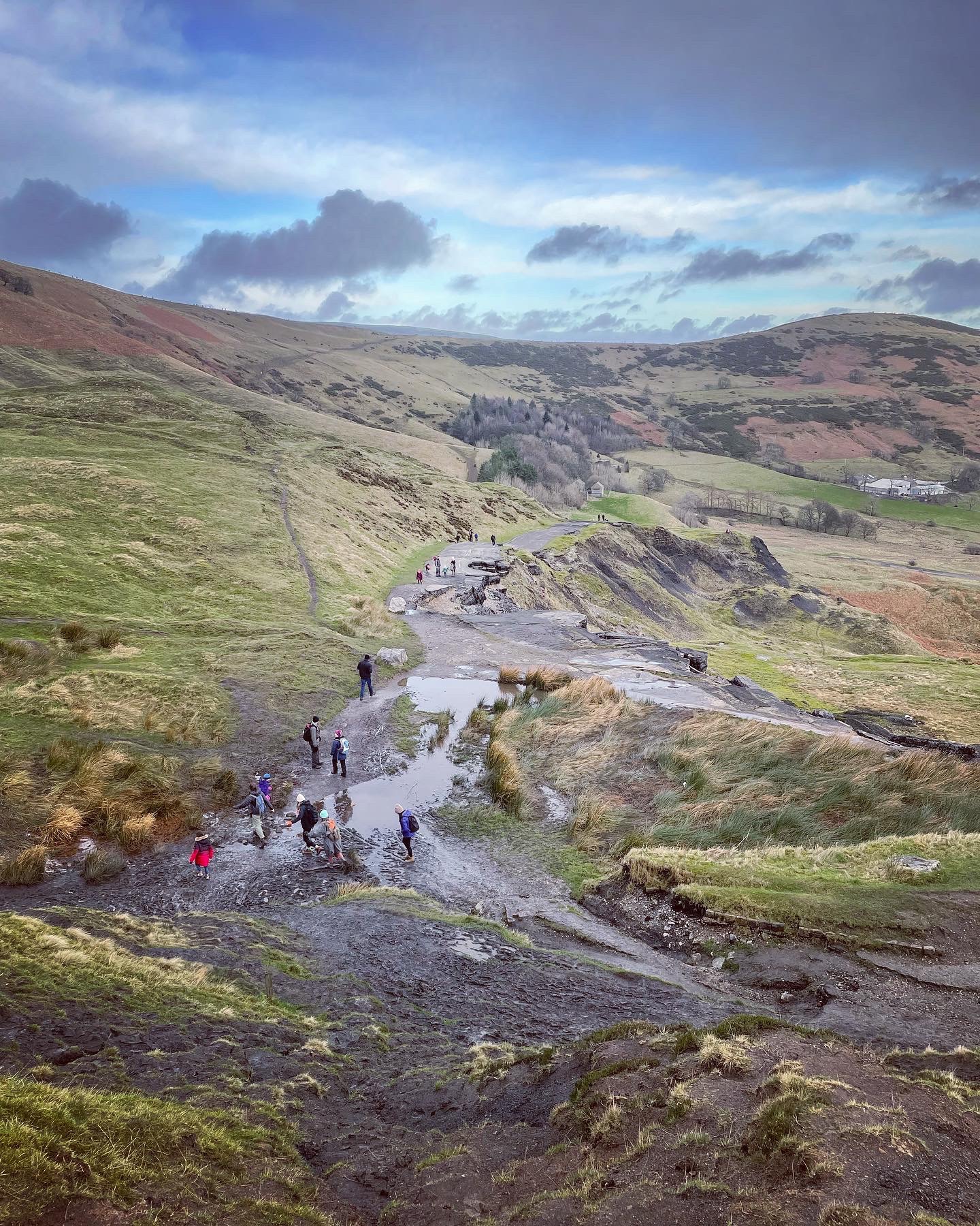
The Old Broken Road
At the bottom of the eastern side of Mam Tor lies the abandoned or broken road, appropriately named by the situation it is in now. The road has literally crumbled away and fallen down the hillside. To see it the way it is nowadays, it can only be described as eerie and gives a feel of ‘forgotten land’. Yet actually, this is far from the case. The old broken road as it is known, now attracts more tourists than ever before with people keen to experience the sight for themselves.
Whilst stood observing the road surface, I could clearly see the many layers of tarmac and gravel which in places are up to two metres thick. This is where numerous efforts were made over the years to preserve and repair the road and keep it passable. Once the A625, it was first created at the beginning of the 1800s and was finally closed in 1979. A new road now cuts through the centre of Winnat’s Pass and is the through road leading out of Castleton towards Chapel en le Frith with a decision to exclude heavy goods vehicles being the preferred choice.
The spot to visit the broken road is in close proximity to the Blue John and Treak Caverns, two of four tourist caverns within the Castleton location. On the day I visited, many cars were parked along the road and in the car park as people flocked to visit Blue John. It is common for people to visit the broken road whilst in the area after a tour of the caverns.

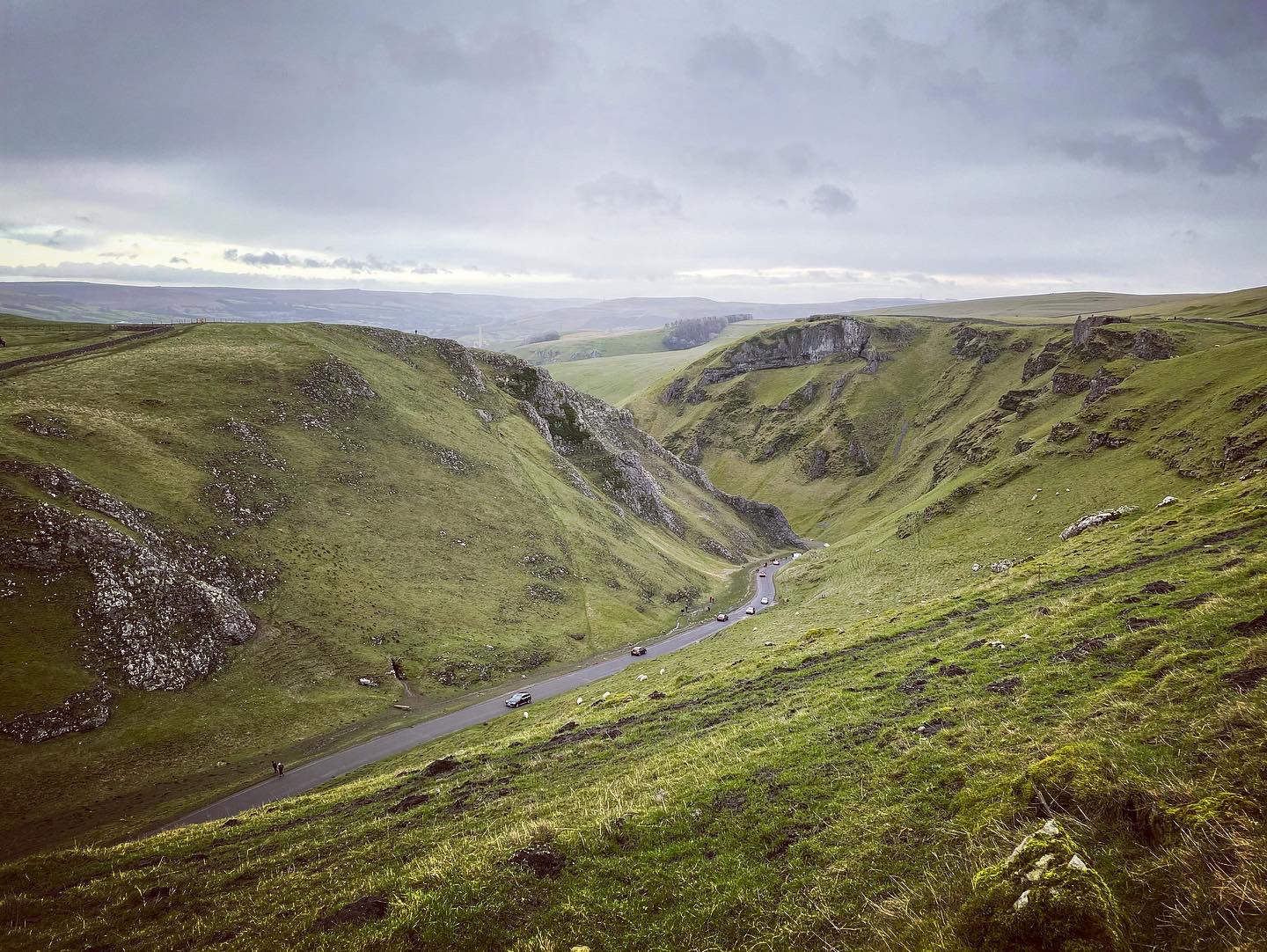
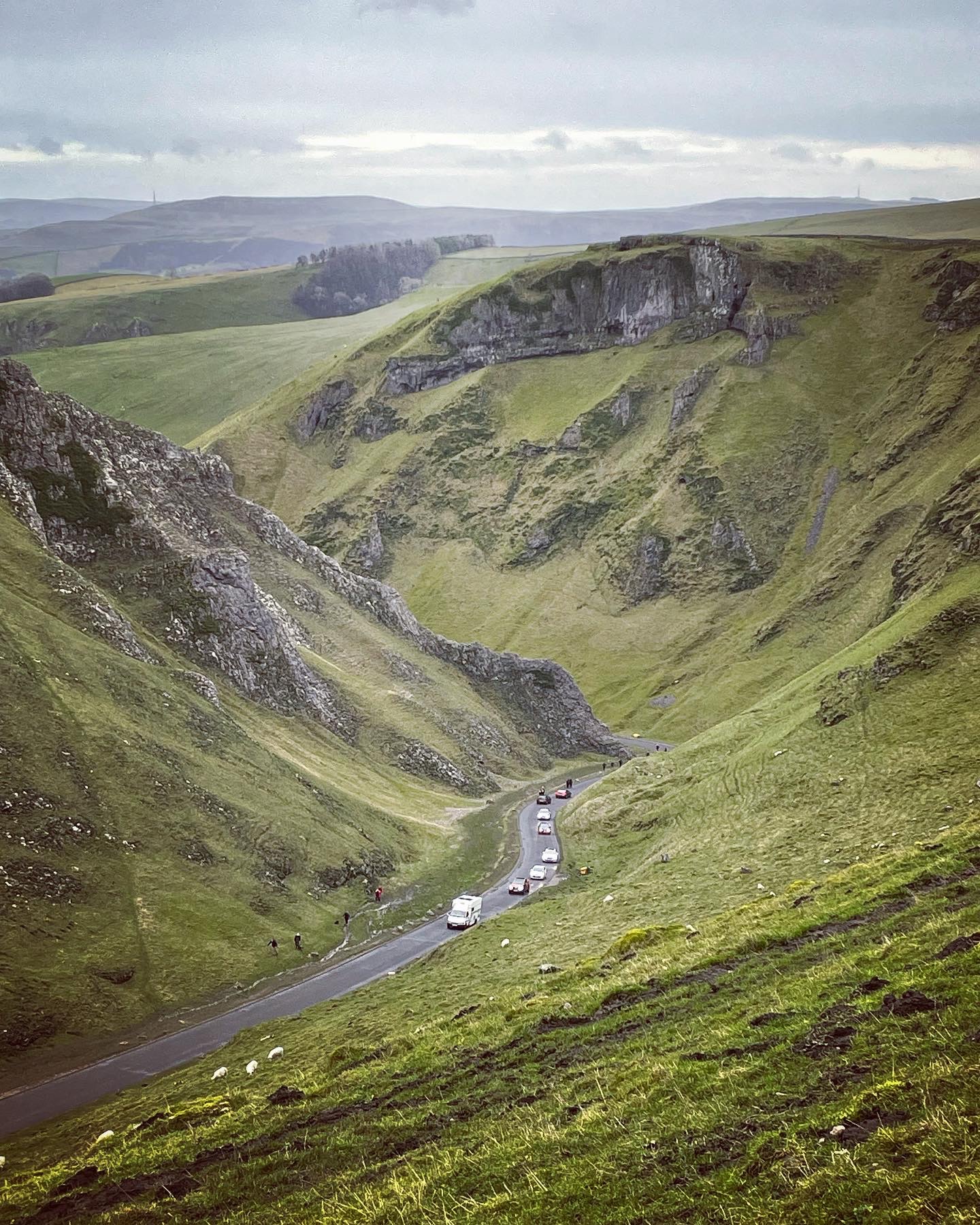
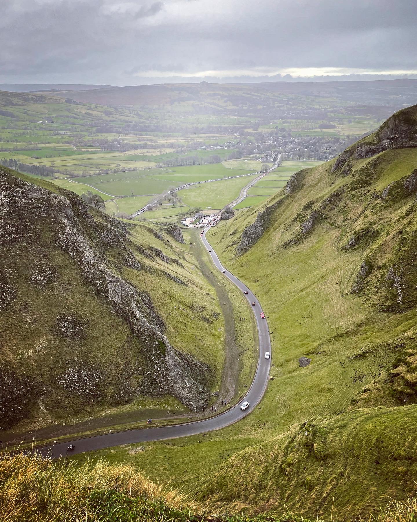
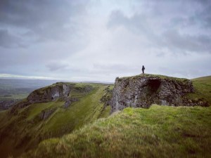
Winnat’s Pass
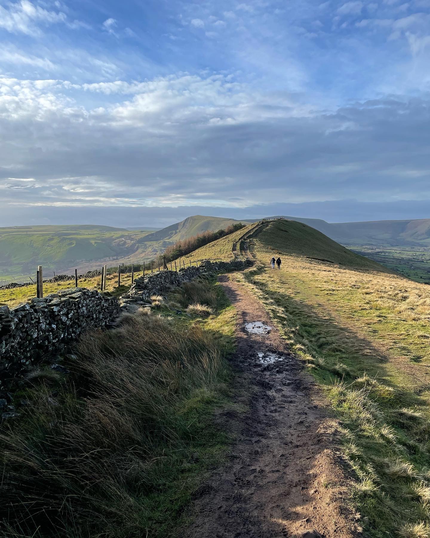
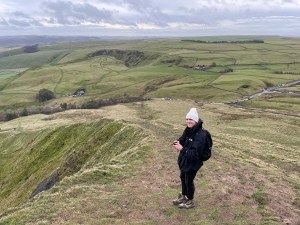
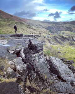
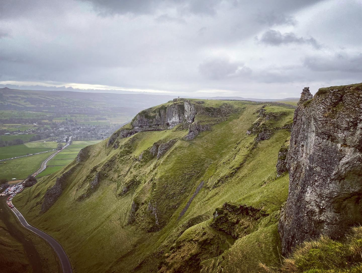
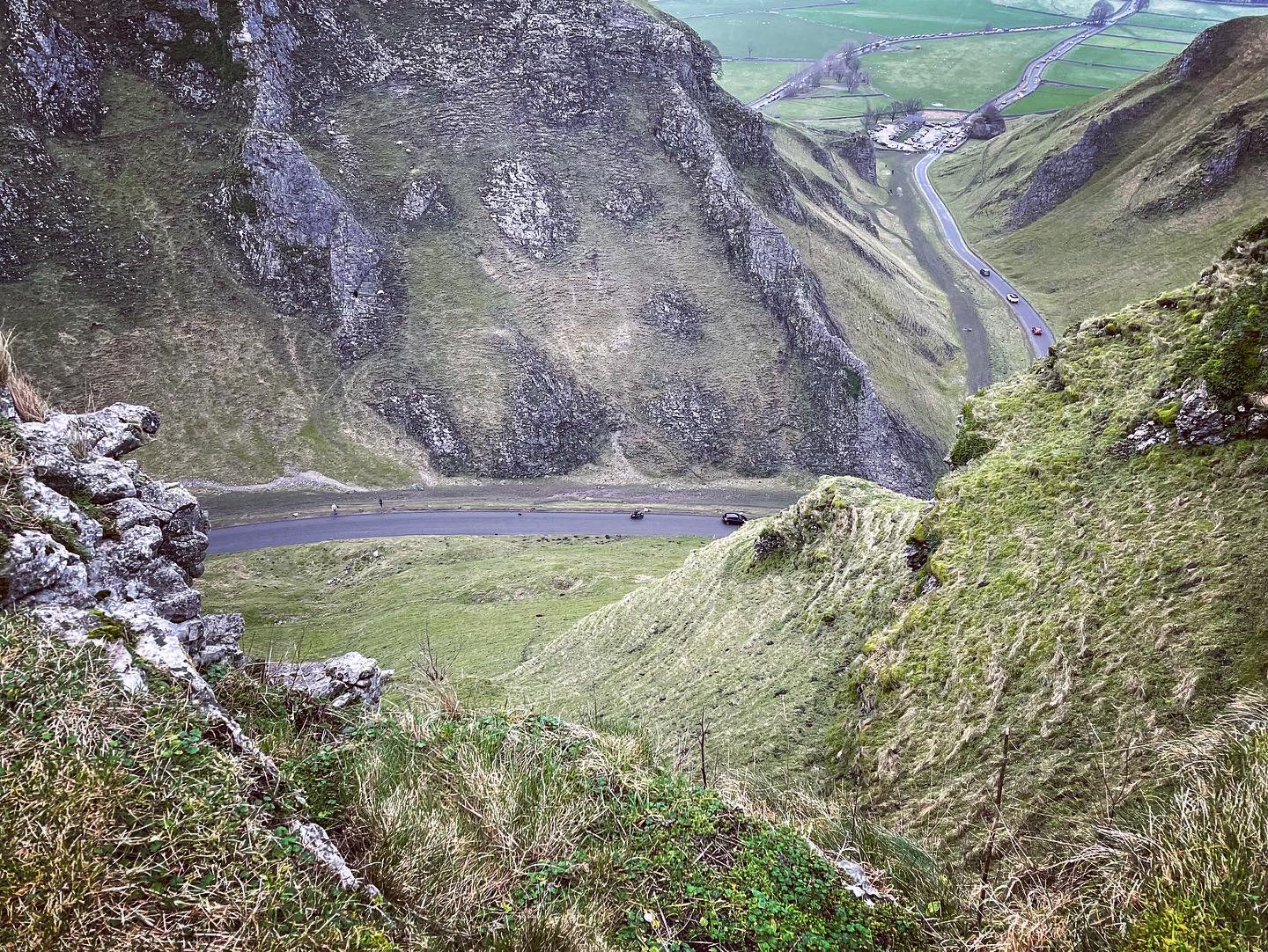
Heading across open pasture land, we followed a footpath over towards the top of Winnat’s Pass where there is the opportunity to walk down the Pass on the side of the road but where would the fun be in that? Our intention that day was to head up onto the far crag and walk the length of Winnat’s Pass taking in the spectacular scenery with almost an aerial view. The climb up in the wind and mud was definitely an obstacle and it did involve using our hands to hold on and lots of taking four steps forward and two steps back but we eventually reached the top.
Winnat’s Pass is a limestone gorge with steep sided, high crag faces located within the High Peak boundary of the Peak District National Park. It is so named after ‘wind gates’ and the loud almost screaming sounds which are heard when the swirling winds blow through the gorge. According to local myth, the Pass is said to be haunted by the spirits of a couple who ran away together in the 17th century only to be murdered by miners, their bodies hidden in mine shafts at Winnat’s Pass. As you make your way down through the gorge or pick your way along the top, small caves can clearly be seen in the crag face. One such cave ‘suicide cave’ is located on the bottom right side of the Pass and is used by experienced cavers.
Here are a selection of photographs taken that day as we ventured over the steep tops of Winnat’s Pass. The climb up was well worth the effort.

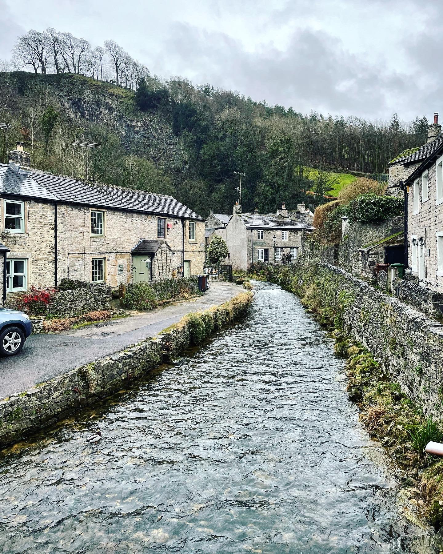
Castleton
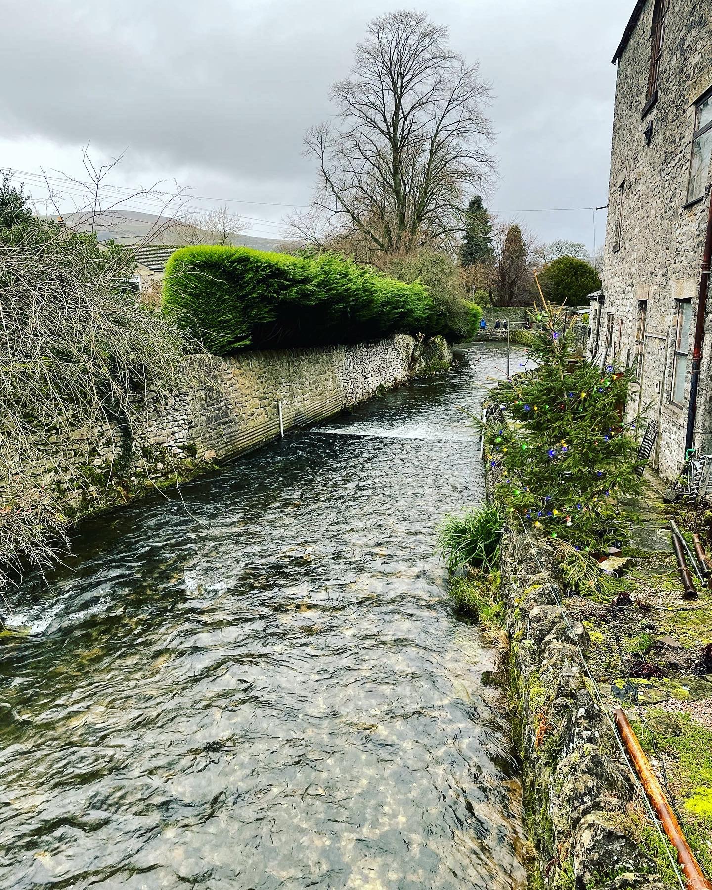
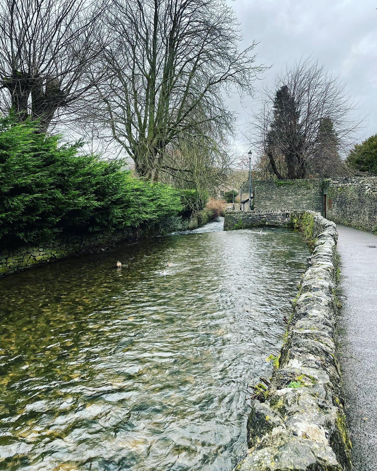
Upon reaching the end of the Winnat’s Pass ridge, we decided to head down off the top and detour into the village of Castleton to finish the day. By the time we reached the bottom, it had started to rain and this continued for the rest of the afternoon. It was quite a muddy walk along a stoney footpath which lead right into the village itself. Upon arrival, it was lovely to see all the cottages and walkways still lit up with Christmas decorations which would no doubt be getting taken down soon. The ducks in the river were all out in full force enjoying the strong currents brought on by the rainfall.
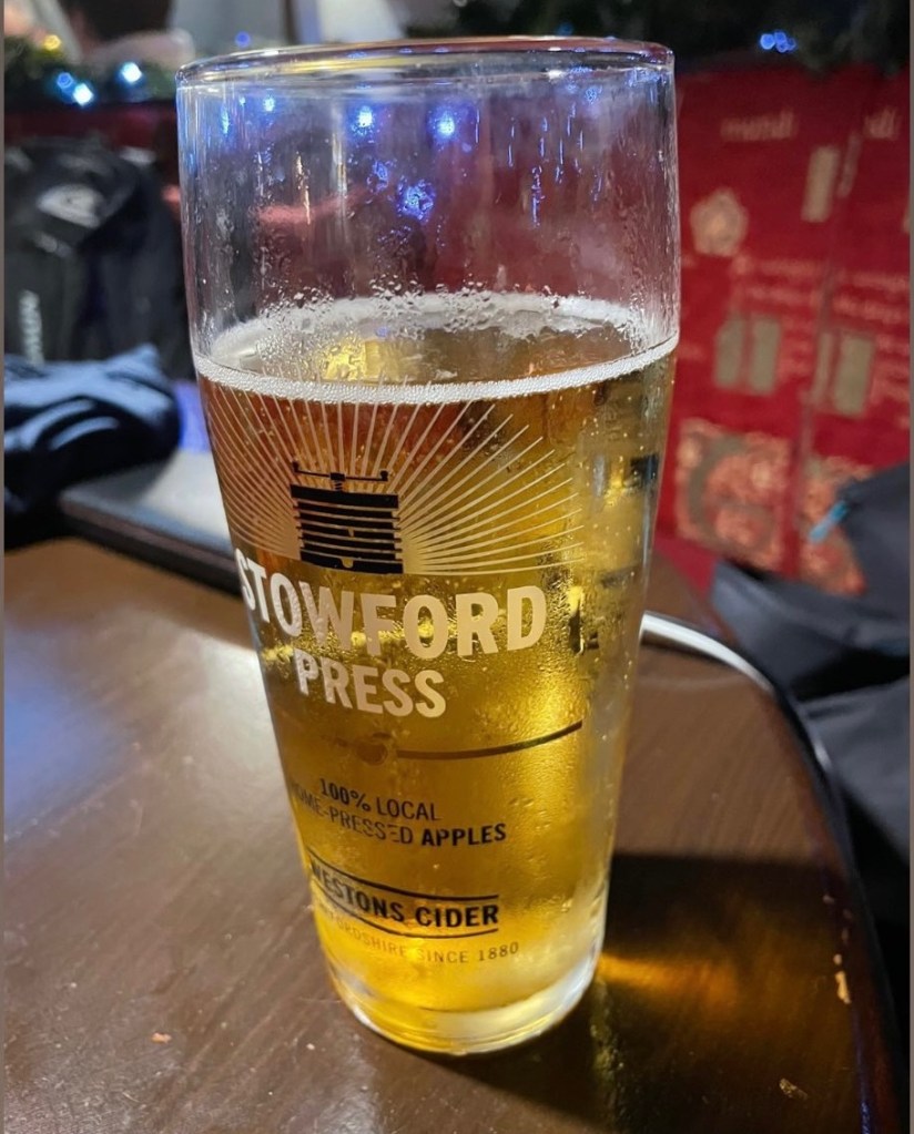
To complete our walk we decided to end it spent in my favourite Castleton public house, Ye Olde Cheshire Cheese. Here we ordered dinner and a pint. Let’s just say it was well needed!

Walk Summary
Distance walked: 6.55 miles.
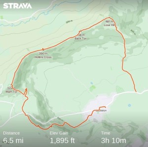
Elevation gain: 1.895 feet.
I thoroughly enjoyed this New Year short hike along the Great Ridge to bring in 2022. It was just the lift I needed and certainly blew away many lingering cobwebs. The walk itself although only a short one in comparison to what I usually take on, was definitely not the easiest. The pull up Losehill at the beginning was a killer but made so worthwhile upon reaching the top with all those spectacular panoramic views to be enjoyed. The journey along the ridge is breathtaking to say the least. Winnat’s Pass too did not disappoint.
This hike today was done in the midst of winter when it was raining at times and was extremely muddy and windy. This did not make the walk any less enjoyable however, it just meant that there was less opportunity or drive to stop and hang around in a particular location for too long. The temperature was freezing and so we kept going much of the time to stay warm more than anything. Arriving in Castleton was the perfect end to such a perfect day and as I sat enjoying dinner in the warm confines of the Olde Cheshire Cheese, shattered yet relaxed, I couldn’t help but smile. The Peak District really is simply one of the best places on Earth.
Thankyou for reading and hope you enjoy the next adventure.
Resources used to aid this blog post are as follows:
http://www.visitpeakdistrict.com
http://www.peakdistrict.gov.uk
http://www.nationaltrust.org.uk
http://www.letsgopeakdistrict.co.uk
All images used within this post are my own and were captured using an iPhone 12 camera. All images were edited using Instagram editor tool and can be viewed from my Instagram account at Soloexplorer23. This walk was tracked using Strava GPS.
